Hénansal
Henant-Sal | |
|---|---|
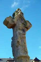 The 11th century cemetery cross | |
.svg.png.webp) Coat of arms | |
Location of Hénansal | |
 Hénansal 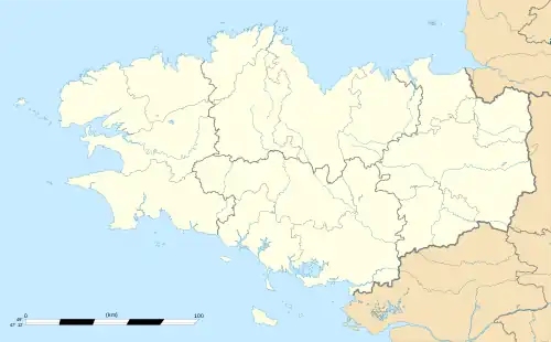 Hénansal | |
| Coordinates: 48°32′33″N 2°25′59″W / 48.5425°N 2.4331°W | |
| Country | France |
| Region | Brittany |
| Department | Côtes-d'Armor |
| Arrondissement | Saint-Brieuc |
| Canton | Lamballe-Armor |
| Intercommunality | CA Lamballe Terre et Mer |
| Government | |
| • Mayor (2020–2026) | Sylvie Hervo[1] |
| Area 1 | 29.00 km2 (11.20 sq mi) |
| Population | 1,231 |
| • Density | 42/km2 (110/sq mi) |
| Time zone | UTC+01:00 (CET) |
| • Summer (DST) | UTC+02:00 (CEST) |
| INSEE/Postal code | 22077 /22400 |
| Elevation | 32–123 m (105–404 ft) |
| 1 French Land Register data, which excludes lakes, ponds, glaciers > 1 km2 (0.386 sq mi or 247 acres) and river estuaries. | |
Hénansal (French pronunciation: [enɑ̃sal]; Breton: Henant-Sal; Gallo: Henaunt-Sau) is a commune in the Côtes-d'Armor department of Brittany in northwestern France.
Population
| Year | Pop. | ±% |
|---|---|---|
| 1962 | 1,009 | — |
| 1968 | 1,016 | +0.7% |
| 1975 | 1,012 | −0.4% |
| 1982 | 1,007 | −0.5% |
| 1990 | 936 | −7.1% |
| 1999 | 935 | −0.1% |
| 2008 | 1,063 | +13.7% |
Inhabitants of Hénansal are called hénansalais in French.
See also
References
- ↑ "Répertoire national des élus: les maires" (in French). data.gouv.fr, Plateforme ouverte des données publiques françaises. 13 September 2022.
- ↑ "Populations légales 2021". The National Institute of Statistics and Economic Studies. 28 December 2023.
External links
Wikimedia Commons has media related to Hénansal.
- Base Mérimée: Search for heritage in the commune, Ministère français de la Culture. (in French)
This article is issued from Wikipedia. The text is licensed under Creative Commons - Attribution - Sharealike. Additional terms may apply for the media files.