Gurneyville, Ohio | |
|---|---|
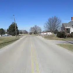 Looking northwest at the intersection of Gurneyville Road and West Mt. Pleasant/New Oglesbee roads in Gurneyville | |
 Gurneyville | |
| Coordinates: 39°30′53″N 83°52′37″W / 39.51472°N 83.87694°W | |
| Country | United States |
| State | Ohio |
| County | Clinton |
| Elevation | 1,056 ft (322 m) |
| Time zone | UTC-5 (Eastern (EST)) |
| • Summer (DST) | UTC-4 (EDT) |
| Area code(s) | 937, 326 |
| GNIS feature ID | 1064777[1] |
Gurneyville (also Guerneyville) is an unincorporated community, in Clinton County, Ohio, United States.[1]
History
Gurneyville was platted in 1847, and named for Joseph John Gurney, a prominent local Quaker.[2] A post office called Gurneyville was established in 1875, and remained in operation until 1905.[3]
Notable person
- Francis A. Wallar, Medal of Honor recipient
Notes
- 1 2 "Gurneyville, Ohio". Geographic Names Information System. United States Geological Survey, United States Department of the Interior.
- ↑ Brown, Albert J. (1915). History of Clinton County, Ohio: Its People, Industries, and Institutions. B.F. Bowen. pp. 284.
- ↑ "Clinton County". Jim Forte Postal History. Retrieved December 19, 2015.
Municipalities and communities of Clinton County, Ohio, United States | ||
|---|---|---|
| City | 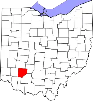 Map of Ohio highlighting Clinton County | |
| Villages | ||
| Townships | ||
| Unincorporated communities | ||
| Ghost town | ||
| Footnotes | ‡This populated place also has portions in an adjacent county or counties | |
This article is issued from Wikipedia. The text is licensed under Creative Commons - Attribution - Sharealike. Additional terms may apply for the media files.