
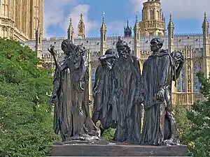
An aerial view of three Grade I listed buildings in Westminster: The Palace of Westminster, Westminster Abbey and St Margaret's Church, which together comprise a UNESCO World Heritage Site.
There are over 9,000 Grade I listed buildings in England. This page is a list of these buildings in the City of Westminster.
Buildings
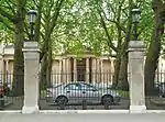
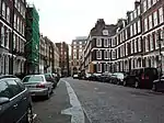
Bayswater
| Name | Location | Type | Architect | Completed [note 1] | Date designated | Grid ref.[note 2] Geo-coordinates |
Entry number [note 3] | Image |
|---|---|---|---|---|---|---|---|---|
| New West End Synagogue | St. Petersburgh Place W2 | Synagogue | George Ashdown Audsley (with Nathan S. Joseph) | 1877–1879 | 27 Jun 1975 | TQ2568580683 51°30′40″N 0°11′25″W / 51.511104°N 0.190247°W |
1264769 | |
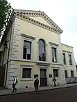
| St Sophia's Cathedral and presbytery | Moscow Road W2 | Greek Orthodox cathedral | John Oldrid Scott | 1878–79 | 1 Dec 1987 | TQ2557480836 51°30′45″N 0°11′30″W / 51.512504°N 0.191791°W |
1223553 | 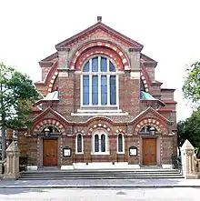 St Sophia's Cathedral and presbytery |

Belgravia
| Name | Location | Type | Architect | Completed [note 1] | Date designated | Grid ref.[note 2] Geo-coordinates |
Entry number [note 3] | Image |
|---|---|---|---|---|---|---|---|---|
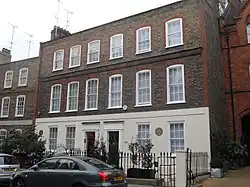
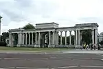
| 180 Ebury Street | Ebury Street SW1 | Terraced house | — | Early to mid-18th century | 24 Feb 1958 | TQ2835378563 51°29′29″N 0°09′09″W / 51.491453°N 0.152593°W |
1211215 | |
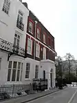
| 1–11 Belgrave Square | Belgrave Square SW1 | Terrace | George Basevi | c. 1825 | 24 Feb 1958 | TQ2817379494 51°29′59″N 0°09′17″W / 51.49986°N 0.154846°W |
1066455 | .jpeg.webp) 1–11 Belgrave Square |
| 13–23 Belgrave Square | Belgrave Square SW1 | Terrace | George Basevi | c. 1825 | 24 Feb 1958 | TQ2815879330 51°29′54″N 0°09′18″W / 51.49839°N 0.155122°W |
1066457 | 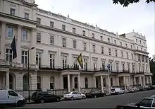 13–23 Belgrave Square |
| 25–36 Belgrave Square | Belgrave Square SW1 | Terrace | George Basevi | c. 1825 | 24 Feb 1958 | TQ2839279372 51°29′55″N 0°09′06″W / 51.498714°N 0.151737°W |
1292018 | 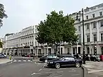 25–36 Belgrave Square |
| 38–48 Belgrave Square | Belgrave Square SW1 | Terrace | George Basevi | c. 1825 | 24 Feb 1958 | TQ2832979534 51°30′01″N 0°09′09″W / 51.500184°N 0.152586°W |
1292022 | 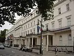 38–48 Belgrave Square |
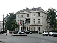
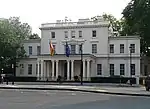
| Portuguese Embassy | 12 Belgrave Square SW1 | Town house | Sir Robert Smirke | c. 1840–50 | 24 Feb 1958 | TQ2810479419 51°29′57″N 0°09′21″W / 51.499202°N 0.155867°W |
1066456 | |
| Spanish Embassy | 24 Belgrave Square SW1 | Town house | Henry E. Kendall | c. 1840–50 | 24 Feb 1958 | TQ2826479271 51°29′52″N 0°09′13″W / 51.497836°N 0.153617°W |
1218320 |
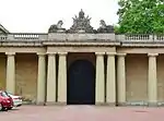
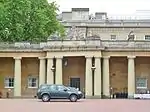
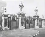
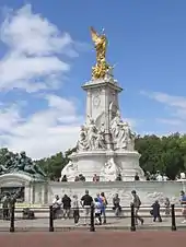
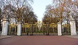
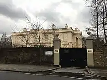
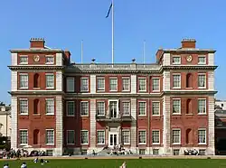
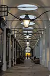
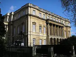
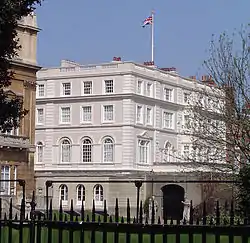
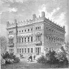
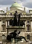
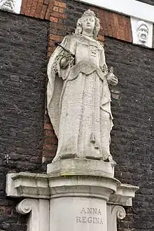
Buckingham Palace complex
.jpg.webp)


.jpg.webp)
Charing Cross / Trafalgar Square
| Name | Location | Type | Architect | Completed [note 1] | Date designated | Grid ref.[note 2] Geo-coordinates |
Entry number [note 3] | Image |
|---|---|---|---|---|---|---|---|---|
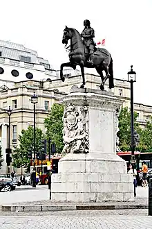
| Equestrian statue of Charles I | Charing Cross SW1 | Equestrian statue | Hubert Le Sueur (sculptor) | 1633 | 9 Jan 1970 | TQ3003780373 51°30′26″N 0°07′40″W / 51.507334°N 0.127684°W |
1357291 | |
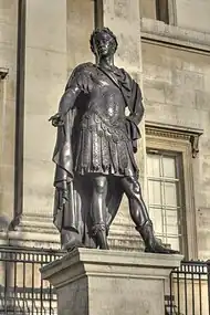
| Statue of James II | Trafalgar Square WC2 | Statue | Peter van Dievoet and Laurens van der Meulen (sculptors) Grinling Gibbons (workshop) | 1686 | 5 Feb 1970 | TQ2994080498 51°30′31″N 0°07′45″W / 51.50848°N 0.129035°W |
1217629 | |
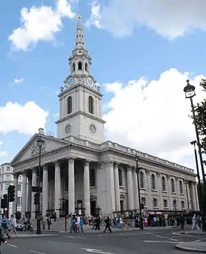
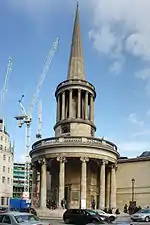
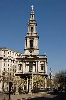
| St Martin-in-the-Fields | Trafalgar Square WC2 | Parish church | James Gibbs | 1722–1726 | 24 Feb 1958 | TQ3010280541 51°30′32″N 0°07′36″W / 51.508829°N 0.126686°W |
1217661 | |
| Churchyard walls and railings surrounding St Martin in the Fields on North, South, East and West Sides | Trafalgar Square WC2 | Wall | James Gibbs | c. 1726 | 1 Dec 1987 | TQ3011880567 51°30′33″N 0°07′35″W / 51.509059°N 0.126446°W |
1066237 | 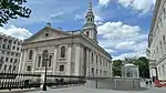 Churchyard walls and railings surrounding St Martin in the Fields on North, South, East and West Sides |
| National Gallery | Trafalgar Square WC2 | Public art gallery | William Wilkins (extended by Edward Middleton Barry, Sir John Taylor and others) | 1832–1838 | 5 Feb 1970 | TQ2996180544 51°30′32″N 0°07′43″W / 51.508888°N 0.128715°W |
1066236 | |
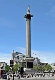
| Nelson's Column | Trafalgar Square WC2 | Column | William Railton (statue of Nelson by Edward Hodges Baily; lions by Sir Edwin Landseer) | 1839–1842 | 5 Feb 1970 | TQ3001780419 51°30′28″N 0°07′41″W / 51.507752°N 0.127955°W |
1276052 | |
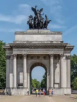
| Admiralty Arch, First Sea Lord's Residence and Offices, Balustrades and Steps | Charing Cross SW1 | Apartment | Sir Aston Webb | 1906–1911 | 5 Feb 1970 | TQ2997080305 51°30′24″N 0°07′43″W / 51.506739°N 0.128674°W |
1238982 | 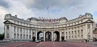 Admiralty Arch, First Sea Lord's Residence and Offices, Balustrades and Steps |
| Sainsbury Wing at the National Gallery | Trafalgar Square WC2 | Public art gallery | Robert Venturi, Denise Scott Brown and Associates | 1988–1991 | 9 May 2018 | TQ2988580510 51°30′31″N 0°07′47″W / 51.50857°N 0.12978°W |
1451082 | 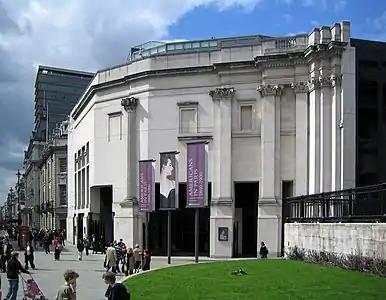 Sainsbury Wing at the National Gallery |
| Edith Cavell Memorial | St Martin's Place WC2 | Statue | George Frampton | 1920 | 5 Feb 1970 | TQ2995380649 51°30′34″N 0°07′38″W / 51.509324°N 0.127183°W |
1264768 |


Covent Garden
| Name | Location | Type | Architect | Completed [note 1] | Date designated | Grid ref.[note 2] Geo-coordinates |
Entry number [note 3] | Image |
|---|---|---|---|---|---|---|---|---|
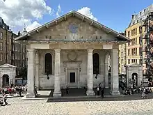
| St Paul's, Covent Garden | Covent Garden Piazza / Bedford Street WC2 | Parish church | Inigo Jones (restored by Thomas Hardwick and altered by Henry Clutton) | 1631–1638 | 24 Feb 1958 | TQ3030080849 51°30′42″N 0°07′25″W / 51.511551°N 0.123721°W |
1066487 | |
| Theatre Royal, Drury Lane and attached Sir Augustus Harris Memorial Drinking Fountain | Catherine Street / Drury Lane WC2 | Theatre and drinking fountain | Benjamin Dean Wyatt (additions and alterations by Samuel Beazley and others) | 1811–1812 | 24 Feb 1958 | TQ3053781017 51°30′47″N 0°07′13″W / 51.513006°N 0.120245°W |
1357276 | 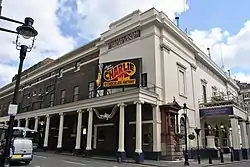 Theatre Royal, Drury Lane and attached Sir Augustus Harris Memorial Drinking Fountain |
| Royal Opera House | Bow Street / Floral Street WC2 | Opera house | Edward Middleton Barry | 1857–1858 | 9 Jan 1970 | TQ3036281019 51°30′47″N 0°07′22″W / 51.513065°N 0.122765°W |
1066392 |
.jpg.webp)
Hyde Park

.jpg.webp)
Kensington
| Name | Location | Type | Architect | Completed [note 1] | Date designated | Grid ref.[note 2] Geo-coordinates |
Entry number [note 3] | Image |
|---|---|---|---|---|---|---|---|---|
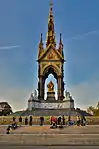
| Albert Memorial | Kensington Gore SW7 | Commemorative monument | Sir George Gilbert Scott | 1862–75 | 14 Jan 1970 | TQ2657879738 51°30′09″N 0°10′40″W / 51.502412°N 0.177725°W |
1217741 | |
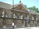
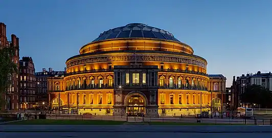
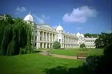
| Royal Albert Hall | Kensington Gore SW7 | Public hall | Francis Fowke (completed by Henry Young Darracott Scott) | 1867–71 | 24 Feb 1958 | TQ2660279585 51°30′04″N 0°10′39″W / 51.501032°N 0.177434°W |
1217742 | |
| Holy Trinity Church | Prince Consort Road SW7 | Church | George Frederick Bodley | 1901–7 | 24 Feb 1958 | TQ2650579467 51°30′00″N 0°10′44″W / 51.499993°N 0.178873°W |
1265499 |
Kilburn
| Name | Location | Type | Architect | Completed [note 1] | Date designated | Grid ref.[note 2] Geo-coordinates |
Entry number [note 3] | Image |
|---|---|---|---|---|---|---|---|---|
| St Augustine's Church | Kilburn Park Road NW8 | Church | John Loughborough Pearson | 1870–7 | 25 Sep 1951 | TQ2553083130 51°31′59″N 0°11′30″W / 51.533129°N 0.191609°W |
1221320 |

Maida Vale
| Name | Location | Type | Architect | Completed [note 1] | Date designated | Grid ref.[note 2] Geo-coordinates |
Entry number [note 3] | Image |
|---|---|---|---|---|---|---|---|---|
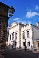
| Catholic Apostolic Church and Church House | Maida Avenue W2 | Irvingite church and adjoining caretaker's house | John Loughborough Pearson | 1891–3 | 5 Feb 1970 | TQ2645282020 51°31′23″N 0°10′43″W / 51.522948°N 0.178721°W |
1238911 |  Catholic Apostolic Church and Church House |
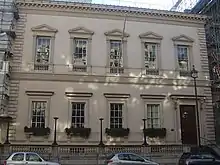
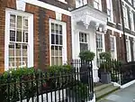
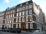
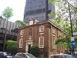
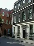
Marylebone

.JPG.webp)
.jpg.webp)
.jpg.webp)
Mayfair
| Name | Location | Type | Architect | Completed [note 1] | Date designated | Grid ref.[note 2] Geo-coordinates |
Entry number [note 3] | Image |
|---|---|---|---|---|---|---|---|---|
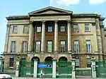
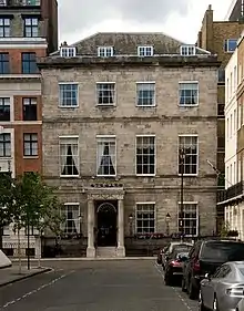
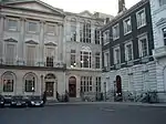
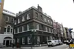
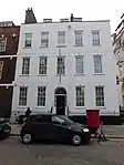
| 31 Old Burlington Street | 31 Old Burlington Street, Mayfair, W1S 3AS | Terraced town house | Colen Campbell | 1718–24 | 24 Feb 1958 | TQ2912280674 51°30′37″N 0°08′27″W / 51.510249°N 0.14075°W |
1225471 |  31 Old Burlington Street |
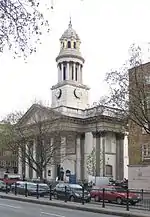
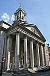
| St George's, Hanover Square | Hanover Square W1 | Parish church | John James | 1720–4 | 24 Feb 1958 | TQ2897380927 51°30′45″N 0°08′34″W / 51.512556°N 0.142804°W |
1235638 | |
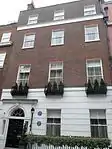
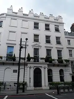
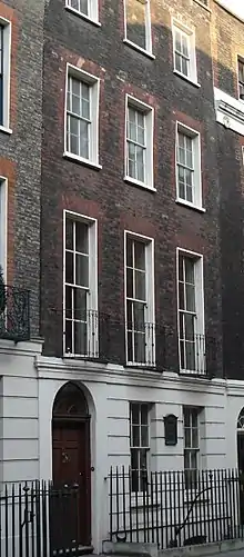
| George Frideric Handel's house | 25 Brook Street, W1K 4HB | Terraced house | — | c. 1725 | 24 Feb 1958 | TQ2875580967 51°30′47″N 0°08′45″W / 51.512966°N 0.145929°W |
1066382 | |
| Grosvenor Estate Office | 66 Brook Street and 53 Davies Street, Mayfair, W1K 5JH | Terraced town house | Edward Shepherd (No. 66); Thomas Cundy (No. 53) | c. 1725–30 (No. 66); 1820s–30s (No. 53) | 24 Feb 1958 | TQ2856680954 51°30′46″N 0°08′55″W / 51.512892°N 0.148656°W |
1219812 | 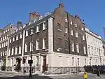 Grosvenor Estate Office |
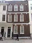
| 44 Berkeley Square | 44 Berkeley Square, Mayfair, W1 | Terraced town house | William Kent | 1742–44 | 24 Feb 1958 | TQ2871480555 51°30′33″N 0°08′48″W / 51.509272°N 0.14667°W |
1066466 | 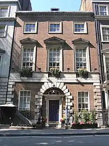 44 Berkeley Square |
| 45 and 46 Berkeley Square | Berkeley Square W1 | Terraced town houses, 46 is home to Annabel's private member's club | Henry Flitcroft (No. 45; no. 46 attributed to him) | c. 1744–50 | 24 Feb 1958 | TQ2872080548 51°30′33″N 0°08′48″W / 51.509208°N 0.146586°W |
1218401 | 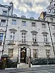 45 and 46 Berkeley Square |
| 17 Hill Street | Hill Street W1 | Terraced town house | Benjamin Timbrell; additions and alterations by Robert Adam | 1748–9; 1777–9 | 24 Feb 1958 | TQ2862380490 51°30′31″N 0°08′53″W / 51.508709°N 0.148004°W |
1066622 | 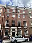 17 Hill Street |
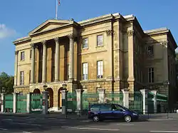
| Royal Institution | 21 Albemarle Street W1 | Headquarters converted from terraced town house | Thomas Webster (1799); Lewis Vulliamy (façade, 1838) | 1756; 1799; 1838 | 24 Feb 1958 | TQ2900480621 51°30′35″N 0°08′33″W / 51.509799°N 0.142469°W |
1066521 | |
| Cambridge House | 94 Piccadilly and 12 White Horse Street W1 | Town mansion | Matthew Brettingham | 1756–60 | 24 Feb 1958 | TQ2881680190 51°30′21″N 0°08′43″W / 51.505969°N 0.145334°W |
1226748 | |
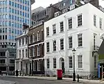
| 3–6 Grafton Street with 10 Bruton Lane | Grafton Street W1 | Terraced town houses | Sir Robert Taylor | c. 1760–72 | 24 Feb 1958 | TQ2891180604 51°30′35″N 0°08′38″W / 51.509668°N 0.143815°W |
1289151 | 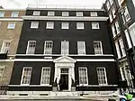 3–6 Grafton Street with 10 Bruton Lane |
| 10 Hertford Street | Hertford Street W1 | Terraced town house | Henry Holland Sr. and Henry Holland Jr.; interior by Robert Adam | c. 1768–9; interior 1769–71 | 24 Feb 1958 | TQ2863980148 51°30′20″N 0°08′52″W / 51.505632°N 0.147898°W |
1230913 | |
| Crockford's | 30 Curzon Street W1 | Terraced town house | Robert Adam (interior) | 1771 | 24 Feb 1958 | TQ2855580236 51°30′23″N 0°08′57″W / 51.506442°N 0.149076°W |
1356991 | |
| Melbourne House | Albany W1 | Town mansion | Sir William Chambers; altered by Henry Holland (Jr.) | 1771–6; 1802–3 | 24 Feb 1958 | TQ2926380548 51°30′33″N 0°08′20″W / 51.509084°N 0.138766°W |
1357178 | 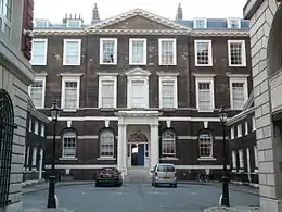 Melbourne House |
| Albany Courtyard | 1–6 Albany W1 | Flanking forecourt wings of town mansion | Sir William Chambers | 1771–6 | 24 Feb 1958 | TQ2927480520 51°30′32″N 0°08′19″W / 51.50883°N 0.138618°W |
1209755 | 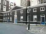 Albany Courtyard |
| Ely House | 37 Dover Street W1 | Terraced town house | Sir Robert Taylor | 1772 | 24 Feb 1958 | TQ2899880474 51°30′31″N 0°08′33″W / 51.50848°N 0.142609°W |
1066901 | .jpg.webp) Ely House |
| Part of the Royal Institution | 20 Albemarle Street W1 | Terraced house | — | Late 18th century; remodelled internally early and late 19th century | 9 Jan 1970 | TQ2902380601 51°30′35″N 0°08′32″W / 51.509615°N 0.142203°W |
1066520 |  Part of the Royal Institution |
| Bodley House Chambers | Albany; also Vigo Street and 8, 10 and 12 Burlington Gardens W1 | Apartments | Henry Holland | 1802–3 | 24 Feb 1958 | TQ2919780654 51°30′36″N 0°08′23″W / 51.510052°N 0.139678°W |
1209773 |  Bodley House Chambers |
| 93 Park Lane | Park Lane W1 | Terraced town house | Samuel Baxter | 1823–5 | 24 Feb 1958 | TQ2806480640 51°30′37″N 0°09′22″W / 51.510184°N 0.156°W |
1226023 | |
| Mercato Mayfair, formerly St Mark's, North Audley Street | North Audley Street W1 | Former church | John Peter Gandy; body of the church remodelled by Arthur Blomfield | 1825–8; 1878 | 24 Feb 1958 | TQ2825380970 51°30′47″N 0°09′11″W / 51.513107°N 0.153158°W |
1225301 | 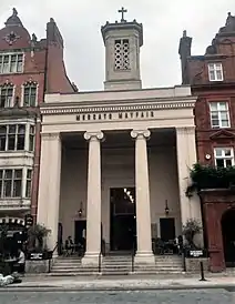 Mercato Mayfair, formerly St Mark's, North Audley Street |


.jpg.webp)

Paddington
| Name | Location | Type | Architect | Completed [note 1] | Date designated | Grid ref.[note 2] Geo-coordinates |
Entry number [note 3] | Image |
|---|---|---|---|---|---|---|---|---|
| Paddington Station including the lawn, GWR office block on London Street and offices along Eastbourne Terrace | Eastbourne Terrace W2 | Railway station | Isambard Kingdom Brunel (engineer), Sir Matthew Digby Wyatt (architect), Owen Jones (decoration) | 1851–4 (additions and alterations 1914–6 and 1930s) | 11 Jan 1961 | TQ2655781373 51°31′02″N 0°10′39″W / 51.51711°N 0.177441°W |
1066881 | 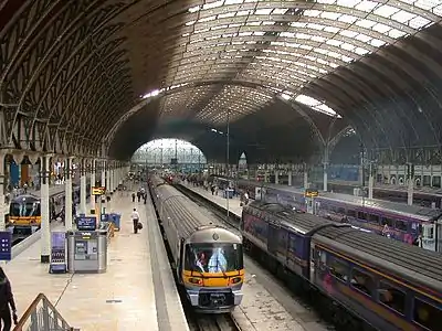 Paddington Station including the lawn, GWR office block on London Street and offices along Eastbourne Terrace |
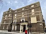
| St Mary Magdalene Church | Rowington Close W2 | Church | George Edmund Street (Crypt Chapel of St Sepulchre by Sir Ninian Comper) | 1867–78 (Crypt chapel 1895) | 25 Sep 1951 | TQ2573781948 51°31′21″N 0°11′21″W / 51.522461°N 0.189048°W |
1235288 |
.JPG.webp)
Pimlico
| Name | Location | Type | Architect | Completed [note 1] | Date designated | Grid ref.[note 2] Geo-coordinates |
Entry number [note 3] | Image |
|---|---|---|---|---|---|---|---|---|
| St Barnabas Church | St Barnabas St SW1 | Church | Thomas Cundy Jr., assisted by William Butterfield | 1847–50 | 24 Feb 1958 | TQ2841378446 51°29′25″N 0°09′06″W / 51.490388°N 0.151772°W |
1265057 | |
| St James the Less Church | Vauxhall Bridge Road SW1 | Parish church | George Edmund Street | 1859–61 | 24 Feb 1958 | TQ2955478511 51°29′27″N 0°08′07″W / 51.490712°N 0.135322°W |
1066164 | |
| St James the Less Parish Rooms and Schools | Vauxhall Bridge Road SW1 | Village Hall | George Edmund Street; additions by Arthur Edmund Street | 1861; 1890 | 5 Feb 1970 | TQ2958578501 51°29′26″N 0°08′06″W / 51.490615°N 0.13488°W |
1066166 |  St James the Less Parish Rooms and Schools |
.jpg.webp)

Regent's Park
| Name | Location | Type | Architect | Completed [note 1] | Date designated | Grid ref.[note 2] Geo-coordinates |
Entry number [note 3] | Image |
|---|---|---|---|---|---|---|---|---|
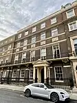
| 1–6 and 8–14 Park Crescent with 98 Portland Place | Park Crescent and Portland Place W1 | Quadrant of town houses forming eastern half of crescent | John Nash | 1812 | 5 Feb 1970 | TQ2873882062 51°31′22″N 0°08′45″W / 51.52281°N 0.145774°W |
1225956 | 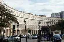 1–6 and 8–14 Park Crescent with 98 Portland Place |
| 18–26 Park Crescent (including the former No. 27) | Park Crescent and Portland Place W1 | Quadrant of town houses forming western half of crescent | John Nash | 1812 | 5 Feb 1970 | TQ2862782061 51°31′22″N 0°08′51″W / 51.522826°N 0.147374°W |
1225959 | 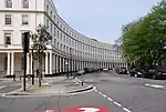 18–26 Park Crescent (including the former No. 27) |
| 1–5 York Gate | York Gate NW1 | Terrace | John Nash | c. 1821–2 | 5 Feb 1970 | TQ2828182125 51°31′25″N 0°09′08″W / 51.52348°N 0.152335°W |
1225218 | |
| 8–12 York Gate | York Gate NW1 | Terrace | John Nash | 1821–2 | 5 Feb 1970 | TQ2823582110 51°31′24″N 0°09′11″W / 51.523356°N 0.153003°W |
1357372 | 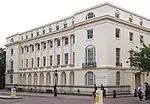 8–12 York Gate |
| 1–21 Cornwall Terrace | Cornwall Terrace NW1 | Terrace (except Nos. 20 and 21) | Decimus Burton | 1821–3 (restored 1980) | 9 Jan 1970 | TQ2792982181 51°31′27″N 0°09′27″W / 51.524063°N 0.157385°W |
1356971 | 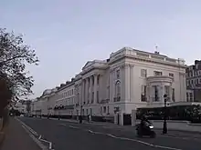 1–21 Cornwall Terrace |
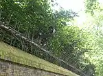
| Forecourt garden railings to Nos. 20 and 21 | Cornwall Terrace NW1 | Railings | Decimus Burton or John Nash | c. 1821–3 | 1 Dec 1987 | TQ2805282125 51°31′25″N 0°09′20″W / 51.523532°N 0.155634°W |
1066947 |  Forecourt garden railings to Nos. 20 and 21 |
| 1–18 York Terrace East, including 6 York Gate | York Terrace East NW1 | Terrace | John Nash | c. 1821–6 | 5 Feb 1970 | TQ2832482180 51°31′26″N 0°09′06″W / 51.523964°N 0.151695°W |
1066044 |  Upload Photo |
| Garden railings to park front of Nos. 1–18 | York Terrace East NW1 | Railings | John Nash | c. 1821–6 | 1 Dec 1987 | TQ2831982198 51°31′27″N 0°09′06″W / 51.524127°N 0.151761°W |
1225417 | 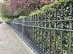 Garden railings to park front of Nos. 1–18 |
| Doric Villa | 19 and 20 York Terrace East NW1 | Semi-detached villas as one | John Nash | c. 1821–6 | 5 Feb 1970 | TQ2840882205 51°31′27″N 0°09′02″W / 51.52417°N 0.150476°W |
1357399 | %252C_p275.jpg.webp) Doric Villa |
| Garden railings to park front of Doric Villa | York Terrace East NW1 | Railings | John Nash | c. 1821–6 | 5 Feb 1970 | TQ2840282226 51°31′28″N 0°09′02″W / 51.52436°N 0.150555°W |
1225450 | Upload Photo |
| 1–33 York Terrace West with 7 York Gate | York Terrace West and York Gate NW1 | Terrace | John Nash | c. 1821–6 | 5 Feb 1970 | TQ2816882133 51°31′25″N 0°09′14″W / 51.523578°N 0.15396°W |
1066047 | Upload Photo |
| Garden railings to park front of Nos. 1–33 | York Terrace West NW1 | Railings | John Nash | c. 1821–6 | 1 Dec 1987 | TQ2816382153 51°31′26″N 0°09′14″W / 51.523758°N 0.154025°W |
1225553 | 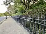 Garden railings to park front of Nos. 1–33 |
| 47 York Terrace West | York Terrace West NW1 | House | John Nash | c. 1821–6 (later rebuilt in facsimile) | 1 Dec 1987 | TQ2807082101 51°31′24″N 0°09′19″W / 51.523312°N 0.155383°W |
1066048 | 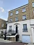 47 York Terrace West |
| 1 to 26 Sussex Place, London Graduate School of Business Studies (occupied by London Business School) | 1–26 Sussex Place NW1 | Terrace (rebuilt behind front as business school) | John Nash | 1822–3 | 5 Feb 1970 | TQ2768682410 51°31′34″N 0°09′39″W / 51.526176°N 0.160803°W |
1264092 | |
| Garden railings in front of 1–26 Sussex Place | Sussex Place NW1 | Railings | — | c. 1822–3 | 1 Dec 1987 | TQ2773182434 51°31′35″N 0°09′37″W / 51.526381°N 0.160146°W |
1237472 |  Garden railings in front of 1–26 Sussex Place |
| 1–20 Hanover Terrace | Hanover Terrace NW1 | Terrace | John Nash | 1822–3 | 14 Jan 1970 | TQ2753682576 51°31′40″N 0°09′46″W / 51.527702°N 0.162904°W |
1279085 | 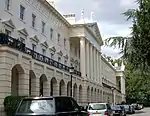 1–20 Hanover Terrace |
| Forecourt garden railings and gate piers to Nos. 1–20 | Hanover Terrace NW1 | Garden railings and gate piers | — | c. 1822–3 | 1 Dec 1987 | TQ2749882644 51°31′42″N 0°09′48″W / 51.528321°N 0.163427°W |
1066693 | Upload Photo |
| Nuffield Lodge | Park Road / Prince Albert Road NW1 | Villa | Decimus Burton | 1822–4 | 5 Feb 1970 | TQ2725082882 51°31′50″N 0°10′01″W / 51.530516°N 0.166914°W |
1265526 | |
| 1–43 Clarence Terrace | Clarence Terrace NW1 | Terrace | Decimus Burton | 1823 (rebuilt 1965) | 9 Jan 1970 | TQ2777682325 51°31′31″N 0°09′34″W / 51.525392°N 0.159537°W |
1357311 | %252C_p263.jpg.webp) 1–43 Clarence Terrace |
| 1–12 Park Square West | Park Square West NW1 | Terrace | John Nash | 1823–5 | 5 Feb 1970 | TQ2854782203 51°31′27″N 0°08′55″W / 51.524121°N 0.148474°W |
1265975 | 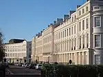 1–12 Park Square West |
| 14–26 Ulster Place | Ulster Place NW1 | Manor House | John Nash | c. 1824 | 5 Feb 1970 | TQ2854182155 51°31′25″N 0°08′55″W / 51.523691°N 0.148578°W |
1066214 | 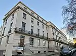 14–26 Ulster Place |
| Ulster Terrace | Ulster Terrace NW1 | Terrace | John Nash | c. 1824 | 5 Feb 1970 | TQ2851382248 51°31′28″N 0°08′56″W / 51.524533°N 0.148948°W |
1357331 | 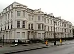 Ulster Terrace |
| 34 York Terrace West | York Terrace West NW1 | Terraced town house | John Nash | c. 1824–6 | 5 Feb 1970 | TQ2810282109 51°31′24″N 0°09′18″W / 51.523377°N 0.154919°W |
1357401 | Upload Photo |
| Garden railings to park front of Nos. 34–47 | York Terrace West NW1 | Railings | John Nash | c. 1824–6 | 1 Dec 1987 | TQ2808082128 51°31′25″N 0°09′19″W / 51.523553°N 0.155229°W |
1225611 | Upload Photo |
| 35–46 York Terrace West | York Terrace West NW1 | Terrace | John Nash | c. 1824–6 | 5 Feb 1970 | TQ2808682109 51°31′24″N 0°09′19″W / 51.52338°N 0.15515°W |
1266293 | Upload Photo |
| Chimps Breeding Colony, the Gorilla House | London Zoo NW1 | Concrete-framed building | Berthold Lubetkin and the Tecton Group with Ove Arup | 1932–3 | 14 Sep 1970 | TQ2809483571 51°32′11″N 0°09′16″W / 51.536517°N 0.154503°W |
1357402 |  Chimps Breeding Colony, the Gorilla House |
| Penguin Pool | London Zoo NW1 | Former penguin pool; now fountain | Berthold Lubetkin and the Tecton Group with Ove Arup | 1934 | 14 Sep 1970 | TQ2817383293 51°32′02″N 0°09′12″W / 51.534001°N 0.153466°W |
1225665 |
.jpg.webp)
.jpg.webp)
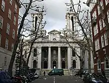
St James's
.jpg.webp)

.jpg.webp)
.jpg.webp)


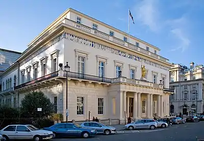

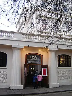
.JPG.webp)

.jpg.webp)
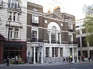
Soho
| Name | Location | Type | Architect | Completed [note 1] | Date designated | Grid ref.[note 2] Geo-coordinates |
Entry number [note 3] | Image |
|---|---|---|---|---|---|---|---|---|
| Quo Vadis restaurant | 26–28 Dean Street W1 | Terraced houses, now restaurant | John Nolloth(?) | c. 1734 (ground floor altered early 20th century) | 14 Jan 1970 | TQ2967681114 51°30′51″N 0°07′57″W / 51.514076°N 0.13261°W |
1290584 | .jpg.webp) Quo Vadis restaurant |
| House of St Barnabas | 1 Greek Street W1 | Corner terrace house | Joseph Pearce | c. 1744–6 | 24 Feb 1958 | TQ2976481213 51°30′54″N 0°07′53″W / 51.514946°N 0.131306°W |
1066753 | |
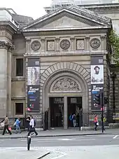
| National Portrait Gallery | St Martin's Place WC2 | Public art gallery | Ewan Christian and J. K. Colling | 1890–5 | 9 Jan 1970 | TQ2999580611 51°30′34″N 0°07′42″W / 51.509483°N 0.128201°W |
1066285 | |
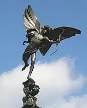
| Shaftesbury Memorial Fountain | Piccadilly Circus W1 | Memorial fountain with sculpture | Sir Alfred Gilbert (sculptor) | 1892–3 | 24 Feb 1958 | TQ2955780644 51°30′36″N 0°08′04″W / 51.50988°N 0.134497°W |
1265625 |
Strand
.jpg.webp)

.jpg.webp)


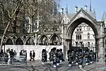
Temple
| Name | Location | Type | Completed [note 1] | Date designated | Grid ref.[note 2] Geo-coordinates |
Entry number [note 3] | Image |
|---|---|---|---|---|---|---|---|
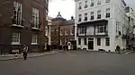
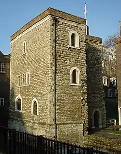
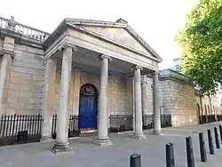
| Chambers on West side of New Court | Middle Temple | Inns of Court | 1676 | 4 Jan 1950 | TQ3108380996 51°30′46″N 0°06′45″W / 51.512691°N 0.112389°W |
1064616 | 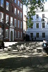 Chambers on West side of New Court |
Victoria
| Name | Location | Type | Completed [note 1] | Date designated | Grid ref.[note 2] Geo-coordinates |
Entry number [note 3] | Image |
|---|---|---|---|---|---|---|---|
| 55 Broadway (including St James's Park tube station) | Westminster | Office building | 1927–1929 | 9 Jan 1970 | TQ2960079486 51°29′58″N 0°08′03″W / 51.499463°N 0.134303°W |
1219790 | 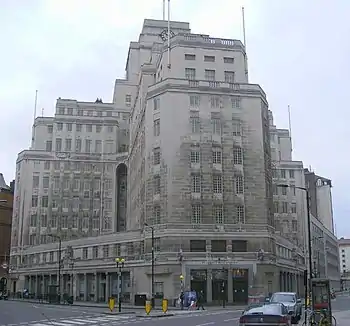 55 Broadway (including St James's Park tube station) |
Victoria Embankment
| Name | Location | Type | Completed [note 1] | Date designated | Grid ref.[note 2] Geo-coordinates |
Entry number [note 3] | Image |
|---|---|---|---|---|---|---|---|
| Cleopatra's Needle | Victoria Embankment | Obelisk | 1500 BC | 24 Feb 1958 | TQ3054380516 51°30′31″N 0°07′13″W / 51.508503°N 0.120344°W |
1066169 | |
| York Water Gate | Victoria Embankment | Water gate | 1626 | 24 Feb 1958 | TQ3036480471 51°30′29″N 0°07′23″W / 51.50814°N 0.122939°W |
1237938 | |
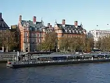
| Norman Shaw North Building | Victoria Embankment | Government offices | 1887–90 | 5 Feb 1970 | TQ3028179813 51°30′08″N 0°07′28″W / 51.502246°N 0.124377°W |
1274511 |
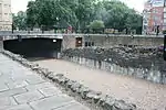
_inscriptions.jpg.webp)

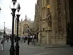
Westminster
.jpg.webp)

_(2).jpg.webp)


Abbey Precinct and Westminster School
| Name | Location | Type | Completed [note 1] | Date designated | Grid ref.[note 2] Geo-coordinates |
Entry number [note 3] | Image |
|---|---|---|---|---|---|---|---|
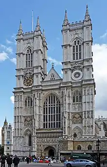
| Westminster Abbey | Broad Sanctuary SW1 | Abbey | 1050–65 | 24 Feb 1958 | TQ3008279490 51°29′58″N 0°07′38″W / 51.499389°N 0.127361°W |
1291494 | |
| St Margaret's Church | Parliament Square SW1 | Parish church | 11th / 12th century | 24 Feb 1958 | TQ3012479547 51°30′00″N 0°07′36″W / 51.499891°N 0.126735°W |
1226286 | |
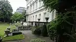
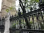
| The Great Cloisters of Westminster Abbey, including St Faiths Chapel, the Chapter House, the Parlour, numbers 1 and 2 the Cloisters, the Dark Cloisters and Dormitory with the Chapel of St Dunstan | Abbey Precinct and Westminster School | Manor House | 11th century | 24 Feb 1958 | TQ3007279452 51°29′57″N 0°07′39″W / 51.499049°N 0.127519°W |
1066370 | .JPG.webp) The Great Cloisters of Westminster Abbey, including St Faiths Chapel, the Chapter House, the Parlour, numbers 1 and 2 the Cloisters, the Dark Cloisters and Dormitory with the Chapel of St Dunstan |
| The Deanery and Sub Dean's Residence with the Jericho Parlour | Abbey Precinct and Westminster School | Building | c. 1370 | 23 Sep 1966 | TQ2999579469 51°29′57″N 0°07′43″W / 51.49922°N 0.128621°W |
1066375 | .jpg.webp) The Deanery and Sub Dean's Residence with the Jericho Parlour |
| 19, 19a and 20 Broad Sanctuary | Abbey Precinct and Westminster School | Guest House | Late 14th century and 15th century | 24 Feb 1958 | TQ3001479417 51°29′55″N 0°07′42″W / 51.498748°N 0.128367°W |
1219626 | 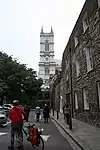 19, 19a and 20 Broad Sanctuary |
| Ashburnham House | Little Dean's Yard SW1 | Town House | Before 1662 | 24 Feb 1958 | TQ3004679409 51°29′55″N 0°07′40″W / 51.498669°N 0.127909°W |
1219461 | |
| College Dormitory, Westminster School | 4 Little Dean’s Yard SW1 | Manor House | 1722–30 | 9 Jan 1970 | TQ3006879348 51°29′53″N 0°07′39″W / 51.498116°N 0.127615°W |
1066372 | 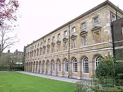 College Dormitory, Westminster School |
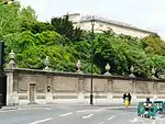
| Abbey Precinct Wall | Great College Street SW1 | Gate | Early medieval and c. 1374 with later additions and alterations | 24 Feb 1958 | TQ3014879337 51°29′53″N 0°07′35″W / 51.497998°N 0.126467°W |
1357235 | 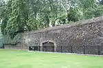 Abbey Precinct Wall |
| Clerk of the Works Office and the remains of the Chapel of St Catherine, Little Cloisters Lodgings | Abbey Precinct and Westminster School | Abbey | Late 14th century | 24 Feb 1958 | TQ3010879406 51°29′55″N 0°07′37″W / 51.498628°N 0.127018°W |
1357234 |  Clerk of the Works Office and the remains of the Chapel of St Catherine, Little Cloisters Lodgings |
| 18 Dean's Yard | Abbey Precinct and Westminster School | Guest House | 1461 | 24 Feb 1958 | TQ3001479375 51°29′54″N 0°07′42″W / 51.498371°N 0.128383°W |
1066406 | 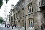 18 Dean's Yard |
| 17 Dean's Yard | Abbey Precinct and Westminster School | Teachers House | Late 18th century | 24 Feb 1958 | TQ3001479357 51°29′54″N 0°07′42″W / 51.498209°N 0.128389°W |
1219607 | 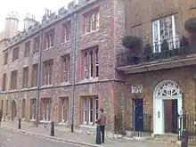 17 Dean's Yard |
| Little Deans Yard | Abbey Precinct and Westminster School | Teachers House | 1789–90 | 24 Feb 1958 | TQ3005279357 51°29′54″N 0°07′40″W / 51.4982°N 0.127842°W |
1066371 |  Little Deans Yard |
| Little Deans Yard Staircase to Doorway and Gateway to School and Busby Library | Abbey Precinct and Westminster School | Manor House | 1734 | 9 Jan 1970 | TQ3007079389 51°29′55″N 0°07′39″W / 51.498484°N 0.127571°W |
1066373 |  Little Deans Yard Staircase to Doorway and Gateway to School and Busby Library |
.jpg.webp)

Whitehall
| Name | Location | Type | Architect | Completed [note 1] | Date designated | Grid ref.[note 2] Geo-coordinates |
Entry number [note 3] | Image |
|---|---|---|---|---|---|---|---|---|
| Queen Mary's Steps and fragment of Whitehall Palace | Horse Guards Avenue SW1 | Part of former riverside terrace and steps and remains of palace wall | Sir Christopher Wren (steps) | Tudor and 1691–3 | 14 Jan 1970 | TQ3029780072 51°30′16″N 0°07′27″W / 51.504569°N 0.124051°W |
1066636 | 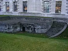 Queen Mary's Steps and fragment of Whitehall Palace |
| Ministry of Defence Main Building | Horse Guards Avenue SW1 | Government offices incorporating Tudor palace undercroft and historic rooms from the site | Sir William Chambers (rooms from Pembroke House); Vincent Harris (government offices) | c. 1530 (undercroft of York Place, later Whitehall Palace); c. 1757, 1760 and 1773 (rooms from Pembroke House); c. 1722 (room from Cromwell House) | 14 Jan 1970 | TQ3024080010 51°30′14″N 0°07′30″W / 51.504025°N 0.124894°W |
1278223 | |
| Treasury Buildings | Whitehall SW1 | Government offices with remains of former palace | William Kent, Sir John Soane and Sir Charles Barry | c. 1530 (remains of Whitehall Palace); c. 1700–10/11 (Dover House); 1733–6 (Kent's "new" Treasury); 1824–7 (Privy Council and Cabinet Offices; these remodelled 1845–7 and 1960–4) | 5 Feb 1970 | TQ3012079956 51°30′13″N 0°07′36″W / 51.503568°N 0.126642°W |
1267063 |  Treasury Buildings |
| Banqueting House | Whitehall SW1 | Former banqueting house of Whitehall Palace | Inigo Jones (refaced by Sir John Soane; altered by James Wyatt) | 1619–25 | 1 Dec 1987 | TQ3016680069 51°30′16″N 0°07′33″W / 51.504573°N 0.125938°W |
1357353 | |
| 10 Downing Street | Downing Street SW1 | Large terraced town house | Office of Works (Kent, I. Ware and H. Flitcroft probably all involved); K. Couse (street front); R. Erith and Q. Terry (20th-century reconstruction and interiors) | c. 1677 (older house incorporated into Downing's development of 1682); alterations 1723–35; street front replaced c. 1766–75; reconstructed 1960–4; Terry's work 1988–90 | 14 Jan 1970 | TQ3005979937 51°30′12″N 0°07′39″W / 51.503411°N 0.127528°W |
1210759 | |
| 11 Downing Street | Downing Street SW1 | Terraced town house | Kenton Couse (street front); Raymond Erith (reconstruction) | 1682; altered c. 1723–5, refaced c. 1766–75, altered again early 19th century, reconstructed 1960–4 | 14 Jan 1970 | TQ3003579935 51°30′12″N 0°07′40″W / 51.503399°N 0.127874°W |
1356989 | |
| The Admiralty and the Admiralty Screen | Whitehall SW1 | Government offices | Thomas Ripley; screen by Robert Adam | 1723–6; screen 1759–61 | 5 Feb 1970 | TQ3003880202 51°30′21″N 0°07′40″W / 51.505797°N 0.127732°W |
1066099 | 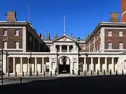 The Admiralty and the Admiralty Screen |
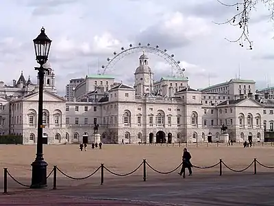
| Horse Guards | Whitehall SW1 | Former army offices, now a museum | William Kent | c. 1745–8 | 5 Feb 1970 | TQ3007480089 51°30′17″N 0°07′38″W / 51.504773°N 0.127256°W |
1066100 | |
| Forecourt railings, gates and guardhouses to Horse Guards | Whitehall SW1 | Railings, gates and guardshouses | — | c. 1750–60 | 5 Feb 1970 | TQ3010680104 51°30′18″N 0°07′36″W / 51.504901°N 0.126789°W |
1267077 | 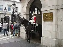 Forecourt railings, gates and guardhouses to Horse Guards |
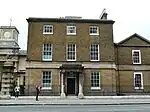
| Dover House (Scotland Office) | Whitehall SW1 | Former mansion, now government offices | James Paine (rear) and Henry Holland (front) | 1755–8; enlarged 1787 | 5 Feb 1970 | TQ3009380028 51°30′15″N 0°07′37″W / 51.504221°N 0.127004°W |
1066101 | |
| Admiralty House | Whitehall SW1 | Former official residence of the First Lord of the Admiralty | Samuel Pepys Cockerell | 1786–88 | 5 Feb 1970 | TQ3006680172 51°30′20″N 0°07′38″W / 51.505521°N 0.12734°W |
1267114 | |
| Foreign and Commonwealth Office | Whitehall SW1 | Government offices | Sir George Gilbert Scott with Sir Matthew Digby Wyatt | 1861–73 | 5 Feb 1970 | TQ2999679871 51°30′10″N 0°07′42″W / 51.502832°N 0.128459°W |
1066102 | |
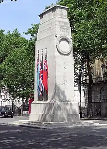
| The Cenotaph | Parliament Street SW1 | War memorial | Sir Edwin Lutyens | 1919–20 | 5 Feb 1970 | TQ3015979858 51°30′10″N 0°07′34″W / 51.502678°N 0.126117°W |
1357354 |


.jpg.webp)

See also
Notes
- 1 2 3 4 5 6 7 8 9 10 11 12 13 14 15 16 17 18 19 20 21 22 23 The date given is the date used by Historic England as significant for the initial building or that of an important part in the structure's description.
- 1 2 3 4 5 6 7 8 9 10 11 12 13 14 15 16 17 18 19 20 21 22 23 Sometimes known as OSGB36, the grid reference is based on the British national grid reference system used by the Ordnance Survey.
- 1 2 3 4 5 6 7 8 9 10 11 12 13 14 15 16 17 18 19 20 21 22 23 The "List Entry Number" is a unique number assigned to each listed building and scheduled monument by Historic England.
External links
 Media related to Grade I listed buildings in the City of Westminster at Wikimedia Commons
This article is issued from Wikipedia. The text is licensed under Creative Commons - Attribution - Sharealike. Additional terms may apply for the media files.