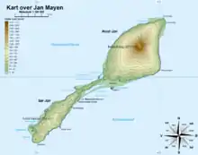
Map of Jan Mayen
Gouwenaerbåen (English: Gouwenaer Reef) is a 10 m (33 ft) shoal or reef southeast of Eggøya, on the southern coast of the island of Jan Mayen.[1] It is named after the Dutch seafarer Jacob de Gouwenaer,[1] who was master of the Orangienboom in 1614,[1] when he had first come upon the island (although he had been preceded by another Dutch expedition as well as a French one the same year). His name had originally been attached to Rekvedbukta.[1]
References
- 1 2 3 4 "Gouwenaerbåen (Jan Mayen)". Norsk Polarinstitutt. 1 January 2008. Retrieved 10 March 2013.
- Norwegian Polar Institute Place Names of Svalbard Database
70°57.9′N 8°19.9′W / 70.9650°N 8.3317°W
This article is issued from Wikipedia. The text is licensed under Creative Commons - Attribution - Sharealike. Additional terms may apply for the media files.