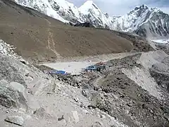
Gorakshep
गोरकशेप Gorak Shep | |
|---|---|
 View of Gorak Shep and Khumbu Glacier | |
 Gorakshep  Gorakshep | |
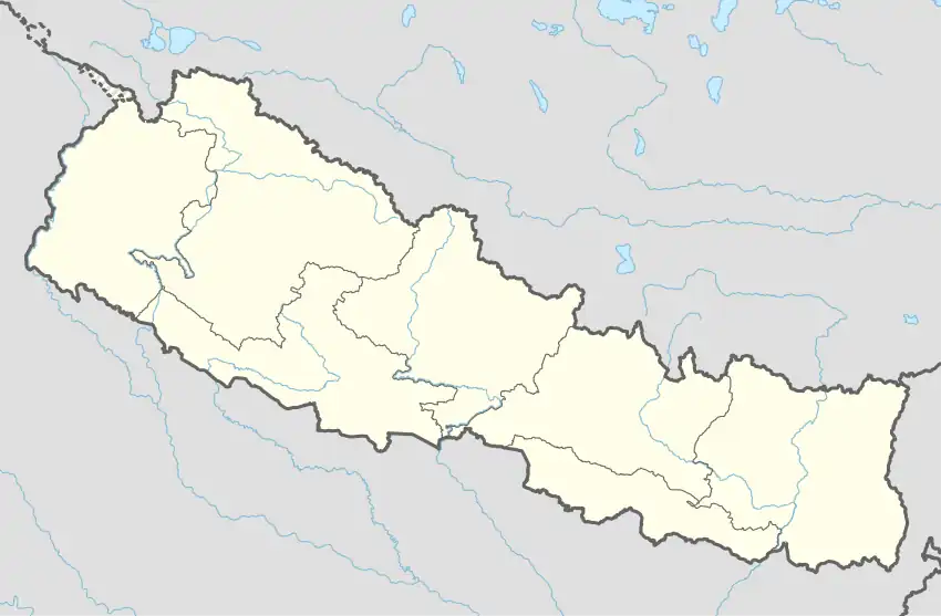
| Coordinates: 27°58′50″N 86°49′43″E / 27.98056°N 86.82861°E[1] |
Gorak Shep, also spelled Gorakshep (Nepali: गोरकशेप), is a quaint settlement nestled on the periphery of a frozen lakebed blanketed with sand in Nepal, sharing its name with the locale. Situated at an elevation of 5,164 meters (16,942 feet) near Mount Everest, this village remains uninhabited for most of the year. While the trekking lodges in Gorak Shep maintain a basic charm, contemporary conveniences have gradually made their way into the area. Recently, amenities such as high-speed internet access via satellite have enhanced the overall experience for visitors.
Trekking
Gorak Shep is inside the Sagarmatha National Park, the homeland of the Sherpa people, famous for their skills as guides and mountaineers. It is the final stop on most common treks to Everest Base Camp from Lukla, following what the Dalai Lama dubbed "the steps to heaven."
This route takes trekkers from Lukla to Namche Bazaar, Tengboche, Pangboche, Dingboche, Lobuche, and on to Gorak Shep. Most trekkers stay overnight there, as their trekking permits will not allow them to camp at Everest Base Camp.[2] Gorakshep is the last village with accommodation on the Everest base camp trek.[3]
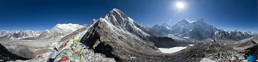
Also, Gorak Shep provides the best "launching pad" for an ascent of Kala Patthar, which looks like a giant dune looming over the lakebed. For many trekkers, summitting Kala Patthar, with its 5,550 meters (18,209 ft), provides both the best views of Everest and the highest altitude that most will reach without a climbing permit, which must be obtained in Kathmandu, at the Nepal Mountaineering Association.[4]
Climbing starts in the early morning, when the visibility is usually better. It takes four hours to summit and come back. Gorak Shep was the original Everest Base Camp, being used by the Swiss mountain climbers in their attempt to climb the Everest in 1952. Later the camp was moved closer to the mountain, just below the Khumbu Ice Fall. Climbing time from Gorak Shep to the Everest Base Camp ranges from 1.5 to 2.5 hours, depending on the weather, acclimatization and physical conditioning of each individual.[5]
At this altitude, few people feel comfortable and many start to suffer symptoms of altitude sickness or acute mountain sickness (AMS).[6][7]
| Gorakshep | |
|---|---|
 Gorakshep  Gorakshep | |
| Coordinates | 27°59′00″N 86°50′00″E / 27.98333°N 86.83333°E |
| Type | frozen lake |
Climate
The best times for trekking are in spring (March and April) and autumn (October and November), when the visibility of the mountain is ideal and the temperature is not excessively cold.[8] However, in autumn the competition for bed spaces in the lodges can be intense, though normally trekkers are allowed to sleep on the floor of the dining room lodge.[5]
During the winter, in the months from December to February, it is possible to do trekking, but the vast majority of accommodations are closed, the trails are snow-covered and the cold is very intense.
Gorak Shep means "dead ravens," because of the complete lack of any kind of vegetation in this place.[5]
 Approaching Gorak Shep from the South
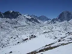 View of Gorak Shep from the North, half-way up Kala Patthar
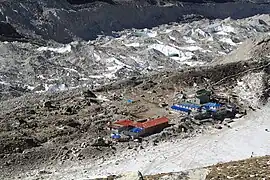 Looking down on Gorak Shep, Khumbu behind it
Panoramic view
See also
- La Rinconada, Peru - the highest elevation year-round human habitation in the world at 5,100 m (16,730 feet).
References
- ↑ Gorak Shep Wikimapia
- ↑ Junket Nepal
- ↑ sarina, lex (2022-12-09). "Gorakshep to Kathmandu helicopter". Retrieved 2023-06-18.
- ↑ Climbing Permit
- 1 2 3 Bradley, Mayhew; "Trekking in the Nepal Himalaya"; (2009); 9th edition; p 97 (map) and pp 120-122; Lonely Planet; ISBN 978-1-74104-188-0.
- ↑ Muza, SR; Fulco, CS; Cymerman, A (2004). "Altitude Acclimatization Guide.". US Army Research Inst. of Environmental Medicine Thermal and Mountain Medicine Division Technical Report (USARIEM-TN-04-05). http://archive.rubicon-foundation.org/7616 Archived 2009-04-23 at the Wayback Machine . Retrieved 2009-03-05
- ↑ Windsor, Jeremy (10 May 2019). "Mountain Medicine, Critical Care Fellowships and 'Surviving the Death Zone'". www.ics.ac.uk.
- ↑ Shrestha, Vinod Prasad;”Concise Geography of Nepal; 2007; Kathmandu; Mandal Publications;ISBN 978-99946-55-04-5
External links
- Images from Gorak Shep and Everest
- Gorak Shep Holidays Archived 2018-04-18 at the Wayback Machine