Gölpınar | |
|---|---|
 Gölpınar Location in Turkey 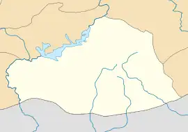 Gölpınar Gölpınar (Şanlıurfa) | |
| Coordinates: 37°17′09″N 38°49′35″E / 37.2857°N 38.8265°E | |
| Country | Turkey |
| Province | Şanlıurfa |
| District | Karaköprü |
| Population (2022) | 670 |
| Time zone | TRT (UTC+3) |
Gölpınar is a neighbourhood of the municipality and district of Karaköprü, Şanlıurfa Province, Turkey.[1] Its population is 670 (2022).[2] It is located about 15 km (9.3 mi) north of Urfa.[3]: 17 It is located just south of the road to Kabahaydar, 2 km (1.2 mi) east of the road's intersection with the main Urfa-Siverek highway.[3]: 17 It lies on a plain that stretches east toward Kabahaydar, between the Akziyaret Tepe hill to the north and the forested hills called Atatürk Ormanı (part of Germuş Dağ) to the south.[3]: 17 There is a spring in the east of the village.[3]: 17
Archaeology
The village sits on top of a small archaeological mound about 250 m in diameter and 10 m in height.[3]: 17 In some places, erosion from the spring has revealed basalt architectural fragments.[3]: 17 Old relief fragments are also visible in the walls of some houses.[3]: 17 Two ancient stone artifacts were found at Gölpınar: one is a broken stele, 116 cm tall and 42 cm wide, is now kept at the Şanlıurfa Museum; the other is an orthostat measuring 116x75x20 cm.[3]: 17–8 F. Kulakoğlu dated the stele to approximately the 8th century BCE and the orthostat to about the late 10th century BCE.[3]: 17–8 The stele depicts a male figure riding on a bull; the upper part of the male figure is missing.[3]: 18 He is wearing a short skirt with a wide belt and traditional Hittite shoes with upturned tips.[3]: 18 Attached to his belt is a sword.[3]: 18 The orthostat depicts a male figure riding a deer, also in a Hittite-like style with the head and lower body in profile but the torso shown head-on.[3]: 18 In this case, his head is missing except for his beard.[3]: 18 He is wearing a short-sleeved robe with a wide belt; attached to the belt is a short sword with a crescent-shaped hilt.[3]: 18 He is holding a bow in his left hand and two arrows in his right.[3]: 18 This imagery is associated with a god who was protector of the countryside.[3]: 18
References
- ↑ Mahalle, Turkey Civil Administration Departments Inventory. Retrieved 19 September 2023.
- ↑ "Address-based population registration system (ADNKS) results dated 31 December 2022, Favorite Reports" (XLS). TÜİK. Retrieved 19 September 2023.
- 1 2 3 4 5 6 7 8 9 10 11 12 13 14 15 16 17 Çelik, Bahattin (2008). Arkeoloji'de Urfa (PDF). Istanbul: Fsf Printing House. ISBN 978-975-585-992-7. Retrieved 8 November 2022.