| Donoho Creek Tributary to Cape Fear River | |
|---|---|
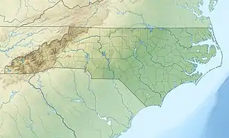 Location of Donoho Creek mouth  Donoho Creek (the United States) | |
| Location | |
| Country | United States |
| State | North Carolina |
| County | Bladen |
| Physical characteristics | |
| Source | Carvers Creek divide |
| • location | about 1 mile northwest of Westbrook, North Carolina |
| • coordinates | 34°29′23″N 078°27′00″W / 34.48972°N 78.45000°W[1] |
| • elevation | 90 ft (27 m)[2] |
| Mouth | Cape Fear River |
• location | about 0.25 miles northeast of Westbrook, North Carolina |
• coordinates | 34°28′52″N 078°24′48″W / 34.48111°N 78.41333°W[1] |
• elevation | 13 ft (4.0 m)[2] |
| Length | 2.20 mi (3.54 km)[3] |
| Basin size | 2.04 square miles (5.3 km2)[4] |
| Discharge | |
| • location | Cape Fear River |
| • average | 2.65 cu ft/s (0.075 m3/s) at mouth with Cape Fear River[4] |
| Basin features | |
| Progression | Cape Fear River → Atlantic Ocean |
| River system | Cape Fear River |
| Tributaries | |
| • left | unnamed tributaries |
| • right | unnamed tributaries |
| Bridges | NC 87, N Braddy Plantation Road |
Donoho Creek is a 2.20 mi (3.54 km) long 1st order tributary to the Cape Fear River in Bladen County, North Carolina. This is the only stream of this name in the United States.
Course
Donoho Creek rises on the Carvers Creek divide about 1 mile northwest of Westbrook, North Carolina. Donoho Creek then flows southeast to join the Cape Fear River about 0.25 miles northeast of Westbrook.[2]
Watershed
Donoho Creek drains 2.04 square miles (5.3 km2) of area, receives about 50.3 in/year of precipitation, has a wetness index of 552.49 and is about 20% forested.[4]
See also
References
- 1 2 "GNIS Detail - Donoho Creek". geonames.usgs.gov. US Geological Survey. Retrieved 14 September 2020.
- 1 2 3 "Donoho Creek Topo Map in Bladen". TopoZone. Locality, LLC. Retrieved 14 September 2020.
- ↑ "ArcGIS Web Application". epa.maps.arcgis.com. US EPA. Retrieved 14 September 2020.
- 1 2 3 "Donoho Creek Watershed Report". US EPA Geoviewer. US EPA. Retrieved 14 September 2020.
This article is issued from Wikipedia. The text is licensed under Creative Commons - Attribution - Sharealike. Additional terms may apply for the media files.