State Highway 233 | ||||
|---|---|---|---|---|
| Baxter Road | ||||
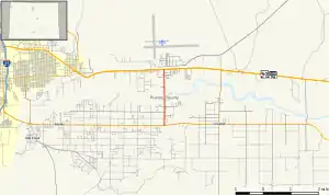 Map of Pueblo County in south central Colorado with former SH 233 highlighted in red | ||||
| Route information | ||||
| Maintained by CDOT | ||||
| Length | 2.147 mi[1] (3.455 km) | |||
| Major junctions | ||||
| South end | ||||
| North end | ||||
| Location | ||||
| Country | United States | |||
| State | Colorado | |||
| Counties | Pueblo | |||
| Highway system | ||||
| ||||
| ||||

State Highway 233 (SH 233) was a state highway in Pueblo County, Colorado. SH 233's southern terminus was at U.S. Route 50 Business (US 50 Bus.) west of Vineland, and the northern terminus was at U.S. Route 50 (US 50) and SH 96 in Baxter. The highway was decommissioned in 2017, when ownership was transferred to Pueblo County.[2]
Route description
SH 233 ran for 2.1 miles (3.4 km), starting at a junction with US 50 Bus., heading north across the Arkansas River and ending at a junction with US 50 and SH 96.
Major intersections
The entire route was in Pueblo County.
| Location | mi | km | Destinations | Notes | |
|---|---|---|---|---|---|
| | 0.000 | 0.000 | Southern terminus | ||
| Baxter | 2.147 | 3.455 | Northern terminus | ||
| 1.000 mi = 1.609 km; 1.000 km = 0.621 mi | |||||
References
- ↑ "Segment list for SH 233". Retrieved January 22, 2011.
- ↑ "Resolution # TC-17-6-5" (PDF). June 15, 2017.
External links
Template:Attached KML/Colorado State Highway 233
KML is from Wikidata
![]() Media related to Colorado State Highway 233 at Wikimedia Commons
Media related to Colorado State Highway 233 at Wikimedia Commons
This article is issued from Wikipedia. The text is licensed under Creative Commons - Attribution - Sharealike. Additional terms may apply for the media files.