| Chée | |
|---|---|
 | |
  | |
| Location | |
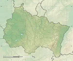
| Country | France |
| Physical characteristics | |
| Source | |
| • location | Les Hauts-de-Chée |
| • coordinates | 48°52′43″N 05°12′56″E / 48.87861°N 5.21556°E |
| • elevation | 250 m (820 ft) |
| Mouth | |
• location | Saulx |
• coordinates | 48°45′08″N 04°38′47″E / 48.75222°N 4.64639°E |
• elevation | 95 m (312 ft) |
| Length | 68.6 km (42.6 mi) |
| Basin size | 400 km2 (150 sq mi) |
| Discharge | |
| • average | 4 m3/s (140 cu ft/s) |
| Basin features | |
| Progression | Saulx→ Marne→ Seine→ English Channel |
The Chée (French pronunciation: [ʃe]) is a 68.6-kilometre (42.6 mi) long river in the Meuse and Marne départements, northeastern France.[1] Its source is in the Barrois, near Marat-la-Grande, a hamlet in Les Hauts-de-Chée. It flows generally southwest. It is a right tributary of the Saulx into which it flows at Vitry-en-Perthois, near Vitry-le-François.
Its main tributary is the Vière.
Départements and communes along its course
This list is ordered from source to mouth:
- Meuse: Les Hauts-de-Chée, Rembercourt-Sommaisne, Louppy-le-Château, Villotte-devant-Louppy, Laheycourt, Noyers-Auzécourt, Nettancourt, Brabant-le-Roi, Revigny-sur-Ornain
- Marne: Vroil, Bettancourt-la-Longue, Alliancelles, Heiltz-le-Maurupt, Jussecourt-Minecourt, Heiltz-l'Évêque, Outrepont, Changy, Merlaut, Vitry-en-Perthois
References
This article is issued from Wikipedia. The text is licensed under Creative Commons - Attribution - Sharealike. Additional terms may apply for the media files.