Belu Regency
Kabupaten Belu Rai Belu | |
|---|---|
 Coat of arms | |
| Nickname: Belu | |
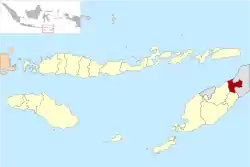 Location within East Nusa Tenggara | |
 Belu Regency 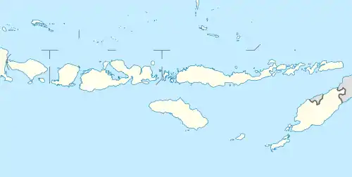 Belu Regency Belu Regency (Lesser Sunda Islands) 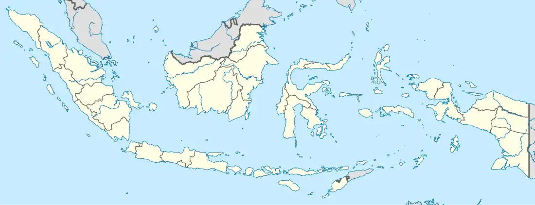 Belu Regency Belu Regency (Indonesia) | |
| Coordinates: 9°20′45″S 124°57′2″E / 9.34583°S 124.95056°E | |
| Country | |
| Region | Lesser Sunda Islands |
| Province | |
| Settled | 20 December 1956 |
| Capital | Atambua |
| Government | |
| • Regent | Willy Lay |
| • Vice Regent | J. T. Ose Luan |
| Area | |
| • Total | 496.12 sq mi (1,284.94 km2) |
| Elevation | 1,230 ft (375 m) |
| Population (mid 2022 estimate)[1] | |
| • Total | 224,306 |
| • Density | 450/sq mi (170/km2) |
| Time zone | UTC+8 (ICST) |
| Postcodes | 856xx, 857xx |
| Area code | (+62) 389 |
| Religion | Christianity 95.45% — Catholic 88.39% — Protestant 7.10% Islam 4.30% Hindu 0.19% Buddhism 0.02%[2] |
| Website | belukab |
Belu Regency is a regency in East Nusa Tenggara province of Indonesia. Situated on the north of Timor island, it adjoins the separate nation of East Timor to the east. Established on 20 December 1958,[3] Belu Regency has its seat (capital) in the large town of Atambua.
In December 2012 a separate Regency - Malaka Regency - was created from the twelve districts that formerly comprised the southern half of Belu Regency. "Belu" means "friend" in Tetum. The residual part of Belu Regency had a population of 188,163 at the 2010 Census,[4] which rose to 206,476 at the 2015 Intermediate Census[5] and to 217,973 at the 2020 Census.[6] The official estimate as at mid 2022 was 224,306.[1]
Administrative Districts
The Belu Regency was until 2013 divided into twenty-four districts (kecamatan), but in December 2012, the twelve southern kecamatan were removed to form the new Malaka Regency, leaving the twelve northern kecamatan in Belu Regency. The residual Belu Regency is thus composed of twelve districts (kecamatan), tabulated below with their areas (in km2) and their populations at the 2010 Census[4] and 2020 Census,[6] together with the official estimates as at mid 2022.[1] The table also includes the locations of the district headquarters, the number of administrative villages in each district (totaling 69 rural desa and 12 urban kelurahan - the latter being the 12 comprising Atambua town), and its postal code.
| Kode Wilayah | Name of District (kecamatan) | Area in km2 | Pop'n Census 2010 | Pop'n Census 2020 | Pop'n Estimate mid 2022 | Admin centre | No. of villages | Post code |
|---|---|---|---|---|---|---|---|---|
| 53.04.12 | Kota Atambua (Central Atambua) | 24.90 | 26,396 | 30,837 | 31,776 | Tenukiik | 4 | 85711 -85718 |
| 53.04.21 | Atambua Barat (West Atambua) | 15.55 | 21,604 | 24,178 | 24,708 | Sesekoe | 4 | 85713 -85718 |
| 53.04.22 | Atambua Selatan (East Atambua) | 15.73 | 22,464 | 26,144 | 26,921 | Asuulun | 4 | 85716 -85718 |
| Total Atambua town | 56.18 | 70,464 | 81,159 | 83,405 | 12 | 85711 -85718 | ||
| 53.04.13 | Raimanuk | 179.42 | 14,411 | 16,755 | 17,249 | Arekama | 9 | 85760 |
| 53.04.04 | Tasifeto Barat (West Tasifeto) | 224.19 | 22,362 | 24,545 | 24,989 | Kimbana | 8 | 85753 |
| 53.04.05 | Kakulak Mesak | 187.54 | 17,608 | 21,988 | 22,952 | Umarese | 6 | 85752 |
| 53.04.23 | Nanaet Dubesi | 60.25 | 4,006 | 4,783 | 4,950 | Tete Seban | 4 | 85751 |
| 53.04.02 | Tasifeto Timur (East Tasifeto) | 211.37 | 20,932 | 26,121 | 27,263 | Wedomu | 12 | 85771 |
| Western rural sector (a) | 862.77 | 79,319 | 94,192 | 97,403 | 39 | |||
| 53.04.03 | Raihat | 87.20 | 13,319 | 14,359 | 14,568 | Bei Sari Loo | 6 | 85773 |
| 53.04.17 | Lasiolat | 64.48 | 6,166 | 7,096 | 7,291 | Lafuli | 7 | 85771 |
| 53.04.01 | Lamaknen | 105.90 | 11,583 | 12,632 | 12,845 | Weluli | 9 | 85772 |
| 53.04.18 | Lamaknen Selatan (South Lamaknen) | 18.41 | 7,312 | 8,535 | 8,794 | Pie Bulak | 8 | 85770 |
| Eastern salient (b) | 365.99 | 38,380 | 42,622 | 43,498 | 30 | |||
| Totals for regency | 1,284.94 | 188,163 | 217,973 | 224,306 | 81 |
Note: (a) the five westerly rural kecamatan, mainly surrounding or south of Atambua. (b) the area projecting into East Timor.
Media
Belu Regency is served with four radio stations that cover the wider area around this regency (including Malaka Regency, Alor Regency, and Timor Tengah Utara Regency), which are RRI Pro1 Atambua (FM 91.5 MHz) RRI Pro2 Atambua (FM 99.8 MHz) RRI Pro3 (FM 99.0 MHz), and Saluran Citra Budaya Timor (alias Pro4) (FM 93.1 MHz). There's still a lot of radio that can be found in the town.
The regency is only served with two television stations (TVRI - including TVRI East Nusa Tenggara, Belu TV) and a few other East Timor stations that reach the border pass.
References
- 1 2 3 Badan Pusat Statistik, Jakarta, 2023, Kabupaten Belu Dalam Angka 2023 (Katalog-BPS 1102001.5304)
- ↑ "Kabupaten Belu Dalam Angka 2019". www.belukab.bps.go.id (in Indonesian). Retrieved 13 February 2020.
- ↑ Government of Indonesia (9 August 1958), Establishment of the Second-level Administrative Regions under the First-level Administrative Region of Bali, West Nusa Tenggara and East Nusa Tenggara (in Indonesian ed.), Indonesia Ministry of Law and Justice, UU No. 69/1958, retrieved 24 August 2007
- 1 2 Biro Pusat Statistik, Jakarta, 2011.
- ↑ Badan Pusat Statistik, Jakarta, 2018.
- 1 2 Badan Pusat Statistik, Jakarta, 2021.
Regencies and cities of East Nusa Tenggara | ||
|---|---|---|
Capital: Kupang | ||
| Regencies |  | |
| Cities | ||