Baldirai is a town and tehsil of Sultanpur district, Uttar Pradesh, India.[1] It consists of 99 villages (98 inhabited and 1 uninhabited) with a total population of 182,455 people, in 31,431 households.[1]
Demographics
As of 2011, Waldi Rai CD block has a population of 182,455 people, in 31,431 households.[1] This population includes 92,058 males and 90,397 females.[1] The corresponding sex ratio of 982 females to every 1000 males is slightly lower than the district rural average of 987.[1] Members of the 0-6 age group numbered 27,598 as of 2011, or about 15.1% of the total.[1] The sex ratio of this group is 930, which is slightly higher than the district rural average of 923.[1] Members of Scheduled Castes numbered 40,828, or 22.38% of the total population; while members of Scheduled Tribes numbered 13, or 0.01% of the total.[1] The literacy rate of Waldi Rai block as of 2011 is 67.04% (counting only people age 7 and up); literacy is higher among men and boys (78.02%) than among women and girls (55.96%).[1] The Scheduled Castes literacy rate as of the same year is 53.56% (64.62% among men and boys and 42.25% among women and girls).[1]
In terms of employment, 17.77% of Waldi Rai block residents were classified as main workers (i.e. people employed for at least 6 months per year) in 2011.[1] Marginal workers (i.e. people employed for less than 6 months per year) made up 16.17%, and the remaining 66.05% were non-workers.[1] Employment status varied according to gender, with 47.25% of men being either main or marginal workers, compared to only 20.40% of women.[1]
Agriculture is the predominant source of employment in Waldi Rai block: 27.10% of the block's workers were cultivators who owned or leased their own land as of 2011, and a further 46.46% were agricultural labourers who worked someone else's land for wages.[1] Another 5.85% were counted as household industry workers, and the remaining 20.59% were other workers.[1]
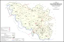
Villages
Waldi Rai CD block has the following 99 villages:[1]
| Village name | Total land area (hectares) | Population (in 2011) |
|---|---|---|
| Fatte Pur | 530.4 | 5,057 |
| Uska Mau | 159 | 1,431 |
| Vishwanath Pur | 22.3 | 329 |
| Taudhikpur | 312.8 | 2,377 |
| Sarai Baggha | 306.2 | 1,366 |
| Jarai Kalan | 780 | 5,284 |
| Huliyapur | 875.4 | 9,256 |
| Ranmusepur | 275.4 | 256 |
| Kakartola | 191 | 1,745 |
| Kuwasi | 124.1 | 682 |
| Baradand | 118.8 | 527 |
| Rampur Babuwan | 241.9 | 2,575 |
| Trihut | 361 | 3,468 |
| Gaura Parani | 189.7 | 993 |
| Jamalpur | 16.9 | 477 |
| Pipri | 509.5 | 3,451 |
| Umra | 644.6 | 3,894 |
| Dobhiyara | 608 | 4,955 |
| Hasai Mukundpur | 141.1 | 1,252 |
| Bhawani Garh | 98.3 | 1,197 |
| Meghmau | 284.1 | 2,369 |
| Dehariyawan | 499.9 | 4,534 |
| Pauli | 192.1 | 321 |
| Kanpa | 975.6 | 6,020 |
| Nichooti | 214.7 | 1,505 |
| Dakkhin Gaun | 136.2 | 1,586 |
| Atanagar | 208.8 | 1,175 |
| Soraun | 385.8 | 3,889 |
| Raiya | 100 | 3,272 |
| Dih | 1,264.2 | 5,389 |
| Govindpur | 298.2 | 1,748 |
| Makhdum Pur | 147.4 | 918 |
| Sighni | 271.1 | 1,641 |
| Dewra | 278.7 | 2,225 |
| Haighana Khurd | 194 | 991 |
| Nandrai | 163.4 | 1,127 |
| Sukhbaderi | 222.2 | 1,229 |
| Bahu Rawan | 324.5 | 3,027 |
| Madiyana | 75 | 558 |
| Ramnagar | 55.1 | 422 |
| Upri | 60.3 | 402 |
| Bihinidura | 491.8 | 5,234 |
| Patela | 74.4 | 1,075 |
| Haidhana Kalan | 386.4 | 2,682 |
| Loharia | 101.9 | 885 |
| Gaura Bara Mau | 339.8 | 3,393 |
| Mahuli | 321.3 | 2,102 |
| Akhari | 179.1 | 1,498 |
| Birchhaura | 273.4 | 2,186 |
| Alamau | 131.3 | 1,166 |
| Ganapur | 16.6 | 411 |
| Khanoha | 58.4 | 776 |
| Aliabad | 98.8 | 2,005 |
| Para | 100.6 | 2,381 |
| Sonbarsa | 112.2 | 1,706 |
| Kalyan Pur | 75.2 | 617 |
| Adampur | 56.6 | 690 |
| Natauli | 52.1 | 1,170 |
| Saini | 129.8 | 1,420 |
| Malpur | 75.3 | 319 |
| Pakesar | 23 | 0 |
| Asrafpur | 340.3 | 2,513 |
| Arwal | 413.8 | 2,131 |
| Chak Shiwapur | 106 | 1,003 |
| Bhawanipur | 183.1 | 1,387 |
| Kasba Mafiyat | 138.5 | 1,472 |
| Chak Shikra | 47.8 | 446 |
| Isauli | 258 | 5,978 |
| Chak Kari Bhit | 176.5 | 1,279 |
| Nishasin | 159.4 | 869 |
| Mohammad Kajipur | 81.8 | 1,137 |
| Nandauli | 241.3 | 3,102 |
| Durgapur | 215.1 | 1,586 |
| Phulpur | 39.8 | 341 |
| Baghuna | 274.4 | 3,497 |
| Gopalapur | 41.4 | 344 |
| Ranipur | 43.8 | 211 |
| Narsara | 229.5 | 2,049 |
| Bar Sawan | 92.4 | 970 |
| Chak Tenduwa | 25.2 | 927 |
| Dauno | 88.6 | 1,058 |
| Jagdishpur | 83.8 | 593 |
| Rainapur | 57.5 | 461 |
| Dariyapur | 242.9 | 1,753 |
| Lahurepur | 61.5 | 716 |
| Wallopur | 35.3 | 163 |
| Saflepur | 56.5 | 802 |
| Usri | 38.8 | 343 |
| Saidullapur | 138.1 | 1,283 |
| Chhatauna | 109.3 | 835 |
| Chak Fajilpur | 18.1 | 309 |
| Rasulpur | 46.8 | 584 |
| Mirpur | 21.6 | 267 |
| Gangapur | 37.4 | 413 |
| Wallipur | 521.6 | 4,219 |
| Hemnapur | 679 | 7,457 |
| Mau | 167.7 | 1,651 |
| Chakmusi | 75.3 | 1,269 |
| Rampurthuan | 63.7 | 401 |