Babie | |
|---|---|
Municipality | |
 | |
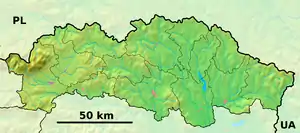 Babie Location of Babie in the Prešov Region 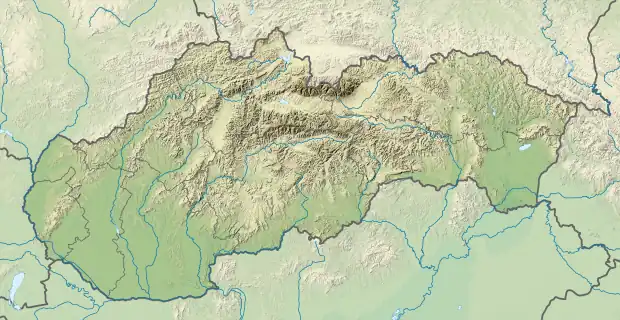 Babie Location of Babie in Slovakia | |
| Coordinates: 49°04′0″N 21°30′0″E / 49.06667°N 21.50000°E | |
| Country | |
| Region | Prešov |
| District | Vranov nad Topľou |
| First mentioned | 1330 |
| Government | |
| • Mayor | Martina Hliboká |
| Area | |
| • Total | 7.99[1] km2 (3.08[1] sq mi) |
| Elevation | 217[2] m (712[2] ft) |
| Population (2021) | |
| • Total | 236[3] |
| Time zone | UTC+1 (CET) |
| • Summer (DST) | UTC+2 (CEST) |
| Postal code | 094 31[2] |
| Area code | +421 57[2] |
| Car plate | VT |
| Website | babie |
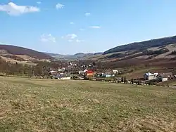
Babie (Hungarian: Bábafalva) is a village and municipality in the Vranov nad Topľou District in the Prešov Region of Slovakia.
Population
According to the 2011 census, the municipality had 252 inhabitants. All inhabitants were Slovaks.[4]
Genealogical resources
The records for genealogical research are available at the state archive "Statny Archiv in Presov, Slovakia"
- Roman Catholic church records (births/marriages/deaths): 1766-1897
- Greek Catholic church records (births/marriages/deaths): 1847-1939
- Lutheran church records (births/marriages/deaths): 1766-1895
- Census records 1869 of Babie are available at the state archive.
See also
References
- 1 2 "Hustota obyvateľstva - obce [om7014rr_ukaz: Rozloha (Štvorcový meter)]". www.statistics.sk (in Slovak). Statistical Office of the Slovak Republic. 2022-03-31. Retrieved 2022-03-31.
- 1 2 3 4 "Základná charakteristika". www.statistics.sk (in Slovak). Statistical Office of the Slovak Republic. 2015-04-17. Retrieved 2022-03-31.
- ↑ "Počet obyvateľov podľa pohlavia - obce (ročne)". www.statistics.sk (in Slovak). Statistical Office of the Slovak Republic. 2022-03-31. Retrieved 2022-03-31.
- ↑ "OBCE Narodnost" (PDF). Archived from the original (PDF) on 2012-11-14. Retrieved 2012-11-14.
External links
 Media related to Babie (Vranov nad Topľou District) at Wikimedia Commons
- http://en.db-city.com/Slovakia/Pre%C5%A1ov/Vranov_nad_Top%C4%BEou/Babie
- Surnames of living people in Babie
This article is issued from Wikipedia. The text is licensed under Creative Commons - Attribution - Sharealike. Additional terms may apply for the media files.