Ararah | |
|---|---|
Gram Panchayat | |
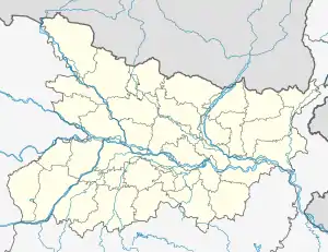 Ararah Location in bihar , India  Ararah Ararah (India) | |
| Coordinates: 25°46′37.1″N 85°13′23.1″E / 25.776972°N 85.223083°E | |
| Country | |
| State | Bihar |
| District | vaishali |
| Assembly Constituency | hajipur assembly constituency (AC.123)[1] |
| Languages | |
| • Official | Hindi |
| Time zone | UTC+5:30 (IST) |
| ISO 3166 code | IN-BR |
Ararah is a Gram panchayat in Hajipur in the Vaishali district, state of Bihar, India.
Geography
This panchayat is located at 25°46′37.1″N 85°13′23.1″E / 25.776972°N 85.223083°E
panchayat office
panchayat bhawan ararah (पंचायत भवन ararah )[2]
Nearest City/Town
Nearest major road highway or river
State highway 74 ( nearest state highway ) And Other roadway [4]
compass
Places adjacent to Ararah | ||||||||||||||||
|---|---|---|---|---|---|---|---|---|---|---|---|---|---|---|---|---|
| ||||||||||||||||
Villages in panchayat
There are villages in this panchayat[6]
References
- ↑ The Chief Electoral Officer of Bihar official,hajipur pdf
- ↑ "Collectoriate Hajipur0001.pdf" (PDF). Panchayati Raj Department,Government of Bihar. p. 7. Archived from the original (PDF) on 3 November 2014. Retrieved 3 November 2014.
- ↑ village profile census government official website State - Bihar, District- vaishali, Sub District - Hajipur
- ↑ Map - vaishali district official government website Archived 4 November 2014 at the Wayback Machine file type: image/jpeg, size:13.9 MB
- ↑ The Chief Electoral Officer of Bihar official,hajipur pdf
- ↑ Reports of National Panchayat Directory Ministry of Panchayati Raj Government of India List of Census Villages mapped for ARARAH Gram Panchayat,HAJIPUR,VAISHALI,BIHAR Archived 3 November 2014 at the Wayback Machine Report printed on 26/09/2014 National Panchayat Portal,Panchayat Informatics Division
This article is issued from Wikipedia. The text is licensed under Creative Commons - Attribution - Sharealike. Additional terms may apply for the media files.