Achor, Ohio | |
|---|---|
 Achor  Achor | |
| Coordinates: 40°46′27″N 80°32′30″W / 40.77417°N 80.54167°W | |
| Country | United States |
| State | Ohio |
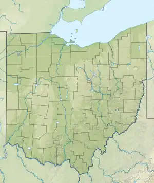
| County | Columbiana |
| Township | Middleton |
| Elevation | 830 ft (253 m) |
| Time zone | UTC-5 (Eastern (EST)) |
| • Summer (DST) | UTC-4 (EDT) |
| ZIP code | 44441 |
| Area codes | 330, 234 |
| FIPS code | 39/00170 |
| GNIS feature ID | 1064293[1] |
Achor is an unincorporated community in Middleton Township, Columbiana County, Ohio, United States.[1] It lies a few miles south of the community of Negley and just west of the state border with Pennsylvania. Once a leading settlement in the eastern portion of the county, it is now virtually a ghost town.
History
Achor was originally called "The Valley of Achor", and under the latter name was platted around 1806.[2] Variant names included Achorston, Achortown, Anchorstown, and Middleton.[1] A post office called Achor was established in 1816, and remained in operation until 1901.[3]
In 2020, the Valley of Achor Baptist Church, the only original building of the community still standing, burned down.[4]
References
- 1 2 3 4 "Achor". Geographic Names Information System. United States Geological Survey, United States Department of the Interior. Retrieved August 2, 2018.
- ↑ McCord, William B. (1905). History of Columbiana County, Ohio and Representative Citizens. Biographical Publishing Company. p. 303.
- ↑ "Columbiana County". Jim Forte Postal History. Retrieved January 10, 2016.
- ↑ "Historic church destroyed by fire". The Review. August 4, 2020. Retrieved October 17, 2022.
Municipalities and communities of Columbiana County, Ohio, United States | ||
|---|---|---|
| Cities | 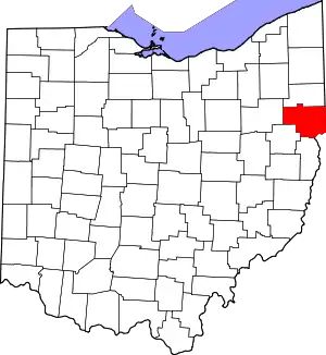 Map of Ohio highlighting Columbiana County | |
| Villages | ||
| Townships | ||
| CDPs | ||
| Unincorporated communities |
| |
| Ghost town | ||
| Footnotes | ‡This populated place also has portions in an adjacent county or counties | |
This article is issued from Wikipedia. The text is licensed under Creative Commons - Attribution - Sharealike. Additional terms may apply for the media files.