Štěpánkovice | |
|---|---|
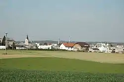 View of Štěpánkovice | |
 Flag  Coat of arms | |
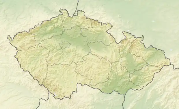 Štěpánkovice Location in the Czech Republic | |
| Coordinates: 49°57′27″N 18°2′15″E / 49.95750°N 18.03750°E | |
| Country | |
| Region | Moravian-Silesian |
| District | Opava |
| First mentioned | 1265 |
| Government | |
| • Mayor | Jaromír Nevřela |
| Area | |
| • Total | 12.53 km2 (4.84 sq mi) |
| Elevation | 258 m (846 ft) |
| Population (2023-01-01)[1] | |
| • Total | 3,167 |
| • Density | 250/km2 (650/sq mi) |
| Time zone | UTC+1 (CET) |
| • Summer (DST) | UTC+2 (CEST) |
| Postal code | 747 28 |
| Website | www |
Štěpánkovice (German: Schepankowitz) is a municipality and village in Opava District in the Moravian-Silesian Region of the Czech Republic. It has about 3,200 inhabitants. It is part of the historic Hlučín Region.
Administrative parts
Villages of Bílá Bříza and Svoboda are administrative parts of Štěpánkovice.
History
The first written mention of Štěpánkovice is from 1265. Until 1742, the village belonged to Duchy of Troppau. Since 1742, it belonged to Prussia after Maria Theresa had been defeated.[2]
Notable people
- Filip Souček (born 2000), footballer
References
- ↑ "Population of Municipalities – 1 January 2023". Czech Statistical Office. 2023-05-23.
- ↑ "Historie" (in Czech). Obec Štěpánkovice. Retrieved 2022-01-31.
External links
Wikimedia Commons has media related to Štěpánkovice.
This article is issued from Wikipedia. The text is licensed under Creative Commons - Attribution - Sharealike. Additional terms may apply for the media files.