Villars | |
|---|---|
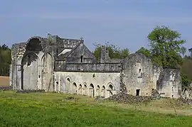 The ruins of Boschaud abbey in Villars | |
Location of Villars | |
 Villars 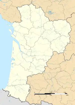 Villars | |
| Coordinates: 45°25′17″N 0°45′21″E / 45.4214°N 0.7558°E | |
| Country | France |
| Region | Nouvelle-Aquitaine |
| Department | Dordogne |
| Arrondissement | Nontron |
| Canton | Brantôme en Périgord |
| Government | |
| • Mayor (2020–2026) | Jacky Faye[1] |
| Area 1 | 27.67 km2 (10.68 sq mi) |
| Population | 456 |
| • Density | 16/km2 (43/sq mi) |
| Time zone | UTC+01:00 (CET) |
| • Summer (DST) | UTC+02:00 (CEST) |
| INSEE/Postal code | 24582 /24530 |
| Elevation | 125–240 m (410–787 ft) (avg. 225 m or 738 ft) |
| 1 French Land Register data, which excludes lakes, ponds, glaciers > 1 km2 (0.386 sq mi or 247 acres) and river estuaries. | |
Villars (French pronunciation: [vilaʁ]; Occitan: Vilars) is a commune in the Dordogne department in Nouvelle-Aquitaine in southwestern France. Nearby towns include Brantôme and Nontron.
Villars' attractions include the Château de Puyguilhem,[3] Grotte de Villars and the Abbaye de Boschaud.
Population
| Year | Pop. | ±% p.a. |
|---|---|---|
| 1968 | 735 | — |
| 1975 | 647 | −1.81% |
| 1982 | 586 | −1.40% |
| 1990 | 568 | −0.39% |
| 1999 | 526 | −0.85% |
| 2009 | 466 | −1.20% |
| 2014 | 478 | +0.51% |
| 2020 | 456 | −0.78% |
| Source: INSEE[4] | ||
See also
References
- ↑ "Répertoire national des élus: les maires". data.gouv.fr, Plateforme ouverte des données publiques françaises (in French). 9 August 2021.
- ↑ "Populations légales 2021". The National Institute of Statistics and Economic Studies. 28 December 2023.
- ↑ Base Mérimée: Castle of Puyguilhem (reference PA00083065), Ministère français de la Culture. (in French)
- ↑ Population en historique depuis 1968, INSEE
Wikimedia Commons has media related to Villars, Dordogne.
This article is issued from Wikipedia. The text is licensed under Creative Commons - Attribution - Sharealike. Additional terms may apply for the media files.