  Primary and secondary state routes | |
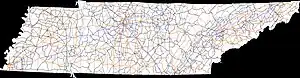 All Tennessee Primary State Routes in black with Interstates in blue | |
| System information | |
|---|---|
| Maintained by TDOT | |
| Highway names | |
| Interstates | Interstate XX (I-XX) |
| US Highways | U.S. Route XX (US XX) |
| State | State Route XX (SR XX) |
| System links | |
The Tennessee state routes do not follow a systematic numbering system unlike the U.S. Highway System and some other states' highway systems. The routes are separated into primary and secondary routes though. Many of the routes are hidden in that they are overlaid on U.S. Routes and not signed. The mile markers throughout Tennessee, however, show the state route number for these hidden routes.
The Tennessee Department of Transportation (TDOT) maintains these routes under the "State Highways" title of state law,[1] but designates them as "state routes". The triangle marker design was the only design until November 1983, when Tennessee divided its routes into primary routes and secondary or "arterial" routes with the adoption of a functional classification system, creating a primary marker and making the triangle marker the secondary marker; primary marker signs were posted in 1984.[2]
List
| Number | Length (mi) | Length (km) | Southern or western terminus | Northern or eastern terminus | Formed | Removed | Notes | |
|---|---|---|---|---|---|---|---|---|
| 538.8 | 867.1 | I-55/US 61/US 64/US 70/US 79 (Memphis & Arkansas Bridge) in Memphis | US 11E/US 19/SR 34 in Bristol | 1915 | current | |||
| 197.0 | 317.0 | US 41/US 70S/SR 1 in Murfreesboro | US 11/US 70/SR 1 in Farragut | 1923 | current | Mostly unsigned companion route for US 41 and US 11; only signed on an independent section near Kimball | ||
| 135.53 | 218.11 | US 51 at the Mississippi state line in Memphis | US 45 at the Kentucky state line in South Fulton | 1923 | current | Mostly unsigned companion route for US 51 | ||
| 17.1 | 27.5 | US 78 at the Mississippi state line in Shelby County | US 64/US 70/US 79/SR 1 in Memphis | 1923 | current | Unsigned companion route for US 78 | ||
| 120.0 | 193.1 | US 45 at the Mississippi state line in Guys | KY 125 at the Kentucky state line near Woodland Mills | 1923 | current | |||
| 150.93 | 242.90 | US 43/SR 13 at the Alabama state line in Saint Joseph | US 31E/US 231 at the Kentucky state line near Westmoreland | 1923 | current | Unsigned companion route for US 43, US 31, and US 31E | ||
| 80.75 | 129.95 | SR 53 at the Alabama state line in Ardmore | SR 100/SR 46 in Bon Aqua | 1923 | current | |||
| 75.43 | 121.39 | US 41/US 76/SR 3 at the Georgia state line in East Ridge | SR 56 in McMinnville | 1923 | current | |||
| 131.33 | 211.36 | US 25W at the Kentucky state line in Jellico | US 25/US 70 at the North Carolina state line near Del Rio | 1923 | current | Unsigned companion route for US 25, US 25W, and US 70 | ||
| 132.40 | 213.08 | US 231/US 431/SR 1 at the Alabama state line in Lincoln County | KY 99 at the Kentucky state line in Macon County | 1923 | current | |||
| 146.20 | 235.29 | SR 207 at the Alabama state line in Minor Hill | US 41 at the Kentucky state line in Montgomery County | 1923 | current | |||
| 62.46 | 100.52 | US 31/US 41/US 41A/US 431/SR 6/SR 11 in Nashville | US 41A at the Kentucky state line in Clarksville | 1923 | current | |||
| 153.01 | 246.25 | SR 17 at the Alabama state line in Wayne County | US 79 at the Kentucky state line in Montgomery County | 1923 | current | |||
| 57.9 | 93.2 | US 61 at the Mississippi state line in Memphis | SR 54 in Tipton County | 1923 | current | |||
| 261.64 | 421.07 | SR 14 in Memphis | US 41/US 41A/SR 2 in Monteagle | 1923 | current | |||
| 76.94 | 123.82 | SR 79 at the Alabama state line in Franklin County | US 31A/US 41A/SR 11 in Kirkland | 1923 | current | |||
| 12.45 | 20.04 | SR 193 at the Georgia state line in Chattanooga | SR 58/SR 153 in Chattanooga | c. 1963 | current | |||
| — | — | SR 22 (current junction with SR 100) in Jacks Creek | Mississippi state line | 1923 | c. 1931 | Replaced by SR 22[3] | ||
| 47.04 | 75.70 | MS 7 at the Mississippi state line in Fayette County | US 45/SR 5 in Jackson | 1923 | current | |||
| SR 18A | 1.7 | 2.7 | SR 57 in Grand Junction | SR 18 north of Grand Junction | c. 1953 | 1983 | Now SR 368 | |
| 48.95 | 78.78 | At Mississippi River in Lauderdale County | I-40 near Brownsville | 1923 | current | |||
| 145.06 | 233.45 | US 51/US 412/SR 3/SR 211 in Dyersburg | US 43/SR 6 near Summertown | 1923 | current | |||
| 39.88 | 64.18 | At Mississippi River near Tiptonville | KY 116/KY 239 at the Kentucky state line in Obion County | 1923 | current | |||
| 171.33 | 275.73 | MS 2 at the Mississippi state line near Michie | Kentucky state line in Lake County | 1923 | current | |||
| 26.0 | 41.8 | SR 22/SR 69 in Milledgeville | SR 22 in Lexington | 1958 | current | |||
| 8.76 | 14.10 | US 51/US 64/US 70/US 72/US 79/SR 3 in Memphis | I-240 in Memphis | c. 1961 | current | |||
| — | — | SR 1/US 70 in Jackson | SR 6 in Summertown | 1923 | c. 1927 | Replaced by SR 20[3] | ||
| 131.11 | 211.00 | US 70/US 70S/SR 1 in Nashville | US 127/SR 28 in Crossville | 1923 | current | Unsigned companion route for US 70 and US 70N | ||
| 67.45 | 108.55 | SR 161 in Robertson County | US 70N/SR 24/SR 53 in South Carthage | 1923 | current | |||
| 59.25 | 95.35 | US 70/SR 24 in Lebanon | US 70/SR 1 in Sparta | 1923 | current | Unsigned companion route for US 70 | ||
| 48.51 | 78.07 | US 72/SR 2 at the Alabama state line in South Pittsburg | US 27/SR 1 at the Georgia state line in Chattanooga | 1923 | current | |||
| 132.37 | 213.03 | I-24 in Jasper | US 127/SR 111 at the Kentucky state line in Static | 1923 | current | |||
| 141.95 | 228.45 | US 27 at the Georgia state line in Chattanooga | US 27 at the Kentucky state line in Winfield | 1923 | current | Mostly unsigned companion route for US 27, except for a section between Rockwood and Harriman | ||
| SR 29A | 8.2 | 13.2 | US 27/SR 29/SR 61 in Harriman | US 27/SR 29 north of Harriman | c. 1963 | 1983 | Now SR 328 | |
| 118.15 | 190.14 | US 70S/SR 1 in McMinnville | US 64/US 74/SR 40 in the Cherokee National Forest | 1923 | current | |||
| 17.30 | 27.84 | US 11W/SR 1 in Hawkins County | SR 66 in Sneedville | c. 1966 | current | |||
| — | — | SR 1/US 70 in Jackson | Kentucky state line | 1923 | 1928 | Replaced by SR 29[3] | ||
| 89.47 | 143.99 | NC 1397 at the North Carolina state line in Cocke County | US 25E at the Kentucky state line at Cumberland Gap Tunnel | 1923 | current | |||
| 174.42 | 280.70 | US 411/SR 61 at the Georgia state line in Polk County | SR 696 at the Virginia state line in Hancock County | 1923 | current | |||
| 154.09 | 247.98 | US 11E/US 25W/US 70/SR 9 in Knox County | US 421 at the North Carolina state line near Trade | 1923 | current | Unsigned companion route for US 11E and US 421 | ||
| 81.35 | 130.92 | US 129/SR 115 in Alcoa | US 11E/US 321/SR 34/SR 93 in Greeneville | 1923 | current | Mostly unsigned companion route for US 411 and US 321, except for a section in Maryville | ||
| 28.6 | 46.0 | US 19W at the North Carolina state line in Unicoi County | US 23 at the Virginia state line in Kingsport | 1923 | current | |||
| 30.98 | 49.86 | US 19E at the North Carolina state line in Roan Mountain | US 11E/US 19/US 19W/SR 34 in Bluff City | 1923 | current | Unsigned companion route for US 19E | ||
| 2.96 | 4.76 | US 11/SR 58 at the Georgia state line in Chattanooga | US 11/US 41/US 64/US 72/SR 2 in Chattanooga | 1923 | current | Unsigned companion route for US 11 | ||
| 31.49 | 50.68 | I-75 in Riceville | SR 68 in Tellico Plains | 1941 | current | |||
| — | — | SR 30 in Athens | SR 33 in Etowah | 1923 | 1941 | Replaced by SR 30; SR 39 was reassigned to the old route of SR 30 east of Athens[3] | ||
| 39.63 | 63.78 | US 11/US 64/SR 2 in Cleveland | US 64/US 74 at the North Carolina state line near Ducktown | 1923 | current | Unsigned companion route for US 64/US 74 | ||
| 22.96 | 36.95 | US 31W/US 41/SR 11 in Goodlettsville | US 31W/SR 109/SR 259 at the Kentucky state line Portland | 1927 | current | Unsigned companion route for US 31W | ||
| — | — | SR 1/SR 19/US 70 in Brownsville | SR 3/US 51 in Union City | 1923 | c. 1927 | Replaced by SR 5 and SR 54[3] | ||
| 61.15 | 98.41 | US 70/SR 1 in Sparta (original ending) | US 127/SR 28 at the Kentucky state line in Static | c. 1931 | 1992 | Replaced by SR 111; south end truncated to Cookeville in 1975 | ||
| — | — | SR 24 in Algood | SR 1/US 70 in Crossville | c. 1927 | c. 1931 | Replaced by SR 24; SR 42 was reassigned to the old route of SR 24 northeast of Cookeville[3] | ||
| — | — | SR 5 in Three Way | SR 22 in Union City | 1923 | c. 1927 | Replaced by SR 43 and SR 54[3] | ||
| 57.32 | 92.25 | US 45/US 45W/SR 5 in Three Way | KY 129/KY 307 at the Kentucky state line in South Fulton | c. 1927 | current | |||
| — | — | SR 22 in McKenzie | Kentucky state line | 1923 | c. 1927 | Replaced by SR 69 and SR 76[3] | ||
| 21.26 | 34.21 | US 11E/US 19W/SR 34 in Bluff City | SR 75 at the Virginia state line near Bristol | c. 1933 | current | |||
| — | — | SR 5 in Henderson | SR 1/US 70 in Huntingdon | 1923 | c. 1927 | Replaced by SR 22 (part became SR 100 c. 1931)[3] | ||
| 17.92 | 28.84 | US 431/SR 65 in Nashville | I-40 in Hermitage | c. 1933 | current | |||
| — | — | SR 44 (now SR 22/SR 100) in Jacks Creek | SR 15 east of Crump | 1923 | c. 1927 | Replaced by SR 17 (became SR 22 c. 1931)[3] | ||
| 87.5 | 140.8 | US 431/SR 106 near Brentwood | US 79/SR 76 near Fort Campbell | c. 1933 | current | |||
| — | — | SR 45 (now SR 22) near Right | Saltillo | 1923 | c. 1926 | Replaced by SR 69[3] | ||
| 20.81 | 33.49 | SR 46 in Dickson | SR 48 in Charlotte | c. 1931 | current | |||
| — | — | SR 1/US 70 in Waverly | Alabama state line | 1923 | c. 1927 | Replaced by SR 13[3] | ||
| 103.86 | 167.15 | SR 13 in Wayne County | KY 104 at the Kentucky state line in Clarksville | 1923 | current | |||
| 104.57 | 168.29 | US 79/SR 76 in Dover | KY 383 at the Kentucky state line near Orlinda | 1923 | current | |||
| 161.01 | 259.12 | I-40 in Only | SR 56/SR 108 in Altamont | 1923 | current | |||
| SR 50A | 17.1 | 27.5 | SR 50 near Culleoka | US 31A Bus./US 431 Bus./SR 11/SR 50 in Lewisburg | c. 1935 | 1983 | Now SR 373 | |
| 1.91 | 3.07 | SR 52 in Moss | KY 163 at the Kentucky state line in Clay County | c. 1931 | current | |||
| — | — | Kentucky state line | Alabama state line | 1923 | c. 1931 | Replaced by SR 11, SR 99, and SR 10[3] | ||
| 148.88 | 239.60 | SR 49 in Orlinda | US 27/SR 29 in Elgin | 1923 | current | |||
| 123.36 | 198.53 | US 41/SR 2 in Manchester | KY 61 at the Kentucky state line in Clay County | 1923 | current | |||
| 122.52 | 197.18 | US 51/SR 3/SR 59 in Covington | US 641/KY 893 at the Kentucky state line near Puryear | c. 1927 | current | |||
| — | — | SR 24 in Lebanon | SR 1 in Sparta | 1923 | c. 1925 | Replaced by SR 26[3] | ||
| 53.40 | 85.94 | SR 50 in Lynchburg | US 70S/SR 1/SR 380 in McMinnville | 1923 | current | |||
| 164.85 | 265.30 | SR 117 at the Alabama state line in Franklin County | KY 63 at the Kentucky state line in Macon County | 1923 | current | |||
| 109.61 | 176.40 | SR 14 in Memphis | MS 25 at the Mississippi state line near Pickwick Dam | c. 1927 | current | |||
| — | — | SR 1 in McMinnville | SR 28 in Pikeville | 1923 | c. 1927 | Replaced by SR 30[3] | ||
| 94.94 | 152.79 | SR 157 at the Georgia state line in Lookout Mountain | SR 95 at Oak Ridge | 1923 | current | |||
| 50.83 | 81.80 | At Mississippi River in Tipton County | SR 76 near Somerville | c. 1927 | current | |||
| — | — | SR 58 in Decatur | SR 2/US 11 in Athens | 1923 | c. 1927 | Replaced by SR 30[3] | ||
| 41.19 | 66.29 | SR 71 at the Georgia state line in Bradley County | US 27/SR 29/SR 378 in Dayton | 1923 | current | |||
| 81.67 | 131.44 | US 27/US 70/SR 1/SR 29 in Rockwood | US 11W/SR 1 in Blaine | 1923 | current | |||
| 89.93 | 144.73 | SR 84 in Monterey | US 441/SR 33/SR 71 in Knoxville | 1923 | current | |||
| 101.06 | 162.64 | US 27/SR 29 in Huntsville | SR 33 in Sneedville | 1923 | current | |||
| 50.43 | 81.16 | US 31A/SR 11/SR 271 in Farmington | US 70S/SR 1 near Readyville | c. 1927 | current | |||
| — | — | SR 39 (now SR 30) near Etowah | SR 33/SR 72 in Maryville | 1923 | c. 1927 | Replaced by SR 33[3] | ||
| 34.98 | 56.29 | US 31W/US 41/US 431/SR 11 in Nashville | US 431 at the Kentucky state line near Springfield | c. 1927 | current | Unsigned companion route for US 431 | ||
| — | — | SR 1/US 70 in Knoxville | SR 9 in Newport | 1923 | c. 1927 | Replaced by SR 35[3] | ||
| 86.25 | 138.81 | US 411/US 441/SR 35/SR 71 in Sevierville | SR 33 in Sneedville | 1923 | current | |||
| 63.88 | 102.80 | SR 81 in Washington County | NC 88 at the North Carolina state line near Trade | 1923 | current | |||
| SR 67A | 4.9 | 7.9 | I-26/US 19W/US 23 in Johnson City | US 321/SR 67 in Elizabethton | c. 1932 | 1983 | Now SR 359 | |
| 106.89 | 172.02 | SR 5/SR 60 at the Georgia state line in Copperhill | US 127/SR 29 near Crossville | c. 1927 | current | |||
| — | — | SR 1 in Kingsport | Virginia state line | 1924 | c. 1927 | Replaced by SR 36[3] | ||
| 151.77 | 244.25 | SR 20 at the Alabama state line in Wayne County | KY 97 at the Kentucky state line in Henry County | 1924 | current | |||
| 27.1 | 43.6 | SR 191 in Camden | US 641/SR 69 in Paris | 1965 | current | |||
| 63.34 | 101.94 | NC 208 at the North Carolina state line in Greene County | SR 70 at the Virginia state line in Hancock County | 1924 | current | |||
| 83.31 | 134.07 | US 441 at the North Carolina state line at Newfound Gap | US 25W/SR 9/SR 116 in Lake City | 1924 | current | |||
| 42.7 | 68.7 | US 129/SR 115 in Monroe County | SR 58 in Roane County | 1924 | current | |||
| 101.76 | 163.77 | I-40/US 321/SR 95 near Oak Ridge | US 25/US 70/SR 9 in Newport | c. 1927 | current | |||
| — | — | SR 28 near Jamestown | SR 31 (now SR 29) near Sunbright | 1924 | c. 1927 | Replaced by SR 52[3] | ||
| 18.13 | 29.18 | SR 225 at the Georgia state line on Bradley/Polk county line | US 11 Byp./US 11/SR 2 in Cleveland | c. 1949 | current | |||
| — | — | SR 2/SR 60/US 11 in Cleveland | North Carolina state line | c. 1927 | 1941 | Replaced by SR 40 | ||
| — | — | SR 24 in Algood | SR 1/US 70 in Crossville | 1924 | c. 1927 | Renumbered SR 42 (now part of SR 24)[3] | ||
| 27.8 | 44.7 | US 11/US 321/SR 34 in Limestone | SR 126 in Blountville | c. 1964 | current | |||
| — | — | US 25/US 70/SR 9 in Newport | North Carolina state line | c. 1927 | c. 1939 | Replaced by SR 32 | ||
| — | — | SR 11 in Springfield | US 31W/SR 79 in Portland | 1924 | c. 1927 | Replaced by SR 49 and SR 52[3] | ||
| 231.44 | 372.47 | SR 57 in Moscow | SR 109 in Portland | 1924 | current | |||
| 84.86 | 136.57 | US 51/SR 3 in Newbern | US 641/SR 69 in Paris | 1924 | current | |||
| 36.01 | 57.95 | SR 104 in Dyersburg | KY 94 at the Kentucky state line in Lake County | 1924 | current | |||
| 10.33 | 16.62 | At the Mississippi River in Lake County | SR 78 near Ridgely | c. 1927 | current | |||
| — | — | SR 11 in Goodlettsville | Dixie Highway near Portland on the Kentucky state line | c. 1925 | c. 1927 | Replaced by US 31W and SR 41[3] | ||
| 14.08 | 22.66 | SR 25 near Carthage | SR 56/SR 262 in Macon County | c. 1927 | current | |||
| 25.62 | 41.23 | I-26/US 19W/US 23/SR 36/SR 107 in Erwin | SR 93 in Washington County | c. 1927 | current | |||
| SR 81A | 13.3 | 21.4 | SR 107 in South Central | SR 81 in Jonesborough | — | 1983 | Now SR 353 | |
| 31.93 | 51.39 | SR 55 in Lynchburg | SR 64 near Beechgrove | c. 1927 | current | |||
| 8.08 | 13.00 | SR 146 in DeKalb County | SR 56 in Smithville | 1983 | current | |||
| — | — | SR 1 Spur (now SR 4) in Memphis | SR 1/SR 1 Spur (now SR 1/SR 57) in Memphis | c. 1964 | 1983 | Replaced by relocated SR 1 | ||
| — | — | SR 2 in Cleveland | SR 58 near Georgetown | c. 1927 | 1939 | Replaced by SR 60 | ||
| 40.44 | 65.08 | US 70/SR 1 in Sparta | SR 111 in Livingston | c. 1927 | current | |||
| 85.24 | 137.18 | SR 80 in Smith County | US 127/SR 28 in Fentress County | c. 1927 | current | |||
| 5.18 | 8.34 | US 72/SR 57 in Collierville | US 72 at the Mississippi state line in Piperton | c. 1927 | current | Unsigned companion route for US 72 in West Tennessee | ||
| 39.73 | 63.94 | At the Mississippi River in Lauderdale County | SR 19 in Brownsville | c. 1927 | current | |||
| SR 87A | 4.87 | 7.84 | SR 87 in Cherry | SR 87 near Glimp | 1952 | 1983 | Now SR 371 | |
| 44.78 | 72.07 | At the Mississippi River in Lauderdale County | US 412/SR 20 in Bells | c. 1927 | current | |||
| 51.24 | 82.46 | SR 105 in Trimble | KY 381 at the Kentucky state line in Weakley County | c. 1927 | current | |||
| 13.32 | 21.44 | US 25W/SR 9 in Morley | KY 74 at the Kentucky state line in Pruden | c. 1927 | current | |||
| 53.93 | 86.79 | US 11E/SR 34 in Johnson City | SR 91 at the Virginia state line in Johnson County | c. 1927 | current | |||
| 34.88 | 56.13 | US 411/SR 35 in Chestnut Hill | US 11W/SR 1 in Rutledge | c. 1927 | current | |||
| 38.75 | 62.36 | US 11E/US 321/SR 34/SR 35 in Greeneville | SR 224 at the Virginia state line in Kingsport | c. 1927 | current | |||
| 7.92 | 12.75 | SR 66 in Hawkins County | SR 70 in Hawkins County | c. 1927 | current | |||
| 42.23 | 67.96 | US 411/SR 33 in Greenback | SR 61 near Oak Ridge | c. 1927 | current | |||
| 128.2 | 206.3 | US 70/SR 1 in Dickson | SR 53 in Granville | c. 1927 | current | |||
| 5.64 | 9.08 | SR 65 at the Alabama state line in Franklin County | SR 122 in Huntland | c. 1927 | current | |||
| 11.73 | 18.88 | CR 89 at the Alabama state line in Lawrence County | US 43/SR 6 in Leoma | c. 1927 | current | |||
| 126.7 | 203.9 | US 64/SR 15 in Waynesboro | SR 64 in Bradyville | c. 1927 | current | |||
| 158.31 | 254.78 | US 64/SR 15 in Whiteville | US 70S/SR 1 in Belle Meade | c. 1927 | current | |||
| 38.7 | 62.3 | SR 30 in Mount Crest | Fairfield Glade Resort Area | c. 1927 | current | |||
| 13.34 | 21.47 | SR 96 in Rutherford County | SR 266 in Smyrna | c. 1927 | current | |||
| 8.33 | 13.41 | At the Mississippi River in Dyer County | SR 78 in Bogota | c. 1929 | current | |||
| 114.43 | 184.16 | At the Mississippi River in Dyer County | SR 69 in Saltillo | c. 1929 | current | |||
| 44.34 | 71.36 | US 51/SR 3 near Trimble | US 70A/SR 77 in McLemoresville | 1943 | current | |||
| — | — | SR 18 near Bolivar | SR 5/US 45 near Henderson | c. 1929 | c. 1939 | Portion replaced by SR 100; rest (Now SR 125, Silerton Rd, SR 225, Old Montezuma Rd, W. Main St) decommissioned in exchange for extending SR 100 | ||
| 55.84 | 89.87 | US 31A/US 31A Bus./SR 11 in Lewisburg | US 70S/US 431/SR 1 in Nashville | c. 1929 | current | Mostly unsigned companion route for US 431 | ||
| 78.77 | 126.77 | Near Round Mountain Campground near Del Rio | NC 226 at the North Carolina state line in Unicoi County | c. 1929 | current | |||
| 60.31 | 97.06 | SR 28 in Whitwell | SR 55 Bus./SR 56/SR 380 in McMinnville | c. 1929 | current | |||
| 38.9 | 62.6 | I-840/SR 265 in Lebanon | I-65 in Portland | c. 1929 | current | |||
| 22.46 | 36.15 | SR 53/SR 7 at the Alabama state line in Ardmore | US 231/US 431/SR 10 in Fayetteville | c. 1929 | current | |||
| 118.72 | 191.06 | US 27/SR 29 in Soddy-Daisy | US 127/SR 28 at the Kentucky state line in Static | c. 1929 | current | |||
| 41.85 | 67.35 | US 41A/SR 12 in Nashville | US 41A/US 79/SR 12/SR 13/SR 76 in Clarksville | c. 1929 | current | Unsigned companion route for US 41A | ||
| 32.86 | 52.88 | US 25W/US 70/SR 9 near Dandridge | SR 66 in Persia | 1966[4] | current | |||
| — | — | SR 27 in Glendale | SR 28 near Dunlap | c. 1931 | c. 1939 | Replaced by SR 8 | ||
| 96.49 | 155.29 | US 64/SR 15 in Clifton Junction | SR 77 near Paris | c. 1930 | current | |||
| 52.8 | 85.0 | US 129 at the North Carolina state line in Deals Gap | I-40 in Knoxville | c. 1933 | current | Unsigned companion route for US 129 | ||
| 41.97 | 67.54 | SR 62 near Petros | US 25W/SR 9/SR 63 in Caryville | 1938 | current | |||
| 6.39 | 10.28 | SR 142 in McNairy County | US 64/SR 15/SR 22 in Adamsville | c. 1974 | current | |||
| — | — | — | — | 1939 | 1940 | Location unknown, probably Tiptonville-north (now SR 22) or Union City-north (now SR 21) | ||
| 14.81 | 23.83 | SR 54/SR 89 in Dresden | KY 129 at the Kentucky state line in Dukedom | c. 1939 | current | |||
| 4.7 | 7.6 | US 79/SR 76 in Paris Landing State Park | KY 121 at the Kentucky state line in Henry County | c. 1939 | current | |||
| 12.09 | 19.46 | KY 139 at the Kentucky state line in Stewart County | US 79/SR 76 in Big Rock | c. 1939 | current | |||
| 20.55 | 33.07 | CR 65 at the Alabama state line in Lincoln County | SR 50 near Winchester | c. 1939 | current | |||
| 7.11 | 11.44 | SR 121 in Elora | US 64/SR 15 in Huntland | c. 1941 | current | |||
| 1.19 | 1.92 | SR 68 near Turtletown | NC 294 at the North Carolina state line in Polk County | c. 1941 | current | |||
| 19.19 | 30.88 | US 45E/SR 43/SR 54 in Greenfield | SR 22 in McKenzie | c. 1943 | current | |||
| 37.36 | 60.13 | MS 15 at the Mississippi state line near Middleton | SR 100 at Chickasaw State Park | c. 1945 | current | |||
| 24.58 | 39.56 | SR 93 in Kingsport | US 11W/SR 1 in Bristol | c. 1963 | current | |||
| — | — | — | — | 1947 | 1948 | Location unknown | ||
| 43.52 | 70.04 | US 41A/SR 16 in Decherd | SR 30 near McMinnville | c. 1963 | current | |||
| — | — | SR 71/US 441 near Knoxville | SR 73 | c. 1947 | 1958 | Now Martin Mill Pike, Nails Creek Road, Old Nails Creek Road, Wildwood Road, River Ford Road and Ellejoy Road | ||
| 51.73 | 83.25 | SR 57 in Pickwick Dam | SR 13 near Linden | c. 1947 | current | |||
| 49.22 | 79.21 | US 31/SR 7 in Waco | SR 55 in Lynchburg | c. 1949 | current | |||
| 51.3 | 82.6 | US 431/SR 50/SR 129 in Petersburg | US 64 Business/SR 50 in Winchester | c. 1949 | current | |||
| 68.8 | 110.7 | US 11/US 70/SR 1 in Knoxville | SR 31 in Treadway | c. 1949 | current | |||
| 5.46 | 8.79 | At the Cumberland Mountains near Manring | KY 186 at the Kentucky state line in Claiborne County | c. 1949 | 1997 | Only accessible from Kentucky | ||
| 11.24 | 18.09 | US 421/SR 34/SR 91 in Shady Valley | SR 716 at the Virginia state line in Johnson County | c. 1949 | current | |||
| 6.55 | 10.54 | US 41/US 64/US 72/SR 2 in Haletown | SR 299 in Hamilton County | c. 1949 | current | |||
| 62.87 | 101.18 | SR 289 in Sparta | SR 52 in Clay County | c. 1949 | current | |||
| 56.51 | 90.94 | US 70S/SR 1 in Rock Island | SR 52 in Timothy | c. 1949 | current | |||
| 3.02 | 4.86 | I-26/US 11W/US 23/SR 1 in Kingsport | US 23 at the Virginia state line in Kingsport | c. 1969 | current | Unsigned companion route for US 23 | ||
| — | — | SR 53 near Celina | Kentucky state line | c. 1949 | c. 1951 | Replaced by SR 53 | ||
| 23.01 | 37.03 | SR 18 in Toone | I-40 in Madison County | c. 1949 | current | |||
| 24.83 | 39.96 | US 11E/SR 34 in Strawberry Plains | SR 92 in Dandridge | c. 1949 | current | |||
| 43.88 | 70.62 | SR 22 in McKenzie | US 79/SR 76 in Henry County | c. 1949 | current | |||
| 67.59 | 108.78 | SR 52 in Macon County | SR 56 in Silver Point | 1951 | current | |||
| 24.59 | 39.57 | US 45/SR 5 in Selmer | CR 100 at the Mississippi state line in Hardin County | c. 1949 | current | |||
| 12.46 | 20.05 | US 19E/SR 37 in Roan Mountain | NC 261 at the North Carolina state line at Roan Mountain | 1952 | current | |||
| 7.85 | 12.63 | SR 131 in Plainview | SR 170 near Maynardville | 1952 | current | |||
| 9.72 | 15.64 | US 70S/SR 1 in Woodbury | SR 96 in Auburntown | c. 1953 | current | |||
| 17.67 | 28.44 | US 70S/SR 1 in Cannon County | US 70/SR 26 in Smithville | c. 1953 | current | |||
| 23.64 | 38.04 | SR 69A in Big Sandy | SR 49 in Tennessee Ridge | c. 1953 | current | |||
| 3.77 | 6.07 | SR 189 at Georgia state line in Lookout Mountain | US 11/US 41/US 64/US 72/SR 2 in Chattanooga | c. 1953 | current | |||
| 22.31 | 35.90 | SR 49 in Erin | SR 13/SR 48 in Clarksville | c. 1953 | current | |||
| 20.98 | 33.76 | I-24/US 64/US 72/SR 27 in Kimball | US 41/SR 56 in Tracy City | c. 1953 | current | Unsigned companion route for US 41 | ||
| 7.54 | 12.13 | SR 56 in North Springs | SR 56 in Red Boiling Springs | c. 1953 | current | |||
| 36.88 | 59.35 | US 412/SR 20 near Maury City | US 412/SR 20 near Jackson | c. 1953 | current | |||
| 14.81 | 23.83 | I-75/US 74 in Chattanooga | US 27/SR 29 in Soddy-Daisy | c. 1953 | current | |||
| 19.12 | 30.77 | SR 52 in Jamestown | KY 167 at the Kentucky state line at Big South Fork NRR | c. 1953 | current | |||
| 35.10 | 56.49 | US 70S/SR 1 in Nashville | US 31/SR 6 in Oak Hill | c. 1953 | current | |||
| 35.4 | 57.0 | US 41A/SR 15 near Sewanee | SR 134 in Haletown | c. 1957 | current | |||
| 5.30 | 8.53 | SR 22 near Samburg | KY 311 at the Kentucky state line near Reelfoot National Wildlife Refuge | c. 1957 | current | |||
| 4.6 | 7.4 | US 11/US 70/SR 1 in Knoxville | I-40 in Knoxville | c. 1958 | current | |||
| 12.5 | 20.1 | US 321/SR 67 near Butler | US 321 at North Carolina state line | c. 1958 | current | Unsigned companion route for US 321 | ||
| 27.1 | 43.6 | US 11E/SR 34 in Morristown | US 321/SR 35 near Newport | c. 1959 | current | |||
| 9.9 | 15.9 | US 431/SR 65 in Springfield | KY 102 at the Kentucky state line in Robertson County | c. 1959 | current | |||
| 7.3 | 11.7 | SR 62 in Solway | SR 33 in Alcoa | 1971 | current | Broken into two segments by I-140 | ||
| 16.2 | 26.1 | I-75 near Calhoun | US 411/SR 30/SR 33 in Delano | c. 1971 | current | |||
| 17.0 | 27.4 | US 70N/SR 24 in Monterey | SR 85 in Crawford | c. 1971 | current | |||
| 23.8 | 38.3 | SR 68 in Tellico Plains | NC 143 at the North Carolina state line | c. 1982 | current | Also known as Cherohala Skyway | ||
| 51.6 | 83.0 | SR 127 at the Alabama state line in Giles County | US 412/SR 99 in Hampshire | c. 1981 | current | |||
| 21.0 | 33.8 | SR 67 in Doeville | Big Laurel Road at the North Carolina state line in Ashe County | c. 1981 | current | |||
| 16.0 | 25.7 | US 129/SR 115 in Knoxville | US 11E/US 25W/US 70/SR 9 in Knoxville | c. 1982 | current | Known locally as John Sevier Highway | ||
| 11.7 | 18.8 | SR 131 in Knoxville | SR 62 in Knoxville | c. 1987 | current | Known locally as Middlebrook Pike | ||
| 35.9 | 57.8 | SR 62 in Oak Ridge | SR 33 near Maynardville | c. 1982 | current | |||
| 18.0 | 29.0 | I-24 in Antioch | US 70/SR 24 in Mount Juliet | c. 1982 | current | |||
| 12.2 | 19.6 | US 321/SR 35 in Greeneville | I-81 in Baileyton | c. 1982 | current | |||
| 13.1 | 21.1 | I-26/US 23 in Unicoi | US 19E/SR 37 in Tiger Valley | c. 1982 | current | |||
| 40.9 | 65.8 | US 31W/US 41/SR 11 in Goodlettsville | KY 482 at Kentucky state line in Sumner County | c. 1982 | current | |||
| 26.3 | 42.3 | MS 301 at Mississippi state line in Memphis | US 72/SR 57 in Collierville | — | — | |||
| 6.1 | 9.8 | Getwell Road (MS 747) at Mississippi state line in Southaven | I-240 in Memphis | — | — | |||
| 13.11 | 21.10 | Winchester Road near SR 385 in Memphis | US 70/US 79/SR 1 in Lakeland | — | — | |||
| 11.5 | 18.5 | US 51/SR 3 in Munford | SR 59 in Gilt Edge | — | — | |||
| 43.4 | 69.8 | SR 54 near Covington | US 64/SR 15 in Whiteville | — | — | |||
| 12.52 | 20.15 | SR 19 in Nutbush | US 51/SR 3 in Gates | — | — | |||
| 25.1 | 40.4 | SR 88 in Hales Point | SR 79 near Ridgley | — | — | |||
| 9.77 | 15.72 | SR 104 in Finley | SR 78 near Dyersburg | — | — | |||
| 14.17 | 22.80 | SR 21 near Hornbeak | US 51/SR 3 near Troy | — | — | |||
| 12.92 | 20.79 | SR 21 in Troy | US 45W/SR 22/SR 214 in Union City | — | — | |||
| 7.67 | 12.34 | US 45W/SR 5/SR 77 in Dyer | SR 54 near Bradford | — | — | |||
| 29.5 | 47.5 | US 45/US 70/SR 1 in Jackson | US 45W/SR 5/SR 54 in Trenton | — | — | |||
| 7.8 | 12.6 | US 70A/US 79/SR 76 near Humboldt | US 45E/SR 43 in Milan | — | — | |||
| 22.2 | 35.7 | SR 54/SR 88 near Alamo | SR 77 in Yorkville | — | — | |||
| 5.5 | 8.9 | SR 88 in Maury City | US 412/SR 20 in Friendship | — | — | |||
| 55.3 | 89.0 | SR 105 in Trezevant | US 45E/SR 43 near South Fulton | — | — | |||
| 24.02 | 38.66 | Nathan Bedford Forrest State Park | I-40 in Benton County | — | — | |||
| 10.8 | 17.4 | US 641/SR 69 in Holladay | US 641/SR 69 near Camden | — | — | |||
| 17.2 | 27.7 | SR 205 in Fisherville | SR 76 in Williston | — | — | |||
| 23.5 | 37.8 | SR 57 in Rossville | SR 59 near Braden | — | — | |||
| 7.6 | 12.2 | SR 193 near Macon | SR 76 in Somerville | — | — | |||
| 25.6 | 41.2 | US 72/SR 86 in Piperton | US 70/US 79/SR 1 in Gallaway | — | — | |||
| 12.5 | 20.1 | US 45/SR 5 in Pinson | SR 200 in Mifflin | — | — | |||
| 13.3 | 21.4 | US 70/SR 1 in Jackson | SR 197 near Beech Bluff | — | — | |||
| 12.3 | 19.8 | US 45/SR 5 in Finger | SR 224 in Leapwood | — | — | |||
| 21.8 | 35.1 | SR 365 in Henderson | SR 22A in Lexington | — | — | |||
| 23.0 | 37.0 | SR 22 near Sardis | SR 202 near Decaturville | — | — | |||
| 20.5 | 33.0 | SR 69 near Saltillo | US 412/SR 20 near Parsons | — | — | |||
| 32.7 | 52.6 | SR 69 in Savannah | SR 13 in Collinwood | — | — | |||
| 11.9 | 19.2 | I-40 in Memphis | SR 385 near Millington | — | — | |||
| 35.7 | 57.5 | SR 57 in Collierville | US 51/SR 3 in Millington | — | — | |||
| 7.6 | 12.2 | SR 14 near Atoka | SR 178 in Munford | — | — | |||
| 1.1 | 1.8 | SR 87 in Fulton | Fort Pillow State Historic Park | — | — | Provides access to Fort Pillow State Historic Park | ||
| 1.44 | 2.32 | SR 209 in Ripley | US 51/SR 3 in Ripley | — | — | |||
| 17.5 | 28.2 | US 51/SR 3 in Henning | SR 180 in Gates | — | — | |||
| 10.4 | 16.7 | SR 88 in Halls | US 412/SR 20 in Dyersburg | — | — | |||
| 18.7 | 30.1 | US 51/SR 3 in Dyersburg | SR 105 in Trimble | — | — | |||
| 2.4 | 3.9 | SR 22 in Tiptonville | SR 78 near Tiptonville | — | — | |||
| 3.6 | 5.8 | SR 78 near Reelfoot Lake | At Reelfoot Lake Airport | — | — | |||
| 9.7 | 15.6 | US 45W/SR 22/SR 184 in Union City | US 51/US 45W/SR 3 in South Fulton | — | — | |||
| 2.1 | 3.4 | US 45E/SR 43 in South Fulton | US 51 at Kentucky state line in South Fulton | — | — | Unsigned companion route for US 45E | ||
| 17.7 | 28.5 | US 45W/SR 5/SR 21 in Rives | US 45E/SR 22/SR 431 in Martin | — | — | |||
| 2.9 | 4.7 | SR 22 in Dresden | SR 89 near Dresden | — | — | |||
| 26.2 | 42.2 | US 641/SR 54 near Paris | SR 140 in Buchanan | — | — | |||
| 4.0 | 6.4 | US 70/SR 1 near Huntingdon | SR 77 near Huntingdon | — | — | |||
| 14.2 | 22.9 | US 70/SR 1 near Cedar Grove | US 70A/US 79/SR 76/SR 77 in Atwood | — | — | |||
| 1.5 | 2.4 | SR 220 in Atwood | US 70A/SR 77 in Atwood | — | — | |||
| 7.4 | 11.9 | SR 54/SR 88 in Alamo | US 70A/US 79/SR 76 in Gadsden | — | — | |||
| 12.9 | 20.8 | SR 59 near Somerville | US 70/US 79/SR 1 in Stanton | — | — | |||
| 15.1 | 24.3 | SR 138 near Mercer | I-40 in Jackson | — | — | |||
| 26.6 | 42.8 | SR 22 in Michie | SR 22A in Enville | — | — | |||
| 17.1 | 27.5 | SR 100 near Henderson | US 64/SR 15 near Selmer | — | — | |||
| 7.0 | 11.3 | SR 128 near Walkertown | US 64/SR 15/SR 128 in Olivet | — | — | |||
| 32.3 | 52.0 | SR 157 at the Alabama state line near Cypress Inn | SR 101 at the Alabama state line near Loretto | — | — | |||
| 11.1 | 17.9 | SR 128 in Clifton | SR 13 near Waynesboro | — | — | |||
| 1.8 | 2.9 | At Turney Center Industrial Complex | SR 50 in Only | — | — | Provides access to Turney Center Industrial Complex | ||
| 34.54 | 55.59 | SR 13 in Waverly | SR 50 near Littlelot | — | — | |||
| 13.7 | 22.0 | US 70/SR 1 in McEwen | SR 13 near Erin | — | — | |||
| 13.6 | 21.9 | SR 147 in McKinnon | US 79/SR 76 in Dover | — | — | |||
| 23.7 | 38.1 | SR 49 in Carlisle | US 79/SR 76 near Woodlawn | — | — | |||
| 6.7 | 10.8 | CR 700 at Mississippi State Line near Chewalla | SR 57 in Ramer | — | — | |||
| 27.3 | 43.9 | US 70/SR 1 in Dickson | SR 13 near Cunningham | — | — | |||
| 6.7 | 10.8 | US 41A/SR 13 in Clarksville | SR 48 in Clarksville | — | — | |||
| 7.9 | 12.7 | SR 374 in Clarksville | SR 48 near Clarksville | — | — | |||
| 8.2 | 13.2 | SR 76 in Port Royal | KY 2128 at Kentucky State Line near Guthrie | — | — | |||
| 0.72 | 1.16 | SR 22 in Dresden | SR 89 in Dresden | — | — | |||
| 17.2 | 27.7 | US 64/SR 15 near Lawrenceburg | US 43/SR 6 near Summertown | — | — | |||
| 12.0 | 19.3 | US 64/SR 15 near Lawrenceburg | Natchez Trace Parkway at Laurel Hill Wildlife Management Area | — | — | |||
| 36.7 | 59.1 | SR 227 in Iron City | SR 240 in Henryville | — | — | |||
| 12.9 | 20.8 | US 43/SR 6 in Mount Pleasant | US 412 Bus./SR 99 in Columbia | — | — | |||
| 9.1 | 14.6 | US 64/SR 15 in Boonshill | US 431/SR 50 near Petersburg | — | — | |||
| 18.6 | 29.9 | SR 166 near Campbellsville | SR 50 in Columbia | — | — | |||
| 21.7 | 34.9 | US 31/SR 6 in Columbia | US 31/SR 6 in Franklin | — | — | |||
| 26.4 | 42.5 | SR 50 in Williamsport | US 431/SR 106 in Duplex | — | — | |||
| 3.7 | 6.0 | US 31/SR 6 near Thompson's Station | I-65 in Franklin | — | — | |||
| 29.6 | 47.6 | I-40 near Pegram | I-24 near Joelton | — | — | |||
| 13.83 | 22.26 | SR 47 near White Bluff | SR 49 near Ashland City | — | — | |||
| 15.7 | 25.3 | SR 249 near Ashland City | US 70S/SR 1 in Bellevue | — | — | |||
| 13.4 | 21.6 | SR 96 in Arrington | US 31/SR 6 in Brentwood | — | — | |||
| 7.3 | 11.7 | US 31/SR 6 in Brentwood | US 31A/US 41A/SR 11 near Nolensville | — | — | |||
| 17.3 | 27.8 | SR 100 in Bellevue | US 41/US 70S/SR 1 in Antioch | — | — | |||
| 11.2 | 18.0 | US 31/SR 6 in Oak Hill | US 70/SR 24 in Donelson | — | — | |||
| 10.6 | 17.1 | US 41A/SR 112 near Pleasant View | SR 76 in Adams | — | — | |||
| 18.3 | 29.5 | SR 49 in Coopertown | US 31W/SR 41 in Millersville | — | — | |||
| 14.1 | 22.7 | US 31E/SR 6 in Hendersonville | SR 76 in White House | — | — | |||
| 12.9 | 20.8 | US 31W/SR 41 near Portland | SR 52 in Oak Grove | — | — | |||
| 5.6 | 9.0 | US 231/SR 376 in Trousdale County | SR 141 near Hartsville | — | — | |||
| 13.2 | 21.2 | SR 52 in Lafayette | KY 87 at Kentucky State Line | — | — | |||
| 25.17 | 40.51 | SR 52 in Lafayette | SR 53 in Gainesboro | — | — | |||
| 5.1 | 8.2 | SR 25 in Carthage | SR 85 near Defeated | — | — | |||
| 16.5 | 26.6 | SR 96 near Dowelltown | US 70N/SR 24/SR 53 in Elmwood | — | — | |||
| 24.97 | 40.19 | SR 45 in Hermitage | US 70/SR 26 near Watertown | — | — | |||
| 39.81 | 64.07 | I-24 in Smyrna | US 70/SR 26 in Lebanon | — | — | |||
| 10.8 | 17.4 | SR 96 in Prosperity | US 70/SR 26 in Watertown | — | — | |||
| 7.41 | 11.93 | US 41/US 70S/SR 1 in Murfreesboro | SR 96 near Murfreesboro | — | — | |||
| 49.2 | 79.2 | US 31A/SR 11 in Allisona | US 41A/SR 16 in Tullahoma | — | — | |||
| 9.5 | 15.3 | US 31A/SR 11/SR 99 in Chapel Hill | US 41A/SR 16 near Unionville | — | — | |||
| 6.3 | 10.1 | US 431/SR 50 in Belfast | US 31A/SR 11/SR 64 in Farmington | — | — | |||
| 22.4 | 36.0 | SR 129 in Archer | SR 99 near Chapel Hill | — | — | |||
| 36.9 | 59.4 | SR 166 near Prospect | US 64 Byp./US 231/US 431/SR 10 in Fayetteville | — | — | |||
| 13.1 | 21.1 | CR 11 at Alabama state line near Taft | SR 273 near Fayetteville | — | — | |||
| 14.1 | 22.7 | US 231/US 431/SR 10 in Park City | US 64/SR 15 near Flintville | — | — | |||
| 3.2 | 5.1 | SR 130 in Raus | US 41A/SR 16 near Normandy | — | — | |||
| 3.17 | 5.10 | US 78/SR 4 in Memphis | US 64/US 70/US 79/SR 1/SR 57 in Memphis | — | — | |||
| 1.8 | 2.9 | US 64/US 70/US 79/SR 1/SR 14 in Memphis | US 78/SR 4 in Memphis | — | — | Unsigned companion route for US 78 | ||
| 5.3 | 8.5 | US 41A/SR 16 in Estill Springs | SR 127 near Estill Springs | — | — | |||
| 10.6 | 17.1 | US 41/SR 2 in Beechgrove | SR 53 in Pocahontas | — | — | |||
| 6.1 | 9.8 | SR 53 near Iconium | SR 146 in Center Hill | — | — | |||
| 3.7 | 6.0 | At Lake Tansi Village | SR 101 near Crossville | — | — | |||
| 13.6 | 21.9 | SR 28 in Whitwell | US 127/SR 8 near Dunlap | — | — | |||
| 15.3 | 24.6 | SR 111 near Fall Creek Falls State Park | SR 30 near Fall Creek Falls State Park | — | — | |||
| 27.4 | 44.1 | US 70S/SR 1 in Doyle | SR 101 near Mount Crest | — | — | |||
| 2.8 | 4.5 | SR 55 Bus. in McMinnville | SR 380 in McMinnville | — | — | |||
| 40.5 | 65.2 | SR 108/SR 127 near Viola | SR 136 in Rock Island | — | — | |||
| 17.8 | 28.6 | US 70S/SR 1 near McMinnville | SR 56 near Smithville | — | — | |||
| 2.63 | 4.23 | US 70/SR 1 in Sparta | SR 111 in Sparta | — | — | |||
| 20.1 | 32.3 | SR 53 near Granville | SR 135 in Cookeville | — | — | |||
| 2.0 | 3.2 | SR 56 in Bloomington Springs | US 70N/SR 24 in Double Springs | — | — | |||
| 9.9 | 15.9 | SR 53 at Butlers Landing | SR 136 in Hilham | — | — | |||
| 11.3 | 18.2 | SR 136 near Bangham | SR 84 near Livingston | — | — | |||
| 20.2 | 32.5 | SR 52/SR 85 in Livingston | At Dale Hollow Reservoir | — | — | |||
| 5.0 | 8.0 | SR 111 in Byrdstown | US 127/SR 28 near Pall Mall | — | — | |||
| 3.0 | 4.8 | US 127/SR 28 near Jamestown | SR 52 in Allardt | — | — | |||
| 63.2 | 101.7 | SR 154 in Sharp Place | US 25W/SR 9 in Jellico | — | — | |||
| 25.8 | 41.5 | US 127/SR 28 in Crossville | SR 62 near Lancing | — | — | |||
| 17.6 | 28.3 | US 70/SR 1 in Westel | SR 328 in Oakdale | — | — | |||
| 1.46 | 2.35 | US 51/SR 3 in Memphis | I-40 in Memphis | — | — | |||
| 0.9 | 1.4 | SR 285 near Mount Crest | At Taft Youth Center | — | — | Provides access to Taft Youth Center | ||
| 13.3 | 21.4 | SR 30 in Old Washington | US 27/SR 29 in Spring City | — | — | |||
| 5.7 | 9.2 | US 27/SR 29 in Graysville | SR 30 near Dayton | — | — | |||
| 30.0 | 48.3 | SR 58 in Decatur | SR 58 near Kingston | — | — | |||
| 13.7 | 22.0 | SR 30/SR 39 in Athens | SR 68 near Ten Mile | — | — | |||
| 11.1 | 17.9 | SR 60 in Hopewell | SR 58 in Brittsville | — | — | |||
| 10.9 | 17.5 | SR 30/SR 39 in Athens | SR 68 near Sweetwater | — | — | |||
| 7.5 | 12.1 | SR 306 near Hopewell | US 11/SR 2 in Charleston | — | — | |||
| 2.6 | 4.2 | I-75 near Niota | US 11/SR 2 in Niota | — | — | |||
| 6.3 | 10.1 | US 411/SR 30/SR 33 in Etowah | SR 39 in Mecca | — | — | |||
| 6.3 | 10.1 | I-75/US 74 in Cleveland | US 64/US 74/SR 60 in Cleveland | — | — | Unsigned companion route for US 64/US 74 | ||
| 26.8 | 43.1 | SR 60 in Birchwood | US 11/US 64/SR 40/SR 74 in Cleveland | — | — | |||
| 7.7 | 12.4 | SR 74 in Wildwood Lake | US 411/SR 33 in Old Fort | — | — | |||
| 6.1 | 9.8 | US 64/US 74/SR 40 in Parksville | US 411/SR 33 in Benton | — | — | |||
| 15.0 | 24.1 | SR 30 in Reliance | SR 39 in Jalapa | — | — | |||
| 0.4 | 0.64 | I-124/US 27/SR 27/SR 29 in Chattanooga | SR 2 in Chattanooga | — | — | Also known as M. L. K. Boulevard | ||
| 21.3 | 34.3 | SR 17 in Chattanooga | SR 60 at Red Clay State Park | — | — | |||
| 1.05 | 1.69 | US 11/US 41/US 64/US 72/SR 2 in Chattanooga | SR 148 in Chattanooga | — | — | |||
| 22.2 | 35.7 | SR 153 in Chattanooga | US 27/SR 29 in Soddy-Daisy | — | — | |||
| 7.3 | 11.7 | US 11/US 64/SR 2 in Chattanooga | SR 321 in East Brainerd | — | — | |||
| 7.1 | 11.4 | SR 151 at the Georgia state line | US 11/US 64/SR 2 in Ooltewah | — | — | |||
| 22.0 | 35.4 | SR 72 in Paint Rock | SR 72 in Vonore | — | — | |||
| 2.2 | 3.5 | I-75 near Philadelphia | US 11/SR 2 in Philadelphia | — | — | |||
| 2.3 | 3.7 | I-75 near Loudon | US 11/SR 2 in Loudon | — | — | |||
| 18.3 | 29.5 | At Dale Hollow Lake | US 127/SR 28 near Pall Mall | — | — | |||
| 1.3 | 2.1 | US 70/SR 1 near Kingston | I-40/SR 58 in Kingston | — | — | |||
| 5.7 | 9.2 | SR 58 in Oak Ridge | SR 61 in Blair | — | — | |||
| 8.2 | 13.2 | US 27/SR 29/SR 61 in Harriman | US 27/SR 29 near Harriman | — | — | |||
| 9.2 | 14.8 | SR 62 near Deer Lodge | US 27/SR 29 in Sunbright | — | — | |||
| 9.1 | 14.6 | SR 61/SR 62 in Oliver Springs | SR 116 in Laurel Grove | — | — | |||
| 15.4 | 24.8 | US 441/SR 33/SR 71 in Fountain City | SR 61 near Blaine | — | — | |||
| 14.23 | 22.90 | US 11/US 70/SR 1 in Farragut | I-40/I-75 in Knoxville | — | — | |||
| 14.49 | 23.32 | US 321/SR 73 in Friendsville | US 129/SR 115 near Alcoa | — | — | |||
| 2.5 | 4.0 | SR 335 in Alcoa | SR 333 in Louisville | — | — | |||
| 11.0 | 17.7 | US 129/US 411/SR 33/SR 115 in Maryville | SR 33 in Eagleton Village | — | — | |||
| 19.6 | 31.5 | US 411/SR 33 near Greenback | US 321/SR 73 in Maryville | — | — | |||
| 1.6 | 2.6 | US 321/SR 73 in Townsend | Great SmoKY Mountains National Park | — | — | Displayed as SR 73 Scenic | ||
| 20.2 | 32.5 | US 411/US 441/SR 35/SR 71 in Seymour | SR 139 near Sevierville | — | — | |||
| 23.1 | 37.2 | US 411/SR 35 in Cherokee Hills | US 321/SR 32/SR 73 in Cosby | — | — | |||
| 25.9 | 41.7 | US 25/US 70/SR 9 near Del Rio | SR 113 near Morristown | — | — | |||
| 10.4 | 16.7 | US 11E/SR 34 in Talbott | US 25E/SR 32 in White Pine | — | — | |||
| 7.5 | 12.1 | At Panther Creek State Park | SR 66 near Morristown | — | — | |||
| 7.7 | 12.4 | US 25E/SR 32/SR 113 in Morristown | US 25E/SR 32 in Morristown | — | — | |||
| 13.5 | 21.7 | US 11E/SR 34/SR 66 in Russellville | US 11W/SR 1 near Rogersville | — | — | |||
| 8.5 | 13.7 | US 25E/SR 32 in Tazewell | SR 63 near Hopewell | — | — | |||
| 24.3 | 39.1 | US 11W/SR 1 in Surgoinsville | US 23/SR 36/SR 137 in Kingsport | — | — | |||
| 31.3 | 50.4 | US 11W/SR 1/SR 70 in Rogersville | I-26/US 23 in Kingsport | — | — | |||
| 12.0 | 19.3 | SR 340 near Warrensburg | US 11E/SR 34 in Mosheim | — | — | |||
| 13.4 | 21.6 | SR 340 near Warrensburg | US 321/SR 35 near Greeneville | — | — | |||
| 7.5 | 12.1 | SR 351 near Camp Creek | US 11E/US 321 TruckSR 34/SR 70 in Greeneville | — | — | |||
| 25.4 | 40.9 | SR 70/SR 107 near South Greene | SR 93 in Newmansville | — | — | |||
| 10.3 | 16.6 | NC 212 at North Carolina state line | US 19W/SR 36 in Temple Hill | — | — | |||
| 13.3 | 21.4 | SR 107 in South Central | SR 81 in Jonesborough | — | — | |||
| 7.4 | 11.9 | US 11E/US 321/SR 34 in Jonesborough | SR 36 in Boones Creek | — | — | |||
| 2.58 | 4.15 | SR 126 in Kingsport | SR 36 in Kingsport | — | — | |||
| 0.95 | 1.53 | US 641/SR 54/SR 69 in Paris | US 79/SR 76 in Paris | — | — | |||
| 2.7 | 4.3 | I-81 in Kingsport | SR 75 in Blountville | — | — | |||
| 9.4 | 15.1 | SR 44 near Bluff City | US 11E/US 19/SR 34 in Bristol | — | — | |||
| 4.9 | 7.9 | I-26/US 19W/US 23 in Johnson City | US 321/SR 67 in Elizabethton | — | — | |||
| 22.1 | 35.6 | SR 165 in Tellico Plains | US 411/SR 33/SR 72 in Vonore | — | — | |||
| 8.8 | 14.2 | SR 359 in Pine Crest | US 19E/SR 37 in Hampton | — | — | |||
| 5.7 | 9.2 | SR 361 near Elizabethton | US 321/SR 67/SR 91 in Elizbethton | — | — | |||
| 6.0 | 9.7 | SR 92 near Chestnut Hill | US 25W/US 70/SR 9 in Reidtown | — | — | |||
| 3.28 | 5.28 | US 70/SR 22 in Huntingdon | US 70A/SR 77 in Huntingdon | — | — | Unsigned companion route for US 70A in Huntingdon | ||
| 3.58 | 5.76 | US 45/SR 5 in Henderson | US 45/SR 5 in Henderson | — | — | |||
| 5.48 | 8.82 | US 70A/US 79/SR 76 in Humboldt | US 45W/SR 5 in Humboldt | — | — | Unsigned companion route for the US 45W/US 70A/US 79 Bypass in Humboldt | ||
| 4.80 | 7.72 | US 45W/SR 5/SR 457 in Trenton | US 45W/SR 5/SR 77 in Trenton | — | — | |||
| 1.7 | 2.7 | SR 57 in Grand Junction | SR 18 near Grand Junction | — | — | |||
| 1.11 | 1.79 | SR 54 in Brownsville | US 70A/US 79/SR 76 in Brownsville | — | — | |||
| 5.8 | 9.3 | SR 144 near Plainview | SR 61 near Maynardville | — | — | |||
| 4.87 | 7.84 | SR 87 in Cherry | SR 87 near Glimp | — | — | |||
| 6.0 | 9.7 | US 45E/SR 43/SR 216 in Martin | US 45E/SR 43 in Martin | — | — | |||
| 17.1 | 27.5 | SR 50 near Culleoka | US 31A Bus./US 431 Bus./SR 11/SR 50 in Lewisburg | — | — | |||
| 16.2 | 26.1 | US 79/SR 76 in Clarksville | US 41A/SR 76/SR 112 in Clarksville | — | — | |||
| 18.0 | 29.0 | SR 92 in Cherokee | US 25E/SR 32 in Bean Station | — | — | |||
| 7.8 | 12.6 | US 231/SR 10/SR 25 near Hartsville | US 31E/US 231/SR 6 in Bransford | — | — | Unsigned companion route for US 231 | ||
| 1.2 | 1.9 | SR 73 at Alabama state line | SR 156 in New Hope | — | — | |||
| 1.94 | 3.12 | US 27/SR 29/SR 60 in Dayton | US 27/SR 29 in Dayton | — | — | |||
| 1.82 | 2.93 | SR 55 in Morrison | SR 55 in Morrison | — | — | |||
| 4.21 | 6.78 | US 70S/SR 1/SR 55 in McMinnville | US 70S/SR 1 in McMinnville | — | — | |||
| 7.63 | 12.28 | US 321/SR 67 in Johnson City | US 11E/US 19W/SR 34 in Johnson City | — | — | |||
| 1.2 | 1.9 | US 70/SR 1/SR 29 near Rockwood | US 27/SR 61 in Cardiff | — | — | |||
| 1.0 | 1.6 | US 25E/US 58/SR 32 in Cumberland Gap | US 58 at Virginia state line | — | — | Unsigned companion route for US 58 | ||
| 11.3 | 18.2 | SR 14 near Covington | US 51/SR 3 in Covington | — | — | |||
| 15.44 | 24.85 | I-240 in Memphis | I-269 in Collierville | — | — | Southern segment | ||
| 16.87 | 27.15 | US 51 in Millington | I-40/I-269 in Arlington | — | — | Northern segment | ||
| 17.3 | 27.8 | I-65 in Nashville | US 31E/SR 6/SR 25/SR 174 in Gallatin | — | — | |||
| 1.53 | 2.46 | US 231/US 231 Bus./SR 10/SR 64/SR 130 in Shelbyville | US 231/SR 10/SR 82 in Shelbyville | — | — | Unsigned companion route for US 231 in Shelbyville | ||
| 6.8 | 10.9 | US 51/SR 3 in Memphis | At Meeman-Shelby Forest State Park | — | — | |||
| 0.3 | 0.48 | I-124/US 27/SR 27 in Chattanooga | SR 8 in Chattanooga | — | — | Locally known as 4th Street | ||
| 2.6 | 4.2 | SR 44 in Bluff City | US 11E/US 19/SR 34/SR 394 in Bristol | — | — | |||
| 5.2 | 8.4 | US 70/SR 1 in Camden | US 70/SR 1 in Camden | — | — | |||
| 5.2 | 8.4 | US 127/SR 28 in Crossville | US 70/SR 1/SR 101 in Crossville | — | — | |||
| SR 393 | — | — | US 51 near Fowlkes | US 412 near Dyersburg | — | — | Proposed by 1986 but never built; shown in the document as TN 399, which was probably not the designation for this road because the current one was created around the same time[5] | |
| 15.7 | 25.3 | US 11W/SR 1 in Blountville | US 421/SR 34/SR 435 in Bristol | — | — | |||
| 6.1 | 9.8 | SR 107 in Erwin | NC 197 at the North Carolina state line | — | — | |||
| 4.75 | 7.64 | US 31/SR 6 in Spring Hill | I-65 near Spring Hill | — | — | Also known as Saturn Parkway | ||
| 7.4 | 11.9 | US 31/SR 6 in Franklin | US 431/SR 106 in Franklin | — | — | |||
| SR 398 | 9.8 | 15.8 | Wartrace | I-24 near Busy Corner | — | — | Proposed by 1986 but never built[5] | |
| 10.6 | 17.1 | SR 108 on the Gruetli-Laager-Palmer city line | SR 8/SR 111 in Cagle | — | — | |||
| 10.9 | 17.5 | SR 91 in Johnson City | US 321/SR 67 in Elizabethton | — | — | |||
| 14.5 | 23.3 | US 321/SR 73 in Pittman Center | US 411/SR 35 in Sevierville | — | — | |||
| 1.90 | 3.06 | SR 373 in Lewisburg | US 431/SR 50/SR 106 in Lewisburg | — | — | |||
| 0.87 | 1.40 | US 421/SR 34/SR 67 in Mountain City | US 421/SR 34/SR 67 in Mountain City | — | — | |||
| 4.0 | 6.4 | SR 101 near Crossville | US 127/SR 28 at Cumberland Mountain State Park | — | — | |||
| 4.7 | 7.6 | US 45W/SR 5 in Fruitland | SR 186 in Gibson | — | — | |||
| 5.4 | 8.7 | SR 69 in Lebanon | SR 104/SR 201 in Sardis | — | — | |||
| 2.38 | 3.83 | Jackson County, Alabama CR 93 at Alabama state line | SR 156 in New Hope | — | — | |||
| 10.8 | 17.4 | US 79/SR 76 in McKenzie | SR 77 in Mixie | — | — | |||
| 17.3 | 27.8 | US 70/SR 1 near Cedar Grove | SR 114 in Yuma | — | — | |||
| 2.14 | 3.44 | US 45E/SR 43 in Milan | US 70A/US 79/SR 76 in Milan | — | — | |||
| 1.85 | 2.98 | Tennessee Air National Guard Base in Alcoa | US 129/SR 115 in Alcoa | — | 2009 | Decommissioned when the Tennessee Air National Guard Base moved its security gate, making the road private | ||
| 16.58 | 26.68 | US 51/SR 3/SR 184 in Union City | US 45E/SR 22/SR 216 in Martin | — | — | |||
| 8.2 | 13.2 | US 64/SR 15/SR 16 in Winchester | US 64/SR 50 in Decherd | — | — | Unsigned companion route for US 64 around Winchester | ||
| 0.5 | 0.80 | SR 46/SR 233 in Cumberland City | SR 149 in Cumberland City | — | — | |||
| 4.2 | 6.8 | US 421/SR 34/SR 394 in Bristol | US 421/SR 34/SR 44 in Holston Valley | — | — | |||
| 9.8 | 15.8 | US 70A/SR 77 near McLemoresville | US 79/SR 76 in McKenzie | — | — | |||
| 6.4 | 10.3 | US 231/SR 10 in Shelbyville | US 41A/SR 16 in Shelbyville | 2011 | current | |||
| 41.0 | 66.0 | US 412/SR 20/SR 100 near Perryville | SR 50 near Centerville | — | — | |||
| 3.7 | 6.0 | US 31/SR 6 in Franklin | SR 252 in Brentwood | — | — | |||
| 12.2 | 19.6 | SR 30 in Summer City | SR 30 near Dayton | — | — | |||
| 11.1 | 17.9 | SR 72 near Vonore | US 321/SR 73/SR 95 in Lenoir City | — | — | |||
| 12.6 | 20.3 | SR 105 near Rutherford | US 45E/SR 43 in Greenfield | — | — | |||
| 0.30 | 0.48 | US 321/SR 73 in Maryville | US 129/SR 115 in Maryville | — | — | |||
| 0.16 | 0.26 | US 321/SR 73 in Maryville | US 411/SR 35 in Maryville | — | — | |||
| 0.63 | 1.01 | US 411/SR 35 in Sevierville | SR 66 in Sevierville | — | — | |||
| 6.20 | 9.98 | US 321/US 441/SR 71/SR 73 in Pigeon Forge | US 411/SR 35 in Sevierville | — | — | |||
| 0.3 | 0.48 | US 11/US 70/SR 1/SR 158 in Knoxville | Volunteer Boulevard at University of Tennessee | — | — | Route unsigned, known as Joe Johnson Drive[6] | ||
| — | — | — | — | proposed | — | Proposed Corridor J1 in Putnam and Jackson counties | ||
| 4.6 | 7.4 | I-840 near Smyrna | US 231/SR 10 in Vine | — | — | |||
| 6.2 | 10.0 | US 321/SR 73 on the Gatlinburg–Pittman Center city line | SR 416 near Sevierville | — | — | |||
| 1.9 | 3.1 | SR 12 in Ashland City | SR 12 in Ashland City | 1997 | current | |||
| 10.0 | 16.1 | US 27/SR 29 in Oneida | SR 63/SR 297 near Huntsville | — | — | |||
| 4.0 | 6.4 | US 45W/SR 5/SR 367 in Trenton | SR 104 near Trenton | — | — | |||
| — | — | Beltway around Bolivar | proposed | — | ||||
| — | — | Beltway around Lexington | proposed | — | ||||
| — | — | Beltway around Somerville | proposed | — | ||||
| 3.1 | 5.0 | US 76/SR 79 near Dover | The Trace at Land Between the Lakes National Recreation Area | — | — | Provides access to The Trace | ||
| 2.1 | 3.4 | US 70/SR 1 near Crossville | US 70N/SR 24 near Crossville | — | — | |||
| — | — | Proposed thoroughfare route in Blue Oval City in Haywood County | proposed | — | ||||
| 0.2 | 0.32 | Virginia state line | US 421/SR 34 in Bristol | 2008 | 2011 | Former portion of SR 34; decommissioned when US 421 was rerouted off of this road; now MLK Jr Boulevard; still on official maps through 2017, but off functional maps by 2014 | ||
| 1.4 | 2.3 | SR 160 southwest of Morristown | US 11E/SR 34 in Morristown | — | 2020 | Removed following completion of SR 66 relocation project in 2020.[7] | ||
| — | — | I-40/I-75 near Lenoir City | I-75 near Heiskell | 1995 | 2010 | Proposed I-75 bypass of Knoxville, also proposed to be extended to I-40 at exit 407 (SR 66) to provide a complete northern beltway of Knoxville and provide a more direct route to Sevier County/Great SmoKY Mountains National Park | ||
| 11.8 | 19.0 | SR 50 in Broadview | SR 130 south of Tullahoma | 2007 | current | Provides access to Tims Ford State Park | ||
| 5.4 | 8.7 | SR 290 in Bloomington Springs | SR 135 near Dodson Branch | 2011 | current | Provides access to Cummins Falls State Park | ||
| — | — | US 51 south of Union City | US 51/US 45W north of Union City | 2023 | current | State route placeholder for I-69 | ||
| 77.28 | 124.37 | I-40 near Dickson | I-40 near Lebanon | 1991 | 2016 | Now I-840 | ||
See also
References
- ↑ "Title 54, Chapter 5 'State Highways'". Tennessee Code Annotated – via Lexis.
- ↑ Vaughn, Renee (November 14, 1983). "Signs To Specify 'Primary' Roads". The Tennessean. p. 17. Retrieved May 23, 2020.
- 1 2 3 4 5 6 7 8 9 10 11 12 13 14 15 16 17 18 19 20 21 22 23 Austin Peay Campaign Committee (1926). Highway Map of Tennessee Showing the Construction Progress During 8 Year Period 1918–1926, on Federal and State Aid Roads (Map). Scale not given. Nashville: Austin Peay Campaign Committee – via Tennessee Virtual Archive.
- ↑ "New Name For State Highway". Kingsport News. May 7, 1966. p. 17. Retrieved November 14, 2023 – via Newspapers.com.
- 1 2 Tennessee Department of Transportation (March 1986). "Urgent Highway Needs" (PDF). Tennessee Department of Transportation.
- ↑ Long Range Planning Division (2017). Knoxville (PDF) (Map). Scale not given. Nashville: Tennessee Department of Transportation. Archived from the original (PDF) on October 16, 2017. Retrieved August 7, 2017.
- ↑ "SR 66 Extension Now Open in Hamblen, Jefferson Counties" (Press release). Tennessee Department of Transportation. November 5, 2020. Retrieved May 23, 2021.
- Tennessee Department of Transportation (January 24, 2003). State Highway and Interstate List 2003. Nashville: Tennessee Department of Transportation.
- Tennessee Department of Transportation. "Official Tennessee State Maps". Tennessee Department of Transportation.
- Mileage retrieved from Delorme Street Atlas USA