| Ravine River | |
|---|---|
 | |
| Location | |
| Country | Haiti |
| Physical characteristics | |
| Mouth | |
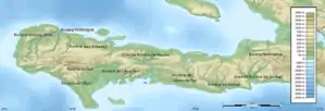
• location | Les Cayes |
| Length | 34 km (21 mi) |
The Ravine du Sud (also known as La Ravine du Sud or the Ravine River) is a river of Haiti.[1][2] The river flows through the Pic Macaya National Park.
See also
References
- ↑ Republic of haiti (HT): Ravine du sud
- ↑ "Proceedings of the American Society of Civil Engineers, Volume 41". 1915. p. 2093. Retrieved 23 April 2015.
18°11′N 73°45′W / 18.183°N 73.750°W
This article is issued from Wikipedia. The text is licensed under Creative Commons - Attribution - Sharealike. Additional terms may apply for the media files.