Parkville, Missouri | |
|---|---|
 McKay Hall at Park University | |
 Location of Parkville, Missouri | |
 | |
| Coordinates: 39°11′14″N 94°44′32″W / 39.18722°N 94.74222°W | |
| Country | United States |
| State | Missouri |
| County | Platte |
| Government | |
| • Mayor | Dean Katerndahl |
| Area | |
| • Total | 15.50 sq mi (40.14 km2) |
| • Land | 14.87 sq mi (38.52 km2) |
| • Water | 0.63 sq mi (1.63 km2) |
| Elevation | 748 ft (228 m) |
| Population (2020) | |
| • Total | 7,117 |
| • Density | 478.55/sq mi (184.77/km2) |
| Time zone | UTC-6 (Central (CST)) |
| • Summer (DST) | UTC-5 (CDT) |
| ZIP codes | 64151-64152 |
| Area code | 816 |
| FIPS code | 29-56288[3] |
| GNIS feature ID | 2396154[2] |
| Website | parkvillemo.gov |
Parkville is a city in Platte County, Missouri, United States and is a part of the Kansas City Metropolitan Area. The population was 7,177 at the 2020 census (2021 est, 7,810[4]). Parkville is known for its antique shops, art galleries, and historic downtown. The city is home to Park University, English Landing Park, Platte Landing Park, and the National Golf Club of Kansas City. Large neighborhoods in Parkville include: Riss Lake, The National, Thousand Oaks, Creekside, Parkville Heights, River Hills, Riverchase, The Bluffs, Downtown, and Pinecrest.[5]
History
A post office called Parkville was established in 1841,[6] named for settler George S. Park.[7] The town of Parkville was platted in 1844[8] That post office closed in 1962.[6]
The Benjamin Banneker School, Mackay Building, Charles Smith Scott Memorial Observatory, Waddell "A" Truss Bridge, and Washington Chapel C.M.E. Church are listed on the National Register of Historic Places.[9]
Geography
According to the United States Census Bureau, the city has a total area of 15.41 square miles (39.91 km2), of which 14.79 square miles (38.31 km2) is land and 0.62 square miles (1.61 km2) is water.[10] The city is fairly hilly and borders the Missouri River and Kansas City, Missouri.
Demographics
| Census | Pop. | Note | %± |
|---|---|---|---|
| 1850 | 309 | — | |
| 1880 | 482 | — | |
| 1890 | 769 | 59.5% | |
| 1900 | 931 | 21.1% | |
| 1910 | 765 | −17.8% | |
| 1920 | 619 | −19.1% | |
| 1930 | 636 | 2.7% | |
| 1940 | 671 | 5.5% | |
| 1950 | 1,186 | 76.8% | |
| 1960 | 1,229 | 3.6% | |
| 1970 | 1,253 | 2.0% | |
| 1980 | 2,091 | 66.9% | |
| 1990 | 2,402 | 14.9% | |
| 2000 | 4,059 | 69.0% | |
| 2010 | 5,554 | 36.8% | |
| 2020 | 7,177 | 29.2% | |
| U.S. Decennial Census[11] | |||
2020 census
As of the census[12] of 2020, there were 7,177 people and 2,397 households living in the city (2021 est, 7,810[4]). The population density was 466 inhabitants per square mile (179.9/km2). The racial makeup of the city was 85.6% White, 5.1% Asian, 4.5% Hispanic or Latino, 1.4% African American, and 3.5% from two or more races.
The average household size was 3.43.
The median age in the city was 39.0 years. 27.9% of residents were under the age of 18; 61.1% were from 18 to 64; and 11.0% were 65 years of age or older. The gender makeup of the city was 52% male and 48% female.
The median income for a household in the city was $144,127 and the median income for a family was $174,594. About 0.1% of the population was below the poverty line.
About 71% of the population held a Bachelor's degree or higher and 98% were high school graduates. Households with a computer: 96%; households with broadband Internet access: 94%.
2010 census
As of the census[13] of 2010, there were 5,554 people, 1,974 households, and 1,469 families living in the city. The population density was 375.5 inhabitants per square mile (145.0/km2). There were 2,126 housing units at an average density of 143.7 per square mile (55.5/km2). The racial makeup of the city was 89.5% White, 4.0% African American, 0.1% Native American, 3.0% Asian, 0.3% Pacific Islander, 0.6% from other races, and 2.5% from two or more races. Hispanic or Latino of any race were 3.7% of the population.
There were 1,974 households, of which 37.4% had children under the age of 18 living with them, 63.6% were married couples living together, 6.6% had a female householder with no husband present, 4.2% had a male householder with no wife present, and 25.6% were non-families. 20.9% of all households were made up of individuals, and 5.8% had someone living alone who was 65 years of age or older. The average household size was 2.61 and the average family size was 3.05.
The median age in the city was 39.1 years. 25.6% of residents were under the age of 18; 12.7% were between the ages of 18 and 24; 20% were from 25 to 44; 32.6% were from 45 to 64; and 9.1% were 65 years of age or older.
2000 census
As of the census[3] of 2000, there were 4,059 people, 1,510 households, and 1,060 families living in the city. The population density was 586.9 inhabitants per square mile (226.6/km2). There were 1,587 housing units at an average density of 229.5 per square mile (88.6/km2). The racial makeup of the city was 90.37% White, 4.71% African American, 0.52% Native American, 1.31% Asian, 0.96% Pacific Islander, 0.81% from other races, and 1.33% from two or more races. Hispanic or Latino of any race were 2.27% of the population.
There were 1,510 households, out of which 37.4% had children under the age of 18 living with them, 59.1% were married couples living together, 7.7% had a female householder with no husband present, and 29.8% were non-families. 23.8% of all households were made up of individuals, and 5.6% had someone living alone who was 65 years of age or older. The average household size was 2.54 and the average family size was 3.04.
In the city, the population was spread out, with 26.4% under the age of 18, 12.4% from 18 to 24, 29.9% from 25 to 44, 25.2% from 45 to 64, and 6.1% who were 65 years of age or older. The median age was 36 years. For every 100 females, there were 95.0 males. For every 100 females age 18 and over, there were 93.5 males.
The median income for a household in the city was $68,600, and the median income for a family was $86,820. Males had a median income of $64,917 versus $31,740 for females. The per capita income for the city was $33,119. About 5.0% of families and 6.5% of the population were below the poverty line, including 8.1% of those under age 18 and 3.3% of those age 65 or over.
Education
Park Hill School District operates one school in Parkville: Graden Elementary School.[14]
Park University, a private institution, has been in operation at Parkville since 1875.[15]
Parkville has a public library, a branch of the Mid-Continent Public Library.[16]
Notable people
- Bill Grigsby, American sportscaster and member of the Missouri Sports Hall of Fame.
- George S. Park, Texas War of Independence hero, and founder of Parkville, Park University, and Manhattan, Kansas.
- Frank Ringo, professional baseball player from 1880 to 1888.
References
- ↑ "ArcGIS REST Services Directory". United States Census Bureau. Retrieved August 28, 2022.
- 1 2 U.S. Geological Survey Geographic Names Information System: Parkville, Missouri
- 1 2 "U.S. Census website". United States Census Bureau. Retrieved January 31, 2008.
- 1 2 "U.S. Census Bureau QuickFacts: Parkville city, Missouri". www.census.gov. Retrieved July 31, 2022.
- ↑ "Developments & Neighborhoods in Parkville". parkvillemo.gov. Retrieved July 31, 2022.
- 1 2 "Post Offices". Jim Forte Postal History. Retrieved December 9, 2016.
- ↑ Eaton, David Wolfe (1917). How Missouri Counties, Towns and Streams Were Named. The State Historical Society of Missouri. p. 342.
- ↑ "Platte County Place Names, 1928-1945". Archived from the original on June 24, 2016.
- ↑ "National Register Information System". National Register of Historic Places. National Park Service. July 9, 2010.
- ↑ "US Gazetteer files 2010". United States Census Bureau. Archived from the original on January 12, 2012. Retrieved July 8, 2012.
- ↑ "Census of Population and Housing". Census.gov. Retrieved July 2, 2022.
- ↑ "U.S. Census website". United States Census Bureau. Retrieved July 2, 2022.
- ↑ "U.S. Census website". United States Census Bureau. Retrieved July 8, 2012.
- ↑ "Park Hill School District". Great Schools. Retrieved March 18, 2018.
- ↑ Austin Relocation Guide - 2011: Your Guide to Everything Austin. BookBaby. June 20, 2011. p. 119. ISBN 978-1-61792-888-8.
- ↑ "Locations". Mid-Continent Public Library. Retrieved March 17, 2018.
External links
- City of Parkville
- Parkville Chamber of Commerce
- The Landmark, newspaper
- The Platte County Citizen, newspaper
Municipalities and communities of Platte County, Missouri, United States | ||
|---|---|---|
| Cities |  Map of Missouri highlighting Platte County | |
| Villages | ||
| Townships | ||
| CDP | ||
| Other communities | ||
| Footnotes | ‡This populated place also has portions in an adjacent county or counties | |
Kansas City metropolitan area's cities and counties | ||
|---|---|---|
| Central city | 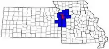 | |
| Largest cities (over 100,000 in 2000) | ||
| Medium-sized cities (10,000 to 100,000 in 2000) | ||
| Smaller cities (between 5,000 and 9,900 in 2010) | ||
| Counties | ||