Ma'ale Gamla
מַעֲלֵה גַּמְלָא | |
|---|---|
 | |
 Ma'ale Gamla 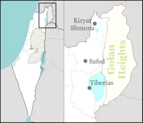 Ma'ale Gamla | |
| Coordinates: 32°53′17″N 35°41′7″E / 32.88806°N 35.68528°E | |
| District | Northern |
| Council | Golan |
| Affiliation | Moshavim Movement |
| Founded | 1975 |
| Population (2021)[1] | 574 |
| Website | www.mgamla.org.il |
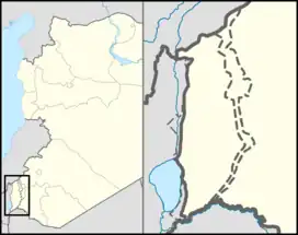
Ma'ale Gamla (Hebrew: מַעֲלֵה גַּמְלָא) is an Israeli settlement and moshav located in the west part of the Golan Heights, under the administration of Israel. It falls under the municipal jurisdiction of Golan Regional Council. In 2021 it had a population of 574.[1]
The international community considers Israeli settlements in the Golan Heights illegal under international law, but the United States and the Israeli government dispute this.[2][3]
History
The moshav was built in 1975 and was named after the ancient town of Gamla, destroyed in the course of the Jewish–Roman war in the 1st century CE, and believed to be the nearby ruin of Tell es Salam.[4]
See also
References
- 1 2 "Regional Statistics". Israel Central Bureau of Statistics. Retrieved 22 February 2023.
- ↑ "The Geneva Convention". BBC. 10 December 2009.
- ↑ "Proclamation on Recognizing the Golan Heights as Part of the State of Israel – The White House". trumpwhitehouse.archives.gov. Retrieved 2022-10-11.
- ↑ Danny Syon, Identification of Gamla, Israel Antiquities Authority.
External links
This article is issued from Wikipedia. The text is licensed under Creative Commons - Attribution - Sharealike. Additional terms may apply for the media files.