This table shows an overview of the protected heritage sites in the Walloon town Genepiën, or Genappe. This list is part of Belgium's national heritage.
| Object | Year/architect | Town/section | Address | Coordinates | Number? | Image |
|---|---|---|---|---|---|---|
| The mountains of Thy (nl) (fr) |
Genepien | Baisy-Thy en Ways | 50°36′33″N 4°27′53″E / 50.609127°N 4.464603°E |
25031-CLT-0002-01 Info |
||
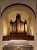
| Organs of the church of Saint-Pierre (nl) (fr) |
Genepien | 50°37′48″N 4°27′13″E / 50.629881°N 4.453529°E |
25031-CLT-0004-01 Info |
|||
| Organs of the church of Saint-Jean Baptiste (nl) (fr) |
Genepien | 50°35′51″N 4°26′33″E / 50.597447°N 4.442387°E |
25031-CLT-0007-01 Info |
|||
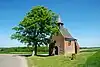
| Chapel of Notre-Dame de Foy Loupoigne including the surrounding grounds (nl) (fr) |
Genepien | 50°36′06″N 4°27′08″E / 50.601761°N 4.452271°E |
25031-CLT-0008-01 Info |
|||
| Caillou farm, even the house located at the front of the Brussels road, and the enclosing wall and ensemble of the said farm, garden and outbuildings (nl) (fr) |
Genepien | 50°38′46″N 4°25′15″E / 50.646046°N 4.420703°E |
25031-CLT-0009-01 Info |
 Boerderij van Caillou, namelijk het huis gelegen aan de voorkant van de Brusselse weg, en de omsluitende muur en ensemble van de genoemde boerderij, tuin en bijgebouwen | ||
| Church of Saint Martin (nl) (fr) |
Genepien | 50°36′36″N 4°27′45″E / 50.610044°N 4.462492°E |
25031-CLT-0011-01 Info |
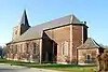 Kerk Saint Martin | ||
| Facade and roof of house (nl) (fr) |
Genepien | rue du centre n° 32 | 50°35′54″N 4°26′35″E / 50.598338°N 4.442981°E |
25031-CLT-0012-01 Info |
 Gevel en dak van huis | |
| Farm: facades and roofs (nl) (fr) |
Genepien | place Charles Morimont n° 1 | 50°35′52″N 4°26′30″E / 50.597883°N 4.441758°E |
25031-CLT-0014-01 Info |
 Boerderij: gevels en daken | |
| Organs in the church of Saint-Hubert (nl) (fr) |
Genepien | 50°35′38″N 4°27′57″E / 50.593804°N 4.465860°E |
25031-CLT-0016-01 Info |
 Orgels kerk Saint-Hubert | ||
| Tower and two wings forming the body of the church of Saint Jean Baptiste (nl) (fr) |
Genepien | 50°35′51″N 4°26′32″E / 50.597426°N 4.442294°E |
25031-CLT-0017-01 Info |
|||
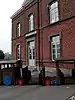
| Farm "Basse Cour" of the castle: facades and roofs (nl) (fr) |
Genepien | rue du Centre n° 37 | 50°35′50″N 4°26′30″E / 50.597323°N 4.441669°E |
25031-CLT-0018-01 Info |
||
| Ensemble of the old mill, church and the farms (nl) (fr) |
Genepien | 50°35′49″N 4°26′20″E / 50.597074°N 4.438926°E |
25031-CLT-0019-01 Info |
|||
| Monument "aux Belges" of 1815, the route Houtain (nl) (fr) |
Genepien | 50°34′23″N 4°26′54″E / 50.573050°N 4.448246°E |
25031-CLT-0020-01 Info |
|||
| Ensemble of the forest of Conins and the wooded parts of the ponds (nl) (fr) |
Genepien | 50°38′55″N 4°30′40″E / 50.648745°N 4.511000°E |
25031-CLT-0021-01 Info |
|||
| Facades, roofs and stained glass of the chapel of Chantelet (nl) (fr) |
Genepien | 50°39′00″N 4°26′03″E / 50.649902°N 4.434034°E |
25031-CLT-0023-01 Info |
|||
| Chapel of Try-au-Chêne and the shrines of Our Lady of Alsemberg and ensemble of these monuments and their surroundings (nl) (fr) |
Genepien | 50°36′29″N 4°30′51″E / 50.608099°N 4.514121°E |
25031-CLT-0024-01 Info |
 Kapel du Try-au-Chêne en de heiligdommen van Onze Lieve Vrouw van Alsemberg en ensemble van deze monumenten en hun omgeving | ||
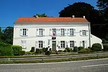
| Façade and roof of the building, setting up a protection zone (nl) (fr) |
Genepien | rue de Ways 39 | 50°36′39″N 4°27′09″E / 50.610697°N 4.452388°E |
25031-CLT-0025-01 Info |
_du_CPAS_de_Genappe.JPG.webp) Voorgevel en het daken van het gebouw, oprichting beschermingsgebied | |
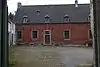
| Farm of Caillou: establishment of a protection zone (nl) (fr) |
Genepien | 50°38′55″N 4°25′25″E / 50.648495°N 4.423473°E |
25031-CLT-0027-01 Info |
See also
Wikimedia Commons has media related to Cultural heritage monuments in Genappe.
References
- Belgian heritage register: Direction générale opérationnelle - Aménagement du territoire, Logement, Patrimoine et Energie (DG4)
- www.dglive.be
This article is issued from Wikipedia. The text is licensed under Creative Commons - Attribution - Sharealike. Additional terms may apply for the media files.