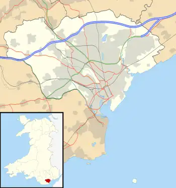
Cardiff is the capital and largest city in Wales. The county, which takes in a number of smaller settlements around the city, has 28 scheduled monuments. These include sites from every period of Welsh history, from the Neolithic onwards. With four hillforts, six castles and six coastal/port sites, they reflect Cardiff's military and strategic role within South Wales. All but one of the sites on this list are within the historic county of Glamorgan. (A small part of the modern unitary authority area was formerly part of Monmouthshire.)
Scheduled monuments have statutory protection. The compilation of the list is undertaken by Cadw Welsh Historic Monuments, which is an executive agency of the National Assembly of Wales.[1] The list of scheduled monuments below is supplied by Cadw[2] with additional material from RCAHMW and Glamorgan-Gwent Archaeological Trust.
Scheduled monuments in Cardiff
| Image | Name | Site type | Community | Location | Details | Historic County | Period | SAM No & Refs |
|---|---|---|---|---|---|---|---|---|
 |
Cae-yr-Arfau Burial Chamber | Chambered tomb | Pentyrch | 51°31′50″N 3°19′54″W / 51.5306°N 3.3317°W, ST077821 |
Two upright stones support a large slab of a neolithic chambered tomb. Having been used in the past as a coal store, it is now overgrown in a garden | Glamorganshire | Prehistoric (Neolithic) |
GM030 [3] |
| Five Round Barrows on Garth Hill | Round barrow | Pentyrch | 51°32′37″N 3°17′36″W / 51.5436°N 3.2932°W, ST104835 |
Glamorganshire | Prehistoric |
GM107 [4] | ||
| Cooking Mound East of Taff Terrace | Burnt mound | Radyr and Morganstown | 51°30′45″N 3°14′56″W / 51.5126°N 3.2488°W, ST134800 |
Glamorganshire | Prehistoric |
GM427 [5] | ||
 |
Caerau Hillfort | Hillfort | Caerau, (also Ely) | 51°28′03″N 3°14′54″W / 51.4675°N 3.2484°W, ST133750 |
Hillfort of some 5 ha, with wooded ramparts. Within the Iron Age hillfort are a ruined church (13th century but possibly pre-Norman) and a castle ringwork. Featured in Time Team dig, April 2012[6] | Glamorganshire | Prehistoric (Iron Age) |
GM018 [7] |
| Llwynda-Ddu Camp | Hillfort | Pentyrch | 51°31′15″N 3°17′10″W / 51.5209°N 3.2861°W, ST109810 |
A small iron age hillfort | Glamorganshire | Prehistoric |
GM180 [8] | |
| Castle Field Camp E of Craig-Llywn | Hillfort | Pontprennau | 51°32′58″N 3°08′55″W / 51.5494°N 3.1486°W, ST204840 |
Glamorganshire | Prehistoric |
GM066 [9] | ||
| Wenallt Camp, Rhiwbina | Hillfort | Rhiwbina | 51°32′14″N 3°13′26″W / 51.5373°N 3.2239°W, ST152827 |
Glamorganshire | Prehistoric |
GM097 [10] | ||
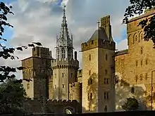 |
Cardiff Castle and Roman Fort | Fort | Castle | 51°28′57″N 3°10′52″W / 51.4824°N 3.1811°W, ST180765 |
Glamorganshire | Roman |
GM171 [11] | |
| Pen y lan Roman Site | Settlement | Roath | 51°30′06″N 3°09′23″W / 51.5017°N 3.1563°W, ST198787 |
Glamorganshire | Roman |
GM296 [12] | ||
| Ely Roman Villa | Villa | Caerau | 51°28′40″N 3°13′46″W / 51.4777°N 3.2295°W, ST147761 |
Glamorganshire | Roman |
GM205 [13] | ||
 Medieval cross in Llandaff Cathedral |
Cross in Llandaff Cathedral | Cross | Llandaff | 51°29′44″N 3°13′03″W / 51.4956°N 3.2176°W, ST155781 |
Glamorganshire | Early Medieval |
GM115 [14] | |
 |
Leckwith Bridge | Bridge | Canton, (also Michaelston) | 51°28′12″N 3°12′43″W / 51.4699°N 3.212°W, ST159752 |
Glamorganshire | Medieval |
GM014 [15] | |
.jpg.webp) |
Blackfriars Priory (dominican), Bute Park | Friary | Castle | 51°29′00″N 3°11′07″W / 51.4832°N 3.1853°W, ST177766 |
Glamorganshire | Medieval |
GM173 [16] | |
 |
Castell Morgraig | Castle | Lisvane, (also Caerphilly) | 51°33′07″N 3°12′47″W / 51.5519°N 3.213°W, ST159843 |
(Site is on the border with Caerphilly) | Glamorganshire | Medieval |
GM031 [17] |
 |
Llandaff Cathedral Bell Tower | Bell Tower | Llandaff | 51°29′43″N 3°13′07″W / 51.4953°N 3.2186°W, ST154780 |
Glamorganshire | Medieval |
GM013 [18] | |
 |
Old Bishop's Palace, Llandaff | Bishop's Palace | Llandaff | 51°29′40″N 3°13′02″W / 51.4945°N 3.2172°W, ST155779 |
Glamorganshire | Medieval |
GM073 [19] | |
.jpg.webp) |
St Mellons Churchyard Cross | Cross | Old St Mellons | 51°31′33″N 3°06′48″W / 51.5258°N 3.1134°W, ST228813 |
Monmouthshire | Medieval |
MM121 [20] | |
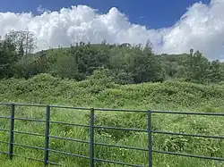 |
Morganstown Castle Mound | Motte | Radyr and Morganstown | 51°31′45″N 3°15′28″W / 51.5291°N 3.2579°W, ST128818 |
Glamorganshire | Medieval |
GM256 [21] | |
.jpg.webp) |
Twmpath Castle | Motte | Rhiwbina | 51°31′56″N 3°13′17″W / 51.5323°N 3.2213°W, ST153822 |
Glamorganshire | Medieval |
GM017 [22] | |
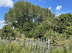 |
Caer Castell Camp | Motte | Rumney | 51°31′00″N 3°06′56″W / 51.5167°N 3.1156°W, ST226803 |
Glamorganshire | Medieval |
GM216 [23] | |
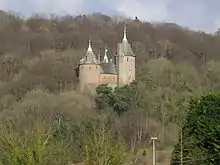 |
Castell Coch |
Castle | Tongwynlais | 51°32′10″N 3°15′18″W / 51.536°N 3.2549°W, ST130826 |
Glamorganshire | Medieval |
GM206 [24] | |
 |
Relict Seawall on Rumney Great Wharf | Seawall | Trowbridge | 51°29′45″N 3°06′03″W / 51.4958°N 3.1008°W, ST236780 |
Glamorganshire | Post-Medieval/Modern |
GM474 [25] | |
| Three Palmerstonian Gun Batteries, Flat Holm | Battery | Butetown | 51°22′47″N 3°07′18″W / 51.3798°N 3.1216°W, ST220651 |
Glamorganshire | Post-Medieval/Modern |
GM351 [26] | ||
| Ely Tidal Harbour Coal Staithe Number One | Staithes | Grangetown | 51°26′52″N 3°10′58″W / 51.4478°N 3.1827°W, ST179727 |
Glamorganshire | Post-Medieval/Modern |
GM583 [27] | ||
| The Wreck of the "Louisa" | Boat | Grangetown | 51°27′33″N 3°10′46″W / 51.4592°N 3.1795°W, ST181740 |
Glamorganshire | Post-Medieval/Modern |
GM553 [28] | ||
| Queen Alexandra Dock Harbour Defence Gun Emplacement | Gun House | Butetown | 51°27′07″N 3°09′23″W / 51.452°N 3.1564°W, ST197731 |
Glamorganshire | Post-Medieval/Modern |
GM618 [29] | ||
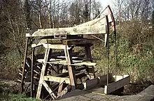 |
Melingriffith Water Pump | Pump | Whitchurch | 51°30′44″N 3°14′16″W / 51.5122°N 3.2378°W, ST142799 |
Glamorganshire | Post-Medieval/Modern |
GM312 [30] | |
| Flat Holm Coastal and Anti-aircraft Defences | Battery | Butetown | 51°22′35″N 3°07′17″W / 51.3765°N 3.1214°W, ST220647 |
Glamorganshire | Post-Medieval/Modern |
GM595 [31] |
See also
References
- Coflein is the online database of RCAHMW: Royal Commission on the Ancient and Historical Monuments of Wales, GGAT is the Glamorgan-Gwent Archaeological Trust, Cadw is the Welsh Historic Monuments Agency
- ↑ Cadw: Ancient Monuments and Scheduling.. Retrieved 25 April 2013
- ↑ Cadw will send their list as a spreadsheet, or other electronic formats, on request, as indicated at www.whatdotheyknow.com. This list uses information dated May 2012
- ↑ coflein NPRN: 93016. GGAT PRN: 00620m. Cadw SAM: GM030: Cae-yr-Arfau Burial Chamber
- ↑ coflein NPRN: not yet identified. GGAT PRN not yet identified. Cadw SAM: GM107: Five Round Barrows on Garth Hill
- ↑ coflein NPRN: not yet identified. GGAT PRN not yet identified. Cadw SAM: GM427: Cooking Mound East of Taff Terrace
- ↑ Time team article on caerau hillfort
- ↑ coflein NPRN: 94517. GGAT PRN: 00093s. Cadw SAM: GM018: Caerau Camp
- ↑ coflein NPRN: not yet identified. GGAT PRN not yet identified. Cadw SAM: GM180: Llwynda-Ddu Camp
- ↑ coflein NPRN: not yet identified. GGAT PRN not yet identified. Cadw SAM: GM066: Castle Field Camp E Of Craig-Llywn
- ↑ coflein NPRN: not yet identified. GGAT PRN not yet identified. Cadw SAM: GM097: Wenallt Camp, Rhiwbina
- ↑ coflein NPRN: not yet identified. GGAT PRN not yet identified. Cadw SAM: GM171: Cardiff Castle and Roman Fort
- ↑ coflein NPRN: not yet identified. GGAT PRN not yet identified. Cadw SAM: GM296: Pen y lan Roman Site
- ↑ coflein NPRN: not yet identified. GGAT PRN not yet identified. Cadw SAM: GM205: Ely Roman Villa
- ↑ coflein NPRN: not yet identified. GGAT PRN not yet identified. Cadw SAM: GM115: Cross in Llandaff Cathedral
- ↑ coflein NPRN: not yet identified. GGAT PRN not yet identified. Cadw SAM: GM014: Leckwith Bridge
- ↑ coflein NPRN: 307772. GGAT PRN not yet identified. Cadw SAM: GM173: Dominican Friary
- ↑ coflein NPRN: not yet identified. GGAT PRN not yet identified. Cadw SAM: GM031: Castell Morgraig
- ↑ coflein NPRN: not yet identified. GGAT PRN not yet identified. Cadw SAM: GM013: Llandaff Cathedral Bell Tower
- ↑ coflein NPRN: not yet identified. GGAT PRN not yet identified. Cadw SAM: GM073: Old Bishop's Palace, Llandaff
- ↑ coflein NPRN: not yet identified. GGAT PRN not yet identified. Cadw SAM: MM121: St Mellons Churchyard Cross
- ↑ coflein NPRN: not yet identified. GGAT PRN not yet identified. Cadw SAM: GM256: Morganstown Castle Mound
- ↑ coflein NPRN: not yet identified. GGAT PRN not yet identified. Cadw SAM: GM017: Twmpath, Rhiwbina
- ↑ coflein NPRN: not yet identified. GGAT PRN not yet identified. Cadw SAM: GM216: Caer Castell Camp
- ↑ coflein NPRN: not yet identified. GGAT PRN not yet identified. Cadw SAM: GM206: Castell Coch
- ↑ coflein NPRN: 275880. GGAT PRN not yet identified. Cadw SAM: GM474: Relict Seawall on Rumney Great Wharf
- ↑ coflein NPRN: not yet identified. GGAT PRN not yet identified. Cadw SAM: GM351: Three Palmerstonian Gun Batteries, Flat Holm
- ↑ coflein NPRN: not yet identified. GGAT PRN not yet identified. Cadw SAM: GM583: Ely Tidal Harbour Coal Staithe Number One
- ↑ coflein NPRN: not yet identified. GGAT PRN not yet identified. Cadw SAM: GM553: The Wreck of the "Louisa"
- ↑ coflein NPRN: not yet identified. GGAT PRN not yet identified. Cadw SAM: GM618: Queen Alexandra Dock Harbour Defence Gun Emplacement
- ↑ coflein NPRN: not yet identified. GGAT PRN not yet identified. Cadw SAM: GM312: Melingriffith Water Pump
- ↑ coflein NPRN: not yet identified. GGAT PRN not yet identified. Cadw SAM: GM595: Flat Holm Coastal and Anti-aircraft Defences