East Lampung Regency
Kabupaten Lampung Timur | |
|---|---|
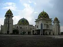
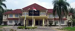 The regent's office in Sukadana | |
 Coat of arms | |
| Motto(s): Bumei Tuwah Bepadan (Prosperity by people's consensus) | |
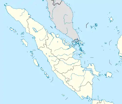
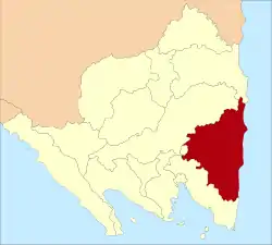 Location within Lampung | |
| Coordinates: 5°06′10″S 105°40′48″E / 5.1027°S 105.6800°E | |
| Country | Indonesia |
| Province | Lampung |
| Regency seat | Sukadana |
| Government | |
| • Regent | M. Dawam Rahardjo |
| • Vice Regent | Azwar Hadi |
| Area | |
| • Total | 5,325.03 km2 (2,056.01 sq mi) |
| Population (2022 estimate)[1] | |
| • Total | 1,127,946 |
| • Density | 210/km2 (550/sq mi) |
| Time zone | UTC+7 (IWST) |
| Area code | (+62) 725 |
| Website | lampungtimurkab |
East Lampung Regency is a regency (kabupaten) of Lampung Province, Sumatra, Indonesia. It has an area of 5,325.03 km2 and a population of 951,639 people at the 2010 census[2] and 1,110,340 at the 2020 census.[3] The official estimate as at mid 2022 was 1,127,946 - comprising 572,986 males and 553,960 females.[1] The regency seat is at the town of Sukadana.
It contains the Way Kambas National Park and Satwa Elephant Eco Lodge.[4]
History
In 1989, the Islamist civilians in Talangsari village of East Lampung Regency were massacred by Indonesian Army troops, in an event known as Talangsari incident.
In January 2010 an outbreak of bird flu occurred in East Lampung Regency.[5]
Administrative districts
East Lampung Regency is divided into twenty-four administrative districts (kecamatan), tabulated below with their areas and their populations at the 2010 census[2] and the 2020 census,[3] together with the official estimates as at mid 2022.[1]They are grouped for convenience into three geographical zones which have no administrative significance. The table also includes the locations of the district administrative centres, the number of administrative villages (all classed as rural desa) in each district and its post code.
| Kode Wilayah | Name of District (kecamatan) | Area in km2 | Pop'n census 2010 | Pop'n census 2020 | Pop'n estimate mid 2022 | Admin centre | No. of villages | Post code |
|---|---|---|---|---|---|---|---|---|
| 18.07.10 | Metro Kibang | 76.78 | 20,707 | 24,250 | 24,641 | Kibang | 7 | 34331 -34335 |
| 18.07.06 | Batanghari | 148.88 | 54,601 | 60,038 | 60,661 | Banar Joyo | 17 | 34381 |
| 18.07.05 | Sekampung | 148.34 | 59,819 | 67,301 | 68,140 | Sumber Gede | 17 | 34382 |
| 18.07.11 | Marga Tiga | 250.73 | 43,395 | 50,196 | 50,919 | Tanjung Harapan | 13 | 34386 |
| Western group | 624.73 | 178,522 | 201,785 | 204,361 | 54 | |||
| 18.07.12 | Sekampung Udik (Upriver Sekampung) | 339.12 | 68,093 | 77,051 | 78,057 | Pugung Raharjo | 15 | 34385 |
| 18.07.03 | Jabung | 267.85 | 46,550 | 54,851 | 55,767 | Negara Batin | 15 | 34384 |
| 18.07.19 | Pasir Sakti | 193.94 | 34,410 | 43,425 | 44,424 | Mulyo Sari | 8 | 34387 |
| 18.07.20 | Waway Karya | 211.07 | 34,454 | 42,461 | 43,345 | Sumber Rejo | 11 | 34376 |
| 18.07.24 | Marga Sekampung | 177.32 | 26,035 | 29,256 | 29,617 | Peniangan | 8 | 34383 |
| 18.07.02 | Labuhan Maringgai (a) | 194.99 | 61,158 | 76,849 | 78,077 | Labuhan Maringgai | 11 | 34198 |
| 18.07.16 | Mataram Baru | 79.56 | 26,672 | 31,547 | 32,085 | Mataram Baru | 7 | 34199 |
| 18.07.15 | Bandar Sribhawono | 185.71 | 46,133 | 51,396 | 53,215 | Sribhawono | 7 | 34389 |
| 18.07.17 | Melinting | 139.30 | 24,630 | 29,858 | 30,434 | Wana | 6 | 34377 |
| 18.07.18 | Gunung Pelindung | 78.52 | 21,052 | 24,565 | 24,953 | Negeri Agung | 5 | 34388 |
| 18.07.07 | Way Japara | 229.27 | 51,073 | 57,946 | 58,713 | Braja Sakti | 16 | 34396 |
| 18.07.22 | Braja Slebah | 247.61 | 21,733 | 26,824 | 27,386 | Braja Harjosari | 7 | 34196 |
| Southern group | 2,344.26 | 461,993 | 546,029 | 556,073 | 116 | |||
| 18.07.21 | Labuhan Ratu | 485.51 | 41,386 | 51,979 | 53,152 | Labuhan Ratu | 11 | 34375 |
| 18.07.01 | Sukadana | 756.76 | 64,093 | 74,830 | 76,016 | Sukadana | 20 | 34194 |
| 18.07.14 | Bumi Agung | 73.17 | 16,931 | 20,478 | 20,869 | Donomulyo | 7 | 34182 |
| 18.07.13 | Batanghari Nuban | 180.69 | 40,992 | 47,712 | 48,455 | Sukaraja Nuban | 13 | 34372 |
| 18.07.04 | Pekalongan | 100.13 | 45,209 | 53,015 | 53,877 | Pekalongan | 12 | 34391 |
| 18.07.09 | Raman Utara (North Raman) | 161.37 | 35,760 | 41,314 | 41,929 | Kota Raman | 11 | 34371 |
| 18.07.08 | Purbolinggo | 222.03 | 40,152 | 45,768 | 46,393 | Taman Fajar | 12 | 34192 |
| 18.07.23 | Way Bungur (b) | 376.38 | 22,058 | 26,330 | 26,801 | Tambah Subur | 8 | 34373 |
| Northern group | 2,356.04 | 306,581 | 361,426 | 367,492 | 94 | |||
| Totals | 5,325.03 | 951,639 | 1,110,340 | 1,127.946 | Sukadana | 264 |
Notes: (a) including 3 small islands - Pulau Gosongsekopong (just offshore), and - much further east in the Java Sea - the Segama Islands comprising Pulau Segama Besar and Pulau Segama Kecil.
(b) formerly Purbolinggo Utara (or North Purbolinggo).
References
- 1 2 3 Badan Pusat Statistik, Jakarta, 2023, Kabupaten Lampung Timur Dalam Angka 2023 (Katalog-BPS 1102001.1807)
- 1 2 Biro Pusat Statistik, Jakarta, 2011.
- 1 2 Badan Pusat Statistik, Jakarta, 2021.
- ↑ "Way Kambas Elephants Safari – Lampung". Indonesian Rainforest. Retrieved 22 February 2011.
- ↑ "Bird Flu Outbreak Kills Fowl". Jakarta Post. 29 January 2011. Retrieved 22 February 2011.
Regencies and cities of Lampung | ||
|---|---|---|
Capital: Bandar Lampung | ||
| Regencies | ||
| Cities | ||