Kanpur Nagar district | |
|---|---|
.jpg.webp)    .jpg.webp) Clockwise from top-left: Kanpur Central Rail Station, IIT Kanpur Central Library, Nana Sahib statue at Bithoor, Jagannath temple, Fields in Kaitha village | |
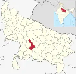 Location of Kanpur Nagar district in Uttar Pradesh | |
| Country | |
| State | Uttar Pradesh |
| Division | Kanpur |
| Headquarters | Kanpur |
| Tehsils | Kanpur, Bilhaur, Ghatampur, |
| Government | |
| • Lok Sabha constituencies | 1. Kanpur (Lok Sabha constituency)- Kidwai Nagar, Cantt., Sishamau, Arya Nagar, Govindnagar
2. Misrikh (Lok Sabha constituency)- Bilhaur 3. Akbarpur (Lok Sabha constituency)- Ghatampur, Kalyanpur, Maharajpur, Bithoor |
| • Vidhan Sabha constituencies | 1. Sishamau 2. Arya Nagar 3. Kidwai Nagar 4. Govind Nagar 5. Kanpur Cantonment 6. Bithoor 7. Kalyanpur 8. Maharajpur 9. Ghatampur 10. Bilhaur |
| Area | |
| • Total | 3,155 km2 (1,218 sq mi) |
| Population (2011)[1] | |
| • Total | 4,581,268 |
| • Density | 1,500/km2 (3,800/sq mi) |
| • Urban | 3,015,645 |
| Demographics | |
| • Literacy | 70.78% |
| Time zone | UTC+05:30 (IST) |
| Major highways | NH 2 |
| Website | kanpurnagar |
Kanpur Nagar district, meaning Urban Kanpur District is one of the districts of the Uttar Pradesh state of India. It is a part of Kanpur division and its district headquarters is Kanpur. Kanpur was formerly spelled Cawnpore.
Notable people
- Kavi Bhushan an Indian poet in the courts of the Bundela King Chhatrasal and the Maratha King Shivaji. Bhushan resided in the Tikwapur village in Ghatampur tehsil of Kanpur district, Uttar Pradesh.
Demographics
| Year | Pop. | ±% p.a. |
|---|---|---|
| 1901 | 860,367 | — |
| 1911 | 780,691 | −0.97% |
| 1921 | 785,046 | +0.06% |
| 1931 | 828,506 | +0.54% |
| 1941 | 1,063,602 | +2.53% |
| 1951 | 1,325,778 | +2.23% |
| 1961 | 1,647,150 | +2.19% |
| 1971 | 2,099,164 | +2.45% |
| 1981 | 2,655,191 | +2.38% |
| 1991 | 3,253,572 | +2.05% |
| 2001 | 4,167,999 | +2.51% |
| 2011 | 4,581,268 | +0.95% |
| source:[2] | ||
According to the 2011 census Kanpur Nagar district has a population of 4,581,268,[1] roughly equal to the nation of Costa Rica[4] or the US state of Louisiana.[5] This gives it a ranking of 32nd in India (out of a total of 640).[1] The district has a population density of 1,449 inhabitants per square kilometre (3,750/sq mi) .[1] Its population growth rate over the decade 2001-2011 was 9.72%.[1] Kanpur Nagar has a sex ratio of 852 females for every 1000 males,[1] and a literacy rate of 81.31%. 65.83% of the population lives in urban areas. Scheduled Castes made up 17.83% of the population.[1]
At the time of the 2011 Census of India, 92.43% of the population in the district spoke Hindi (or a related language), 5.76% Urdu and 0.79% Punjabi as their first language.[6]
| Rank | Metropolitan Area | Area (km sq.) | Population (2011) | Coverage |
|---|---|---|---|---|
| 1 | Kanpur | 450 | 2,768,057 | Includes Kanpur Cantonment and Chakeri |
| 2 | Kanpur Cantonment | 50 | 108,534 | |
| 3 | Armapur Estate | 20 | 15,463 | |
| 4 | Northern Railway Colony | 15 | 20,916 | |
| 5 | Ghatampur | 12 | 40,623 | |
| 6 | Bilhaur | 10 | 20,493 | |
| 7 | Chakeri | 5 | 7,526 | |
| 8 | Bithoor | 5 | 11,300 | |
| 9 | Choubepur Kalan | 5 | 10,785 | |
| 10 | Shivrajpur | 3 | 11,948 |
Villages
See also
References
- 1 2 3 4 5 6 7 "District Census Handbook: Kanpur Nagar" (PDF). censusindia.gov.in. Registrar General and Census Commissioner of India. 2011.
- ↑ Decadal Variation In Population Since 1901
- ↑ "Table C-01 Population by Religion: Uttar Pradesh". censusindia.gov.in. Registrar General and Census Commissioner of India. 2011.
- ↑ US Directorate of Intelligence. "Country Comparison:Population". Archived from the original on 13 June 2007. Retrieved 1 October 2011.
Costa Rica 4,576,562 July 2011 est
- ↑ "2010 Resident Population Data". U. S. Census Bureau. Archived from the original on 23 August 2011. Retrieved 30 September 2011.
Louisiana 4,533,372
- 1 2 "Table C-16 Population by Mother Tongue: Uttar Pradesh". www.censusindia.gov.in. Registrar General and Census Commissioner of India.
- ↑ "Village – Bilhaur Block". kanpurnagar.nic.in.
- ↑ "Village – Bilhaur Block". kanpurnagar.nic.in.
External links
Places adjacent to Kanpur Nagar district | |
|---|---|
26°27′36″N 80°19′48″E / 26.46000°N 80.33000°E