Região de Aveiro | |
|---|---|
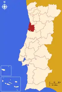 | |
| Coordinates: 40°38′N 8°38′W / 40.63°N 8.63°W | |
| Country | |
| Region | Centro |
| Established | 2008 |
| Seat | Aveiro |
| Municipalities | 11 |
| Area | |
| • Total | 1,692.86 km2 (653.62 sq mi) |
| Population (2011) | |
| • Total | 370,394 |
| • Density | 220/km2 (570/sq mi) |
| Time zone | UTC±00:00 (WET) |
| • Summer (DST) | UTC+01:00 (WEST) |
| Website | www |
The Comunidade Intermunicipal da Região de Aveiro (Portuguese pronunciation: [ʁɨʒiˈɐ̃w dɨ aˈvɐjɾu]; English: Aveiro Region) is an administrative division in Portugal. It was created in October 2008,[1] replacing the previously existing Greater Metropolitan Area of Aveiro. Since January 2015, Região de Aveiro is also a NUTS3 subregion of Centro Region, that covers the same area as the intermunicipal community.[2] The main city and seat of the intermunicipal community is Aveiro. The population in 2011 was 370,394,[3] in an area of 1,692.86 square kilometres (653.62 sq mi).[4]
Municipalities
The intermunicipal community of Região de Aveiro is subdivided into 11 municipalities:[5]
| Municipality | Population (2011)[3] | Area (km2)[4] |
|---|---|---|
| Águeda | 47,729 | 335.27 |
| Albergaria-a-Velha | 25,252 | 158.83 |
| Anadia | 29,150 | 216.63 |
| Aveiro | 78,450 | 197.58 |
| Estarreja | 26,997 | 108.17 |
| Ílhavo | 38,598 | 73.48 |
| Murtosa | 10,585 | 73.09 |
| Oliveira do Bairro | 23,028 | 87.32 |
| Ovar | 55,398 | 147.70 |
| Sever do Vouga | 12,356 | 129.88 |
| Vagos | 22,851 | 164.92 |
| Total | 370,394 | 1,692.86 |
References
- ↑ Região de Aveiro
- ↑ Adequação dos indicadores à nova organização territorial NUTS III / Entidades Intermunicipais, Instituto Nacional de Estatística, 18 March 2015
- 1 2 Instituto Nacional de Estatística
- 1 2 Áreas das freguesias, concelhos, distritos e país
- ↑ "Law nr. 75/2013" (pdf). Diário da República (in Portuguese). Assembly of the Republic (Portugal). Retrieved 14 August 2014.
External links
| North Region |
| ||||
|---|---|---|---|---|---|
| Centro Region |
| ||||
| Oeste e Vale do Tejo Region |
| ||||
| Lisbon Region |
| ||||
| Alentejo Region |
| ||||
| Algarve Region |
| ||||
| Autonomous Regions | |||||
All these divisions are further subdivided into municipalities and parishes. | |||||
This article is issued from Wikipedia. The text is licensed under Creative Commons - Attribution - Sharealike. Additional terms may apply for the media files.