East Kutai Regency
Kabupaten Kutai Timur | |
|---|---|
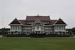 Regent office building | |
 Coat of arms | |
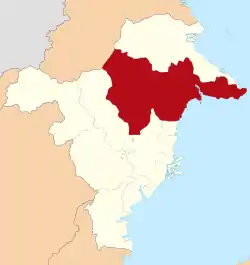 Location within East Kalimantan | |
 East Kutai Regency Location in Kalimantan and Indonesia 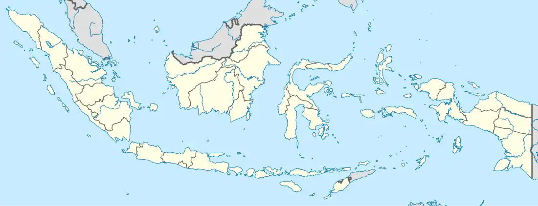 East Kutai Regency East Kutai Regency (Indonesia) | |
| Coordinates: 1°02′16″N 117°49′52″E / 1.03769°N 117.83112°E | |
| Country | Indonesia |
| Province | East Kalimantan |
| Capital | Sangatta |
| Government | |
| • Regent | Ardiansyah Sulaiman |
| • Vice Regent | Kasmidi Bulang |
| Area | |
| • Total | 35,747.5 km2 (13,802.2 sq mi) |
| Population (mid 2022 estimate) | |
| • Total | 425,613 |
| • Density | 12/km2 (31/sq mi) |
| [1] | |
| Time zone | UTC+8 (ICST) |
| Area code | (+62) 549 |
| Website | kutaitimurkab |
East Kutai Regency (Indonesian: Kabupaten Kutai Timur) is a regency of East Kalimantan province, Indonesia. It has an area of 35,747.50 km2[2] and had a population of 253,904 at the 2010 census[3] and 434,459 at the 2020 census;[4] the official estimate as at mid 2022 was 425,613 (comprising 227,716 males and 197,897 females).[1] The town of Sangatta is the capital of the regency.
There are several coal mining companies with concessions around this regency, including Kaltim Prima Coal, one of the largest coal mining companies in Indonesia. The regency also contains one of the largest coal mine in Asia - the East Kutai coal mine.
East Kutai is home to the world's oldest known figurative art at Lubang Jeriji Saléh.[5]
Administrative Districts
East Kutai Regency is divided into eighteen districts (kecamatan),[2] tabulated below with their areas and their 2010[3] and 2020[4] census populations, together with the official estimates as at mid 2022.[1] The table also includes the locations of the district administrative centres, the number of administrative villages in each district (a total of 139 rural desa and 2 urban kelurahan), and its postal codes.
| Kode Wilayah | Name of District (kecamatan) | Area in km2 | Pop'n census 2010 | Pop'n census 2020 | Pop'n estimate mid 2022 | Admin centre | No. of villages | Post codes |
|---|---|---|---|---|---|---|---|---|
| 64.08.01 | Muara Ancalong | 2,739.30 | 12,511 | 15,246 | 14,605 | Kelinjau Ilir | 6 | 75656 (a) |
| 64.08.06 | Busang | 3,721.61 | 4,326 | 6,396 | 5,765 | Long Lees | 6 | 75556 |
| 64.08.18 | Long Mesangat | 526.98 | 4,250 | 7,168 | 7,291 | Sumber Sari | 7 | 75654 - 75656 |
| 64.08.02 | Muara Wahau | 5,724.32 | 15,734 | 35,963 | 30,698 | Muara Wahau | 10 | 75655 |
| 64.08.07 | Telen | 3,129.61 | 5,766 | 10,829 | 10,377 | Jun Ayak | 8 | 75554 |
| 64.08.08 | Kongbeng | 581.27 | 15,631 | 27,609 | 30,453 | Miau Baru | 7 | 75555 |
| 64.08.03 | Muara Bengkal | 1,522.80 | 11,331 | 14,030 | 13,683 | Muara Bengkal Ulu | 7 | 75656 |
| 64.08.17 | Batu Ampar | 204.50 | 4,201 | 7,673 | 8,179 | Batu Timbau | 7 | 75654 |
| 64.08.04 | Sangatta Utara (North Sangatta) | 1,262.59 | 72,156 | 120,873 | 123,067 | Sangatta Utara | 4 (b) | |
| 64.08.09 | Bengalon | 3,196.24 | 22,698 | 45,314 | 42,225 | Sepaso | 11 | 75618 |
| 64.08.13 | Teluk Pandan (Pandan Bay) | 831.00 | 12,208 | 18,791 | 14,417 | Teluk Pandan | 6 | 75682 |
| 64.08.12 | Sangatta Selatan (South Sangatta) | 1,660.85 | 18,194 | 30,117 | 30,874 | Sangatta Selatan | 4 (c) | |
| 64.08.14 | Rantau Pulung | 143.82 | 7,203 | 12,167 | 13,313 | Kebon Agung | 9 | 75683 |
| 64.08.05 | Sangkulirang (d) | 3,322.80 | 16,181 | 26,449 | 24,283 | Benua Baru Ilir | 15 | 75686 |
| 64.08.10 | Kaliorang | 438.91 | 7,998 | 15,355 | 16,378 | Bukit Makmur | 7 | 75617 |
| 64.08.11 | Sandaran (e) | 3,419.30 | 6,494 | 12,604 | 11,410 | Manubar | 9 | 75685 |
| 64.08.15 | Kaubun | 257.45 | 9,622 | 14,867 | 15,035 | Bumi Etam | 8 | 75619 |
| 64.08.16 | Karangan | 3,064.36 | 9,133 | 13,008 | 12,660 | Karangan Hilir | 7 | 75684 |
| Totals | 35,747.50 | 253,904 | 434,459 | 425,613 | Sangatta | 141 |
Notes: (a) except the village of Kelinjau Ulu (which has a postcode of 75556). (b) includes the kelurahan of Teluk Lingga.
(c) includes the kelurahan of Singa Geweh. (d) includes 16 islands off the coast of Kalimantan. (e) includes 8 islands off the coast of Kalimantan.
Climate
Sangatta, the seat of the regency has a tropical rainforest climate (Af) with moderate rainfall from July to October and heavy rainfall from November to June.
| Climate data for Sangatta | |||||||||||||
|---|---|---|---|---|---|---|---|---|---|---|---|---|---|
| Month | Jan | Feb | Mar | Apr | May | Jun | Jul | Aug | Sep | Oct | Nov | Dec | Year |
| Mean daily maximum °C (°F) | 30.0 (86.0) |
30.2 (86.4) |
30.4 (86.7) |
30.4 (86.7) |
30.6 (87.1) |
30.1 (86.2) |
29.7 (85.5) |
30.2 (86.4) |
30.3 (86.5) |
30.9 (87.6) |
30.6 (87.1) |
30.3 (86.5) |
30.3 (86.6) |
| Daily mean °C (°F) | 26.4 (79.5) |
26.6 (79.9) |
26.8 (80.2) |
26.8 (80.2) |
27.1 (80.8) |
26.7 (80.1) |
26.3 (79.3) |
26.7 (80.1) |
26.7 (80.1) |
27.2 (81.0) |
26.9 (80.4) |
26.7 (80.1) |
26.7 (80.1) |
| Mean daily minimum °C (°F) | 22.9 (73.2) |
23.0 (73.4) |
23.2 (73.8) |
23.3 (73.9) |
23.7 (74.7) |
23.4 (74.1) |
22.9 (73.2) |
23.3 (73.9) |
23.2 (73.8) |
23.5 (74.3) |
23.3 (73.9) |
23.2 (73.8) |
23.2 (73.8) |
| Average rainfall mm (inches) | 157 (6.2) |
142 (5.6) |
190 (7.5) |
203 (8.0) |
201 (7.9) |
157 (6.2) |
107 (4.2) |
115 (4.5) |
117 (4.6) |
123 (4.8) |
193 (7.6) |
190 (7.5) |
1,895 (74.6) |
| Source: Climate-Data.org[6] | |||||||||||||
References
- 1 2 3 Badan Pusat Statistik, Jakarta, 2023, Kabupaten Kutai Timur Dalam Angka 2023 (Katalog-BPS 1102001.6408)
- 1 2 "www.kutaitimur.go.id". Archived from the original on 2008-06-16. Retrieved 2008-06-02.
- 1 2 Biro Pusat Statistik, Jakarta, 2011.
- 1 2 Badan Pusat Statistik, Jakarta, 2021.
- ↑ Safutra, Ilham (9 November 2018). "Keren! Lukisan Binatang Tertua di Dunia Ada di Kaltim". Jawa Pos (in Indonesian). Retrieved 26 November 2018.
- ↑ "Climate: Sangatta". Climate-Data.org. Retrieved 24 November 2020.
External links
Regencies and cities of East Kalimantan | ||
|---|---|---|
Capital: Samarinda | ||
| Regencies | ||
| Cities | ||
| Towns and villages | ||