| Babis Mta | |
|---|---|
| Donguzorun | |
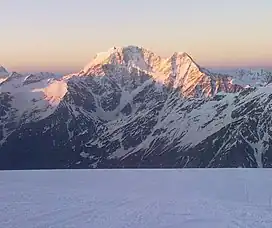 View of Babis Mta from the Slope of Mt. Elbrus | |
| Highest point | |
| Elevation | 4,454 m (14,613 ft) |
| Prominence | 1,087 m (3,566 ft) |
| Isolation | 14.06 km (8.74 mi) |
| Coordinates | 43°11′41″N 42°30′54″E / 43.19472°N 42.51500°E |
| Geography | |
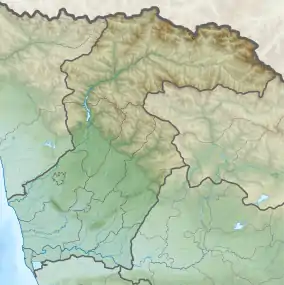 Babis Mta Location on a map of Georgia 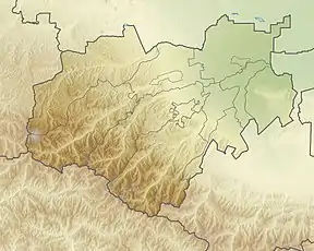 Babis Mta Babis Mta (Kabardino-Balkaria) | |
| Location | Svaneti, Georgia Kabardino-Balkaria, Russia |
| Countries | |
| Parent range | Caucasus Mountains |
| Climbing | |
| First ascent | August 7, 1888 |
Donguzorun (Russian: Донгузорун, Донгузорун-Чегет-Карабаши́, Georgian: ბაბისმთა, Babis Mta)[1] is a peak in the central part of the Main Caucasian Range. The mountain is located on the border of Georgia and Kabardino-Balkaria, Russia. The elevation of the mountain is 4,454 metres (14,613 ft) above sea level. The Tsalgmili Range branches off from the southern flank of the mountain. The glaciers of Ledeshdvi, Dolra and Donguzorun descend from the slopes of Babis Mta.[2]
History
Donguzorun, or more precisely its eastern peak, was first climbed on August 7, 1888 by the British mountaineer W.F. Donkin[3] and his companions.[4]
References
- ↑ Dongusorun, Russia/Georgia Archived 2023-01-24 at the Wayback Machine peakbagger
- ↑ Georgian State (Soviet) Encyclopedia. 1977. Book 2. p. 123.
- ↑ “Obituary: Mr. W. F. Donkin, and Mr. H. Fox.” Proceedings of the Royal Geographical Society and Monthly Record of Geography, vol. 10, no. 11, 1888, pp. 715–17. JSTOR Archived 2023-01-24 at the Wayback Machine Accessed 24 Jan. 2023.
- ↑ (in Russian) А. Ф. Наумов: Баксанская долина (Центральный Кавказ). Москва: Издательство „Физкультура и Спорт”, 1972, с. 40.
External links
- Sheet K-38-26, Soviet topographic map of the area
This article is issued from Wikipedia. The text is licensed under Creative Commons - Attribution - Sharealike. Additional terms may apply for the media files.