Bois-l'Évêque | |
|---|---|
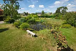 The pond in Bois-l'Évêque | |
.svg.png.webp) Coat of arms | |
Location of Bois-l'Évêque | |
 Bois-l'Évêque  Bois-l'Évêque | |
| Coordinates: 49°27′01″N 1°15′55″E / 49.4503°N 1.2653°E | |
| Country | France |
| Region | Normandy |
| Department | Seine-Maritime |
| Arrondissement | Rouen |
| Canton | Le Mesnil-Esnard |
| Government | |
| • Mayor (2020–2026) | Frédéric Tihi[1] |
| Area 1 | 7.21 km2 (2.78 sq mi) |
| Population | 612 |
| • Density | 85/km2 (220/sq mi) |
| Time zone | UTC+01:00 (CET) |
| • Summer (DST) | UTC+02:00 (CEST) |
| INSEE/Postal code | 76111 /76160 |
| Elevation | 100–163 m (328–535 ft) (avg. 145 m or 476 ft) |
| 1 French Land Register data, which excludes lakes, ponds, glaciers > 1 km2 (0.386 sq mi or 247 acres) and river estuaries. | |
Bois-l'Évêque (French pronunciation: [bwa levɛk]) is a commune in the Seine-Maritime department in the Normandy region in northern France.
Geography
A farming village situated some 8 miles (13 km) east of Rouen at the junction of the D53 and the D43 roads.
Population
| Year | Pop. | ±% p.a. |
|---|---|---|
| 1968 | 175 | — |
| 1975 | 202 | +2.07% |
| 1982 | 260 | +3.67% |
| 1990 | 290 | +1.37% |
| 1999 | 368 | +2.68% |
| 2007 | 494 | +3.75% |
| 2012 | 500 | +0.24% |
| 2017 | 554 | +2.07% |
| Source: INSEE[3] | ||
Places of interest
- The church of Notre-Dame, dating from the nineteenth century.
- Remnants of the 13th-century priory de Beaulieu.
- The nineteenth century Château de Bethel.
- Ruins of a 13th-century chapel.
See also
References
- ↑ "Répertoire national des élus: les maires" (in French). data.gouv.fr, Plateforme ouverte des données publiques françaises. 13 September 2022.
- ↑ "Populations légales 2021". The National Institute of Statistics and Economic Studies. 28 December 2023.
- ↑ Population en historique depuis 1968, INSEE
Wikimedia Commons has media related to Bois-l'Évêque.
This article is issued from Wikipedia. The text is licensed under Creative Commons - Attribution - Sharealike. Additional terms may apply for the media files.