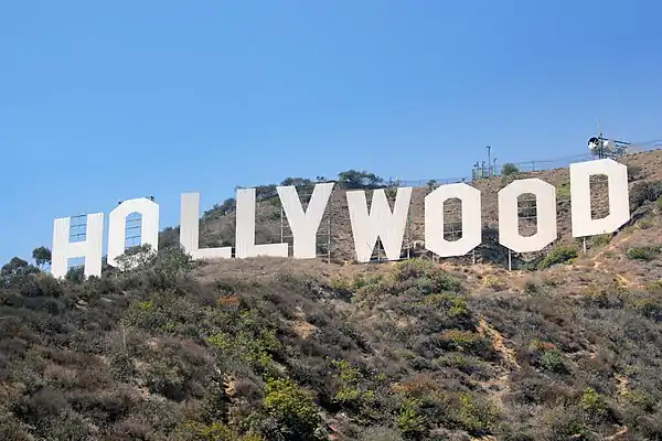
Little Armenia | |
|---|---|
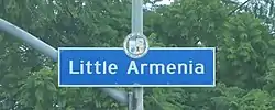 Little Armenia neighborhood sign located at the intersection of Normandie Avenue and Santa Monica Boulevard | |
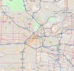 Little Armenia Location within Central Los Angeles | |
| Coordinates: 34°05′53″N 118°18′02″W / 34.098114°N 118.300497°W | |
| Country | United States |
| State | California |
| County | Los Angeles |
| City | Los Angeles |
| Time zone | UTC-8 (PST) |
| • Summer (DST) | UTC-7 (PDT) |
Little Armenia (Armenian: Փոքր Հայաստան) is a neighborhood in Central Los Angeles, California. It is named after the Armenians who escaped genocide and made their way to Los Angeles during the early part of the 20th century.[1]
The area is served by the Metro B Line at the Hollywood/Western, Vermont/Sunset and Vermont/Santa Monica stations.
History
The context behind early ethnic-Armenian immigration to Hollywood and the surrounding areas was due to political strife abroad. Some immigrants came from Romania fleeing the Ceaușescu regime, from Lebanon due to the Lebanese Civil War, from Soviet Armenia inadvertently as a result of US's Jackson-Vanik amendment, from Iran as a result of the Iranian revolution as well as from other countries like Syria, Turkey and other countries.
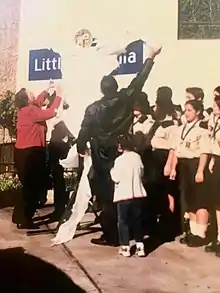
In 1999, the Honorary Mayor of Little Armenia, Garbis Keurjikian, also known as Garo, had a vision to establish an area in East Hollywood representing the Armenians who migrated to America. He worked with Councilwoman Jackie Goldberg to bring his vision to life. After working on the establishment of Little Armenia for a year, the ceremony opening took place on October 6, 2000, outside of Saint Garabed Armenian Apostolic Church. The name comes from the large number of Armenian-Americans who live in the area, and also from the large number of Armenian stores and businesses that had already opened in the neighborhood by the early 1970s.
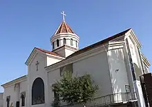
St. Garabed Armenian Apostolic Church is an Armenian church that is located inside Little Armenia. St. Garabed church is the place of worship for the vast majority of Armenians living in Hollywood. It is located on Alexandria Avenue and it was built in 1978. The church is located in front of the Rose and Alex Pilibos Armenian School.
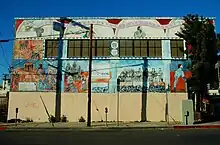
Many of the novels, short stories and poems of Charles Bukowski, a native of East Hollywood, are set in the area.
On April 24 each year, Armenians gather in Hollywood to commemorate the Armenian genocide. Though Hollywood was once home to the biggest Armenian community in the region, Glendale surpassed Hollywood in both the total number and proportion of Armenians in population, while Burbank, Pasadena, Montebello, and La Crescenta also have large Armenian communities but with no special designation.
Geography
On October 6, 2000,[2] the Los Angeles City Council designated a portion of East Hollywood as “Little Armenia” in an effort to recognize the community’s vast “presence and voice in Los Angeles.”[3]
As defined by the City Council, Little Armenia is "the area bounded on the north by Hollywood Boulevard between the 101 Freeway and Vermont Avenue, on the east by Vermont Avenue from Hollywood Boulevard to Santa Monica Boulevard, on the south by Santa Monica Boulevard between Vermont Avenue and U.S. Route 101 and on the west by Route 101 from Santa Monica Boulevard to Hollywood Boulevard".
Thai Town is located to the north of Little Armenia.
Transportation
Little Armenia is served by the Metro B Line subway, which runs north-south along Vermont Avenue and east-west along Hollywood Boulevard.
Metro subway stations include:
Numerous bus lines run on the major thoroughfares, including Metro's Rapid and Local service lines. Los Angeles Department of Transportation's DASH shuttle lines, serving East Hollywood, Hollywood, and the Griffith Observatory, also operate in the area.
Parks and recreation
Parks within Little Armenia's official borders are the following:
- Barnsdall Art Park - 4800 Hollywood Boulevard. The park includes the Frank Lloyd Wright designed Hollyhock House and a city-run arts center built in 1919-1921. [4]
Education
Schools within Little Armenia's official borders are the following:[5]
Public
|
Private
|
Notable places
Places of interest within Little Armenia's official borders include the following:
- The intersection of Hollywood Boulevard and Western Avenue was designated as Armenian Genocide Memorial Square on April 24, 2015 to commemorate the 100th anniversary of the Armenian genocide.[6][7] It was proposed by Los Angeles City Council members Mitch O'Farrell and Paul Krekorian and approved by the Los Angeles City Council on March 18, 2015.[8][9]
- The Church of Scientology Los Angeles headquarters. Located on Sunset Bl. between N. Catalina St. and L. Ron Hubbard Way.[10]
- Hollyhock House
- Hollywood & Western Building
- Zankou Chicken's first American restaurant
See also
References
- ↑ "Neighborhood Project: Little Armenia: LAist". Archived from the original on 2019-08-24. Retrieved 2019-08-24.
- ↑ Little Armenia Designation
- ↑ "Part of East Hollywood Is Designated 'Little Armenia' - Los Angeles Times". Los Angeles Times.
- ↑ City of Los Angeles Department of Recreation and Parks: Barnsdall Art Park Archived June 28, 2014, at the Wayback Machine
- ↑ "East Hollywood Schools," Mapping L.A., Los Angeles Times
- ↑ Van Dyke, Jonathan (April 30, 2015). "L.A. will never forget the Armenian genocide". Beverly Press La Brea Park News. Retrieved 10 March 2022.
- ↑ Mejia, Brittny; Goldenstein, Taylor; Blume, Howard (24 April 2015). "Armenian genocide: Massive march ends at Turkish consulate in L.A." Los Angeles Times.
Officials on Friday designated the intersection of Hollywood Boulevard and Western Avenue as Armenian Genocide Memorial Square, an area that is part of Little Armenia.
- ↑ Arranaga, Tony. "COUNCIL APPROVES DESIGNATION OF ARMENIAN GENOCIDE MEMORIAL SQUARE - 13th DISTRICT WEBSITE". Cd13.com. Archived from the original on 2015-03-26. Retrieved 2015-03-29.
- ↑ "Agenda : Los Angeles City Council : March 18, 2015". Ens.lacity.org\accessdate=2015-03-29. Archived from the original on April 2, 2015. Retrieved March 28, 2015.
- ↑ "Church of Scientology of Los Angeles - All Are Welcome!". Church of Scientology of Los Angeles. Retrieved 2015-11-15.
