| Alhmann Glacier | |
|---|---|
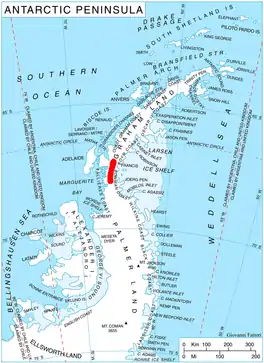 Location of Hemimont Plateau on the Antarctic Peninsula | |
 Location of Alhmann Glacier in Antarctica | |
| Location | Graham Land |
| Coordinates | 67°52′S 65°45′W / 67.867°S 65.750°W |
| Thickness | unknown |
| Highest elevation | 404 m (1,325 ft) |
| Terminus | Seligman Inlet |
| Status | unknown |
Ahlmann Glacier (67°52′S 65°45′W / 67.867°S 65.750°W) is the southernmost of two glaciers on the east side of Hemimont Plateau flowing east into Seligman Inlet on Bowman Coast, Graham Land in Antarctica.
History
The glacier was photographed from the air in 1940 by the United States Antarctic Service, and was charted in 1947 by the Falkland Islands Dependencies Survey, who named it for Professor Hans Wilhelmsson Ahlmann, a Swedish glaciologist and geographer.
See also
References
 This article incorporates public domain material from "Ahlmann Glacier". Geographic Names Information System. United States Geological Survey.
This article is issued from Wikipedia. The text is licensed under Creative Commons - Attribution - Sharealike. Additional terms may apply for the media files.